

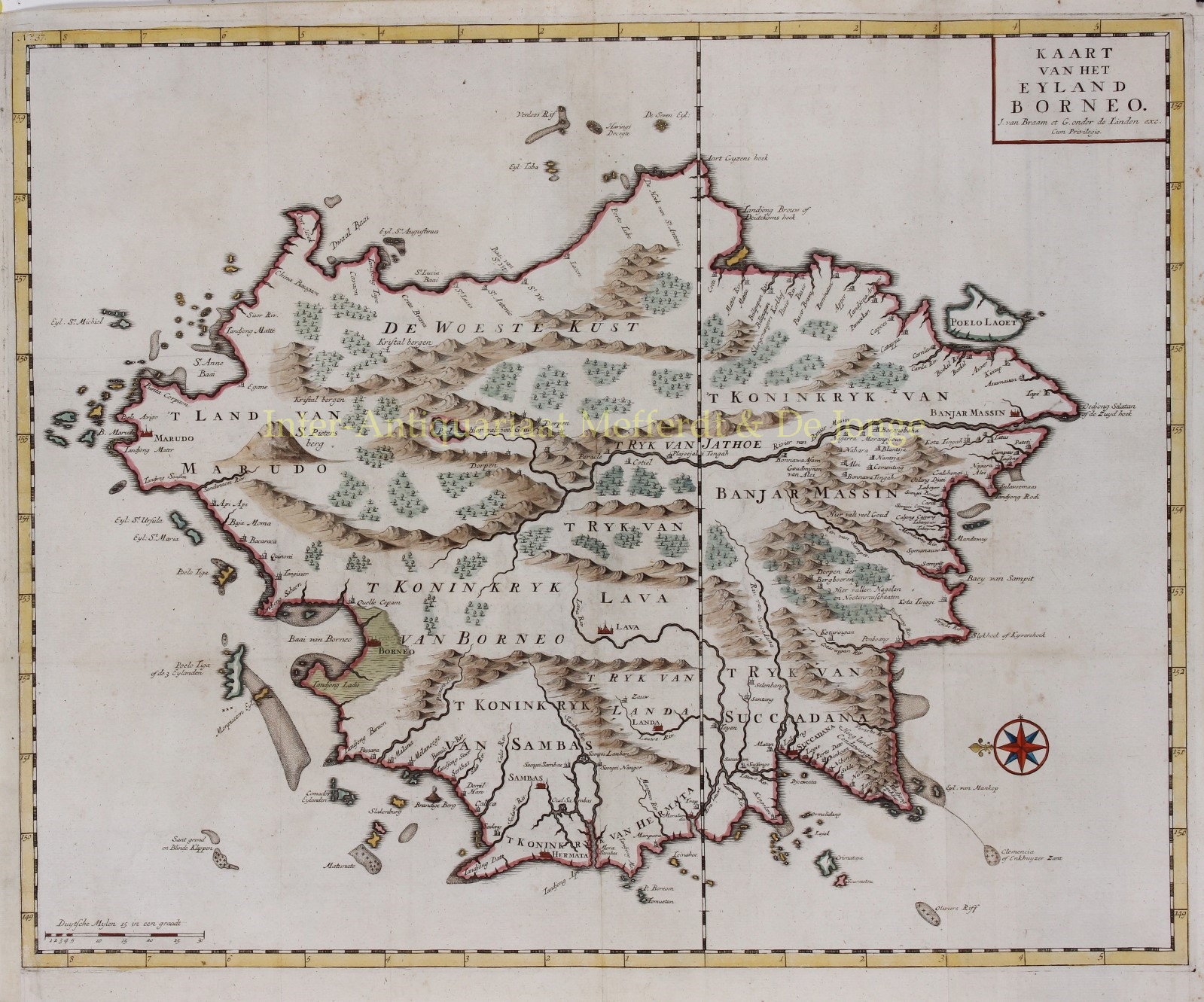
“Kaart van het Eyland Borneo” [Map of the island Borneo] copper engraving from Francois Valentijn‘s “Oud en Nieuw Oost-Indien” [Old and New East Indies] , engraved by Jan van Braam and published in Dordrecht by Gerard Onder de Linden in 1724-1726. Colored by a later hand. Size: 44 x 54 cm.
Since the fall of Malacca in 1511, Portuguese merchants traded regularly with Borneo. Though Borneo was considered rich, the Portuguese made no attempt to conquer it. The English began trading with Sambas in the south in 1609. The Dutch started their trade in 1644 in Banjar and Martapura.
Mapping Borneo started relatively late compared to other large parts of South-East Asia. For a long time the island was pictured only with a few Portuguese place names along the western coastline, the Brunei Bay and an empty and flat eastern coastline. Dutch nautical charts from the mid-17th century had an improved depiction of especially the east coast.
It is only Valentine’s map that shows more details of the interior at the beginning of the 18th century. We see cities and “villages of the mountain farmers, where there are cloves and nutmegs”, also “a lot of gold can be obtained here”.
François Valentijn (1666-1726) was a Dutch miniter, naturalist and writer best known for his “Oud en Nieuw Oost-Indien“, a history of the Dutch East India Company (VOC) and its activities in the East Indies. Valentijn’s maps were among the most accurate and large-scale productions of the East Indies published to date. As an officer Valentijn had access to VOC documents which he compiled into a special collection of maps. Valentijn’s work is so superior to previous maps that its publication is exceptional, given the strict confidentiality policy of the VOC regarding cartographic material.
Price: Euro 950,-