

British Isles – Nicolaes Visscher, c. 1690
€950
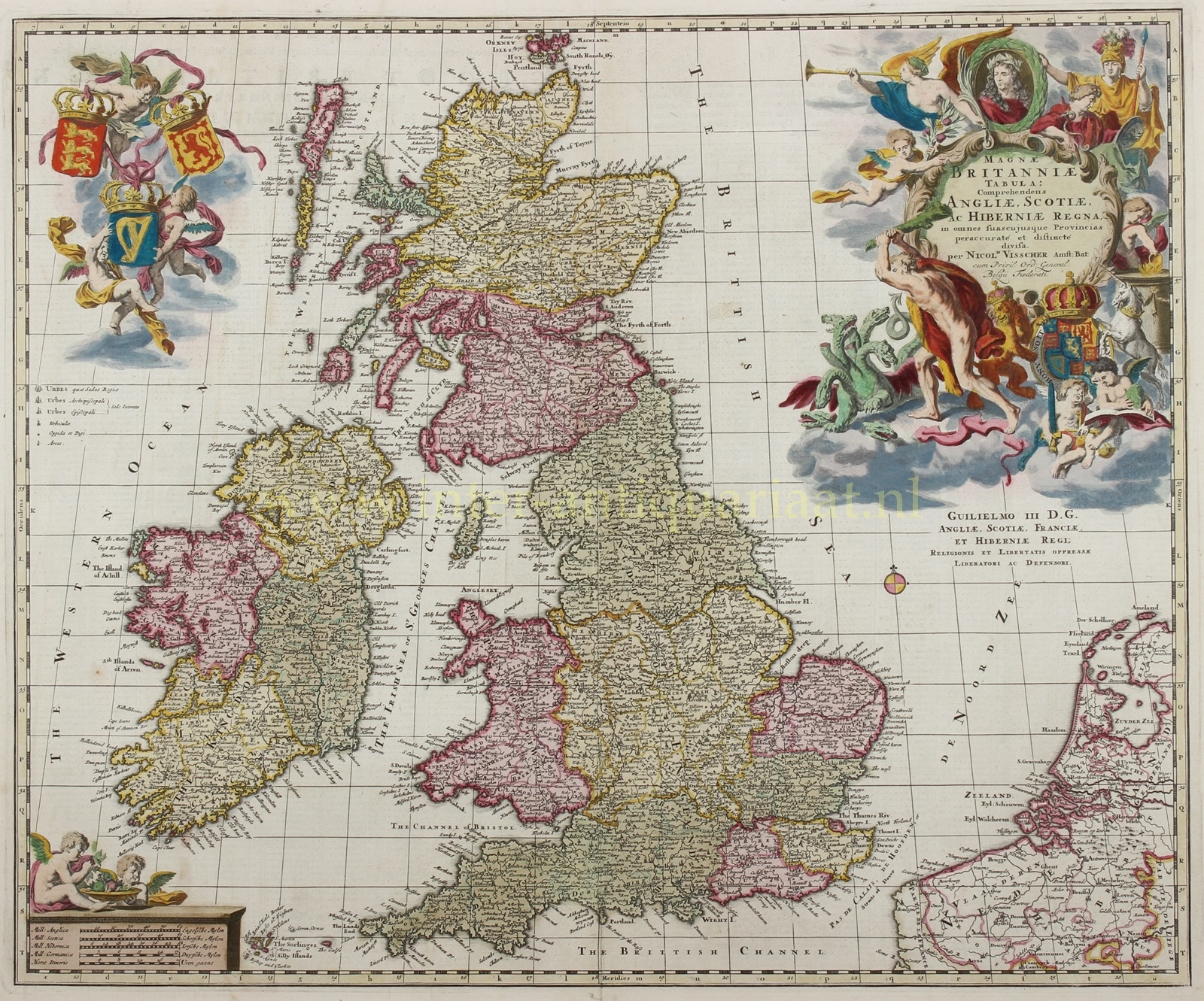


BEAUTIFUL 17THE CENTURY MAP OF THE BRITISH ISLES
“Magnae Britanniae Tabula: Comprehendens Angliae, Scotiae ac Hiberniae Regna.” [Map of Great Britain: Encompassing the Kingdoms of England, Scotland, and Ireland.] Copper engraving published by Nicolaes Visscher in Amsterdam around 1690. Original hand colouring, heigthened with gold. Size: (platemark) 48 x 58,3 cm, (frame) 68,4 x 77,5 cm.
This gorgeous map of the Bristish Isles is dedicated to king William III of England. The very large and decorative title cartouche shows William’s portrait surrounded by a wreath of laurels, a putto trumpets his fame. His coat of arms is held by a crowned English lion and a Scottish unicorn chained by a crown. Hercules is slaying the Hydra (presumably referring to the king’s heroic deeds). A second cartouche depicts three putti carrying the coats of arms of England, Scotland and Ireland.
After a series of conflicts between the Dutch and the English, it was the Glorious Revolution (1686-1688) that made Dutch stadholder William of Orange king of England. Relationships between both countries at the end of the 17th century were therefore very good. Dutch publisher Nicolaes Visscher praised the new English king with this map. It would take almost a century before a next Anglo-Dutch war.
Price: Euro 950,- (incl. frame)