


SPECTACULAR PICTORIAL WALL MAP OF CHINA
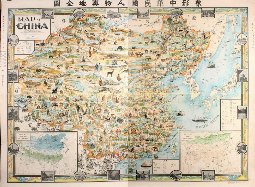
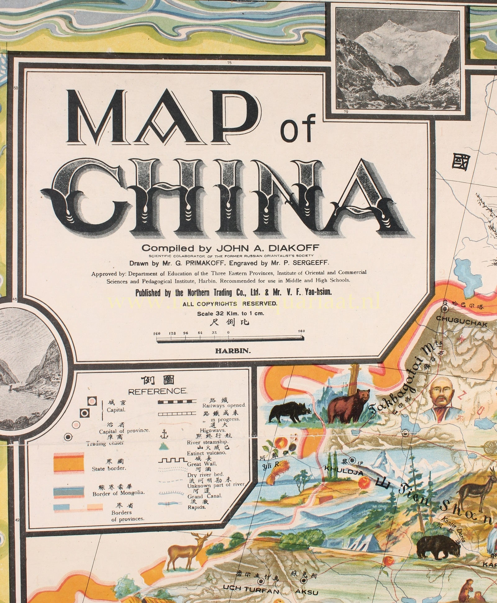
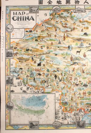
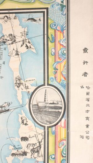
“Map of China” / 象形中華民國人物輿地全圖 / Xiàngxíng Zhōnghuá Mínguó Rénwù Yúdì Quántú (Pictorial Full Map of the People and Geography of the Republic of China.). Chromolithograph compiled in 1931 by John A. Diakoff, drawn by G. Primakoff, and published by the Northern Trading Co. Ltd. & Mr. V.F. Yao-hsiun. Size: approx.. 153 x 204 cm.
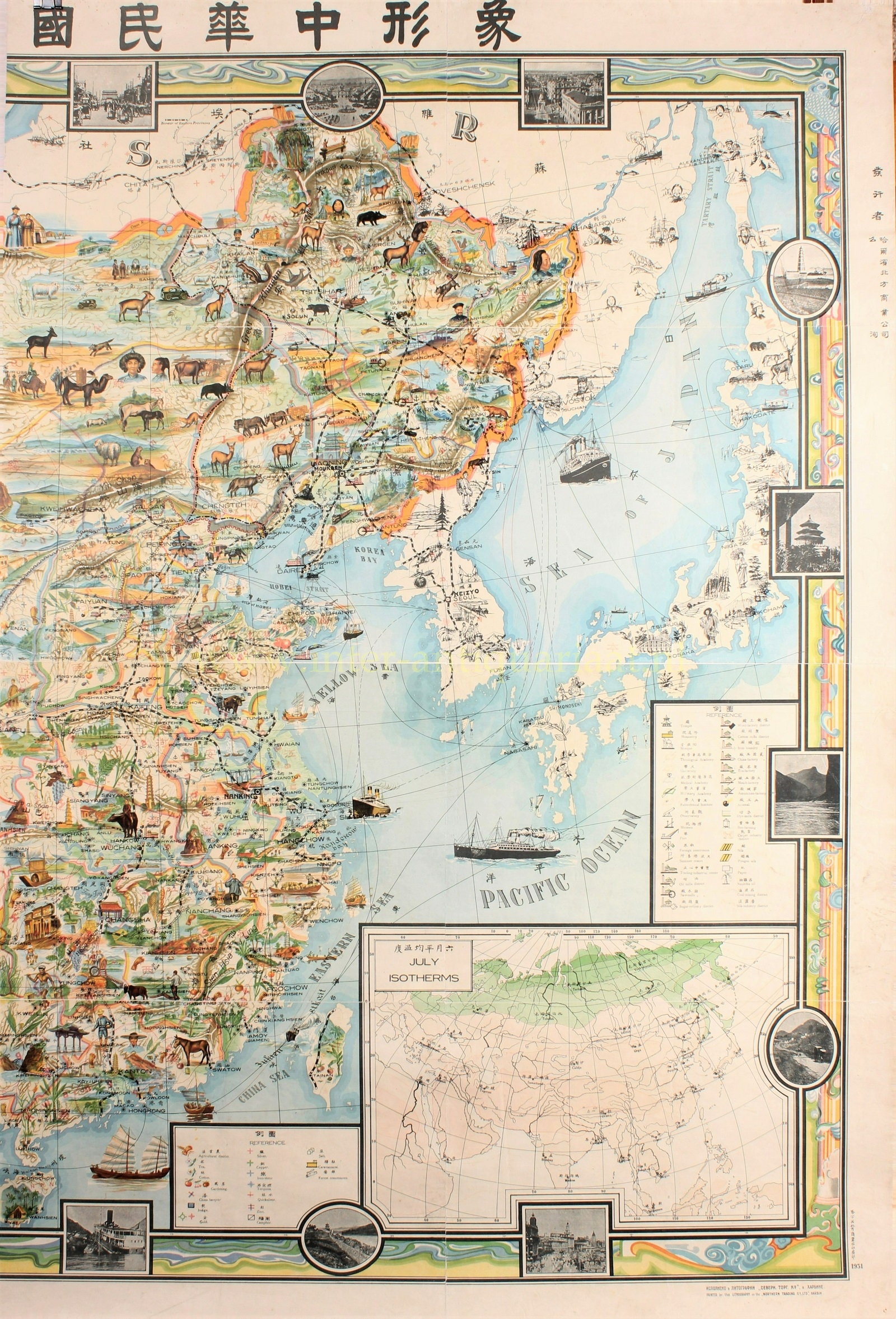
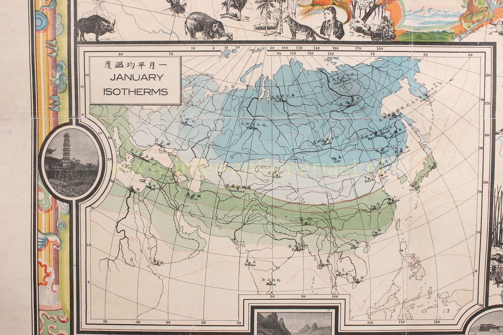
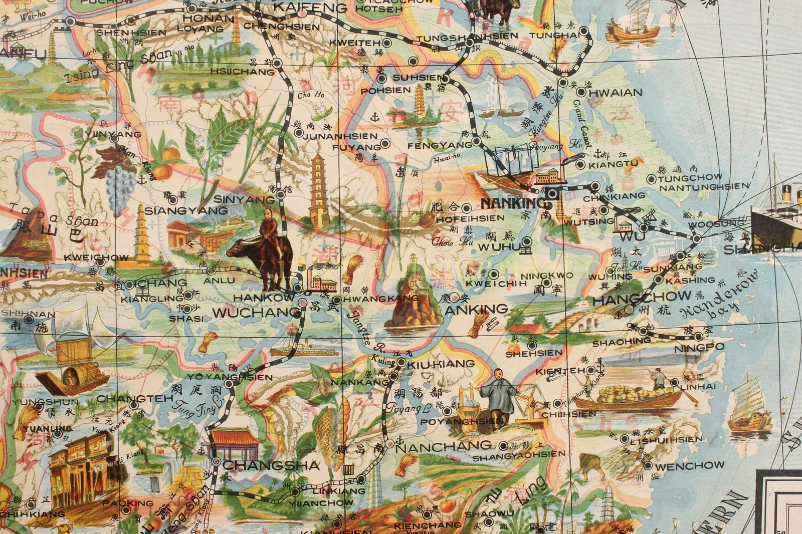
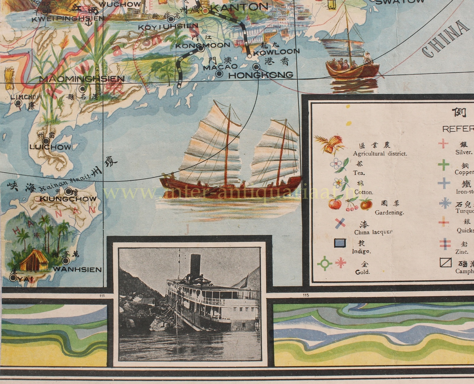
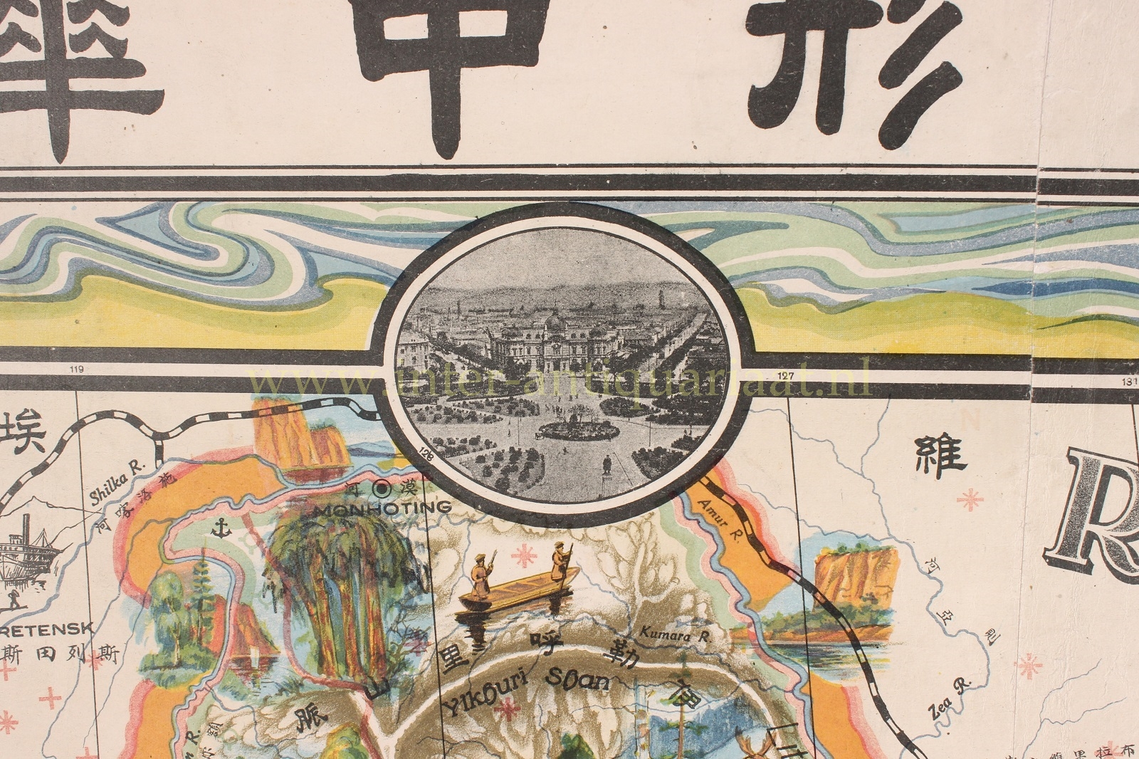
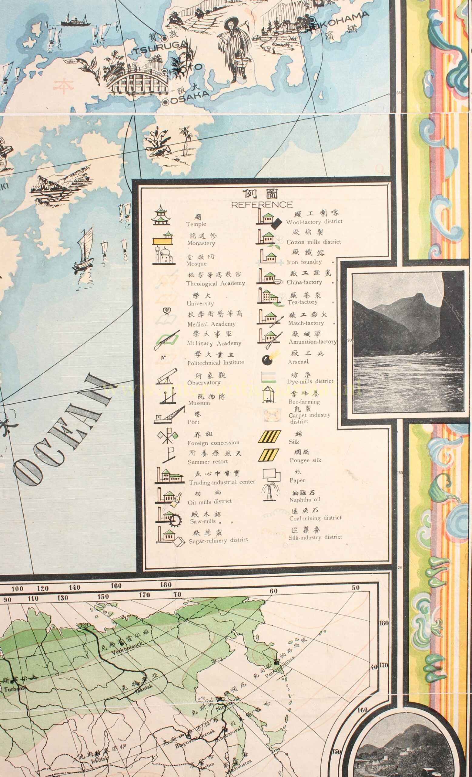
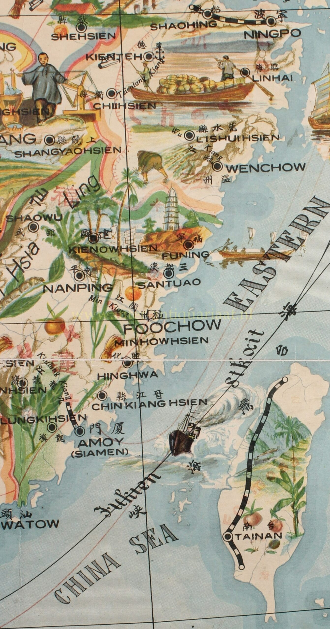
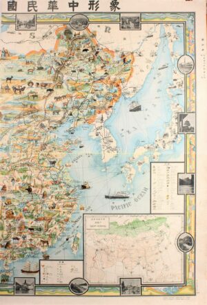
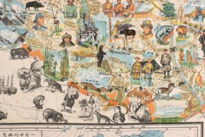
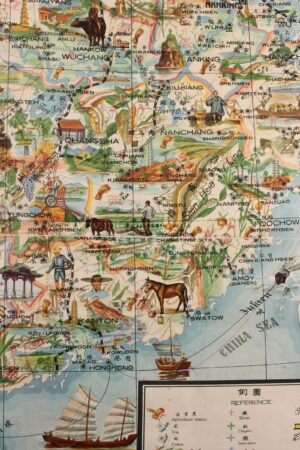
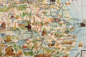
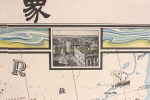
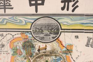
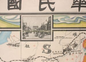
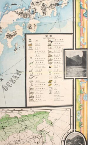
This lavish map covers China from Kashgar to Taiwan, including neighboring Korea, Japan, Mongolia, and Nepal. The map is intended to illustrate the diversity of the country, showing its natural and man-made resources, political and administrative boundaries, provinces, cities, capitals, roads, railroads, wildlife, mountains, rivers, lakes, canals, landmarks, agricultural districts, religious and educational buildings, etc. Text and annotations throughout are in both English and Chinese. All lands within China are rich in color, regions outside like Japan, Korea, and India, are also nicely illustrated with vignettes, but are not in color.
The map mixes the cultural and historical with persuasive elements suggestive of both pro-Chinese and pro-Russian positions – not as diametrically opposed as one might have assumed in 1931, when the greatest threat to China was Japan. In the same year this map was issued, the Japanese staged a confrontation at the Northern Manchuria Railroad hub of Mukden, leading to the infamous Mukden Incident and the Japanese invasion of Manchuria. That none of these events are indicated here suggests this map was issued before September 1931.
This uncommon map, presumably intended for Chinese school children in Harbin (the largest city in Northeast China), hints at some political positions. For example, it suggests that Russians remained active in Manchuria – which in 1931 they were not. Harbin is represented by a nonracially distinct labourer. The inclusion of Tibet within the borders of China is another unusual choice, considering that Tibet threw off the yolk of Qing rule in 1912 and Tibet enjoyed de facto independence until 1951 when it was annexed into the Republic of China. Taiwan, at the time a Japanese colony, is here colour coded as part of China. The artist appears to have been expressing support for China’s historical claims. It is of note that the title states that the map was ‘approved by the Department of Education of the three Eastern Provinces’, suggesting that the inclusion of China’s territorial claims may have been intended to appease this board.
John Diakoff (Иван Андреевич Дьяков, 1881 – 1969), came to Harbin in 1931. There he established himself as a scientific collaborator of the Russian Orientalist Society, a group of Russian scholars (and many say spies) based in Harbin. He was also an inspector of Russian schools and in 1945 was teaching at the St. Nicholas School in Harbin.
Examples of this map are uncommon and because of its visual appeal highly desirable.
Price: Euro 6.250,-