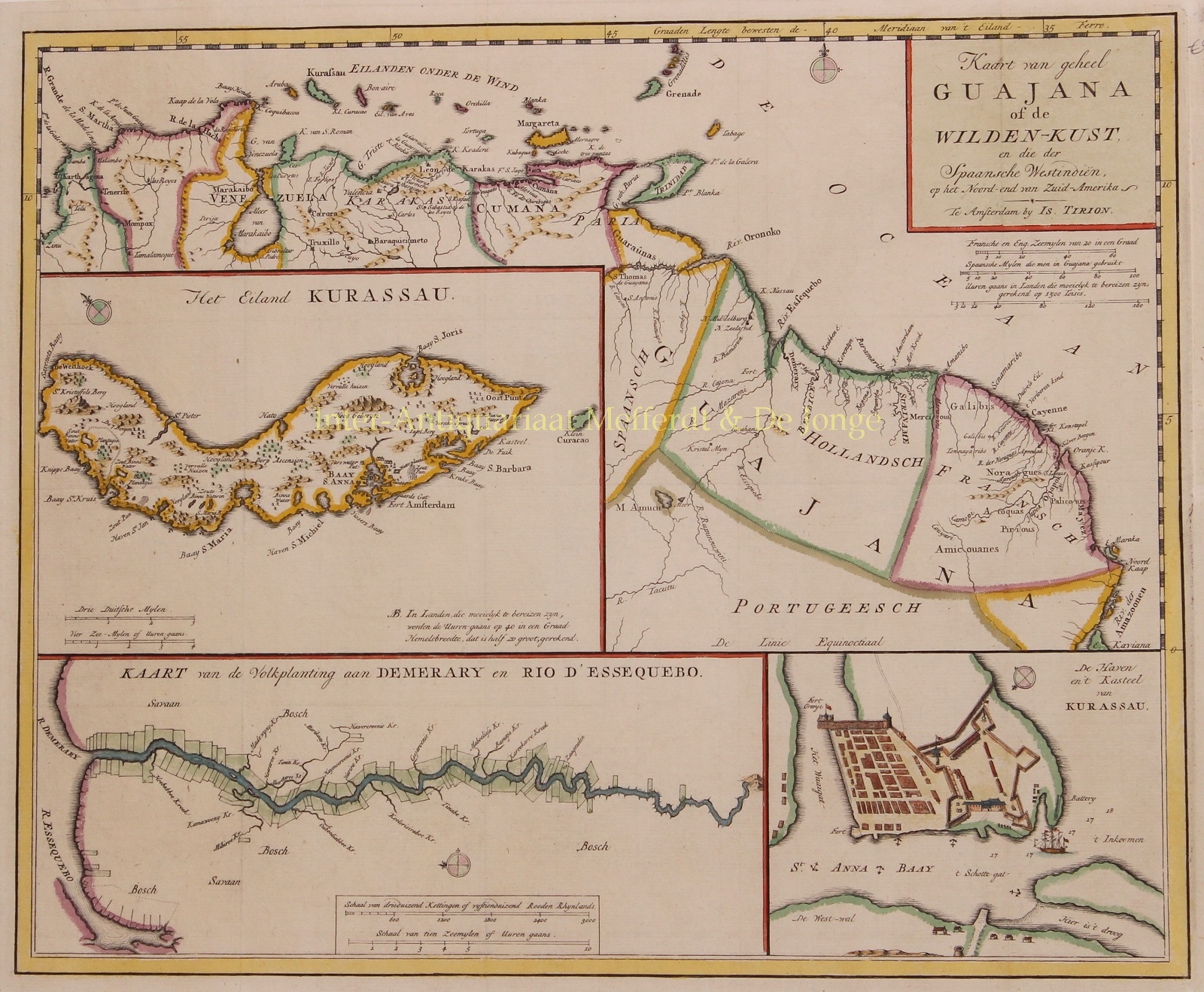
Curaçao, Guyana – Isaak Tirion, 1767
€675
“Kaart van geheel Guajana of de Wilden-Kust en die der Spaanse Westindën op het Noord-end van Zuid-Amerika” / “Het Eiland Kurassau.” / “De Haven en ‘t Kasteel van Kurassau” / “Kaart van de Volksplanting aan Demerary en Rio d’Essequebo.” [Map of entire Guiana also called the “Wild Coast” and the Spanish West Indies on the northern end of South America / The island Curaçao / The harbour and castle of Curaçao / Map of the colonies on the Demerary and Essequebo rivers.] Copper engraving published by Isaak Tirion in Amsterdam c. 1767. With original hand colouring.
While the Dutch made concerted efforts to establish colonies along the Essequibo, Berbice, and Demerary rivers and elsewhere on the mainland, Curaçao proved a more enduring project. The island was well positioned for trading, and it lacked many of the harsh conditions of the continent.
Curaçao was conquered by the Dutch from the Spaniards in 1634 as part of the Eighty Years’ War. The Dutch West India Company (WIC) was particularly interested in Curaçao because of its large natural harbour, the Schottegat, which could be reached from the sea via the Sint Anna Bay.
Immediately after the occupation of the island, a provisional defense structure was built at the entrance of St. Anna Bay. From this first fortification a defensive work was created from stone, called Fort Amsterdam (seen on the inset in the lower right). The governor resided in Fort Amsterdam, it housed offices and warehouses of the WIC, and quartered the officers and soldiers of the garrison.
Curacao has a fascinating history; it was actively colonized by the Dutch starting in 1634. Along with the Dutch came a large contingent of Sephardic Jews who contributed substantially to the island’s culture and economy. Indeed, Curacao has the oldest active Jewish congregation in the Americas, dating back to 1651. The Curacao synagogue is the oldest in continuous use in America, having first opened in 1732 on the site of a previous synagogue.
Price: Euro 675,-


