


GOOD OLD EUROPE
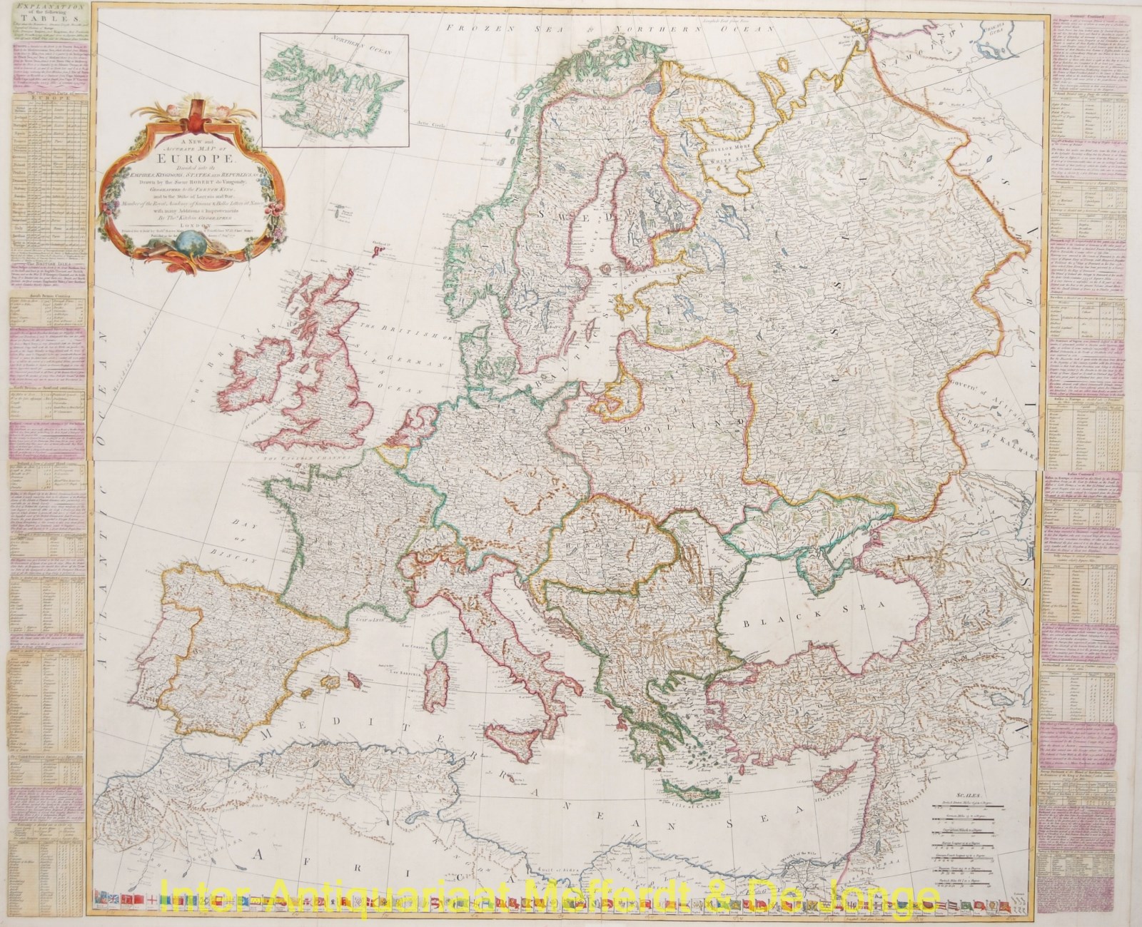
“A New and Accurate Map of Europe divided into its Empires, Kingdoms, States and Republics“, engraving printed from four copper plates made by Thomas Kitchin after the design of Robert de Vaugondy “Geographer to the French King”, published by Robert Sayer in London in 1772. Coloured by a later hand. Size: approx. 100 x 123 cm. Mounted on linen.
Large detailed map of Europe with left and right information on the different countries. About the Dutch Republic it states: “Of these Provinces, the first that entered an Alliance for their common Safety, were Holland & Zealand, Anno 1576. Being driven thereto by the Cruel & Violent Usage they met with from the Spanish Government. The Example of these two Provinces drew severeal others to unite with them, so that in 1581, the Seven Provinces took up Arms against the Spanyards, under the Conduct of Maurice Prince of Orange, who retrieved the Affairs of the States, and forced their haughty Masters to acknowledge them a free & independent People. From such a small Beginning they are grown the most Powerfull Republic in the Universe.” [sic!]
Below the map it depicts 71 flags of the sea faring nations .
Price: Euro1.650,-