

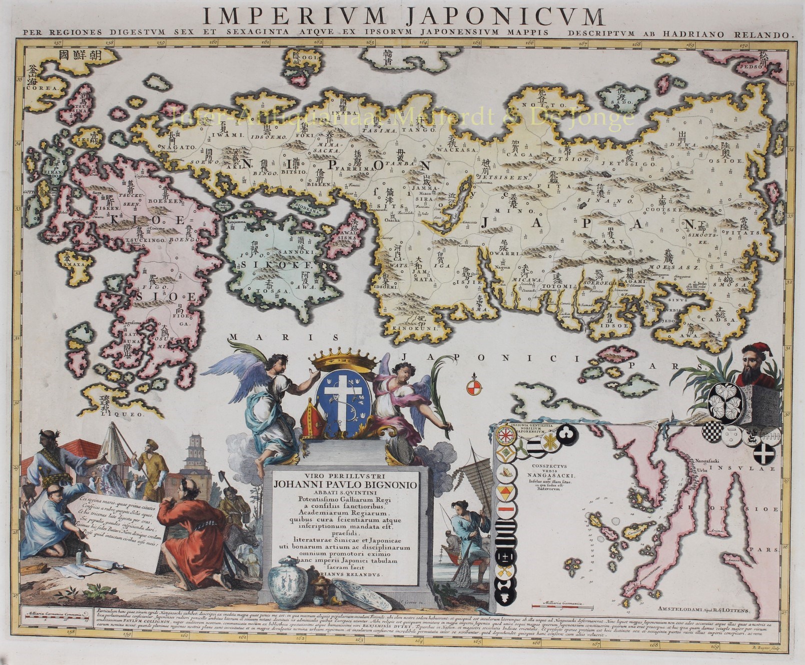
“Imperium Japonicum…” [“The Empire of Japan, here on a Japanese map with sixty six regions, described by Adriaan Reland.”] Copper engraving made by Balthasar Ruyter, published after 1720 in Amsterdam by Reinier and Josua Ottens. Coloured by a later hand. Size: 49 x 60 cm.
Adriaan Reland (1676-1718) was a professor at the University of Utrecht. Reland used Japanese maps, most notably a map by Ishakawa Ryusen from the library or Benjamin Dutry (1668-1751), a former director of the Dutch East India Company (VOC). In the text under the map Reland writes that Japanse woodblock-printed maps are less accurate: “they draw the outlines of the coast lines with a coarser pen, because they lack the European tools”. Reland emphasises that he only used Japanese maps for place-name accuracy. The map was originally published in a smaller size in Utrecht. The copper plate of this third state in folio format however, was bought by Amsterdam publisher Joachim Ottens in 1720, whose sons Reinier and Josua published it in their atlases thereafter.
Reland’s map of Japan was the first map to use Sino-Japanese characters [Kanji] on a European printed map and represents a radical departure from prior European maps of Japan. The map is dedicated to Jean-Paul Bignon, librarian to King Louis XIV of France who had ordered it to be made. Bignon’s coat of arms is prominently depicted.
The inset map at the bottom right shows (the bay of) Nagasaki, “with the island where the Dutch settled”. Dejima island became a factory for the Dutch East India Company in 1641 and was the only place of contact between Japan and Europe until the end of the 1850s. The inset map is embellished with 20 coats of arms of Japanese noble families and headed by the imperial coat of arms.
Price: SOLD