

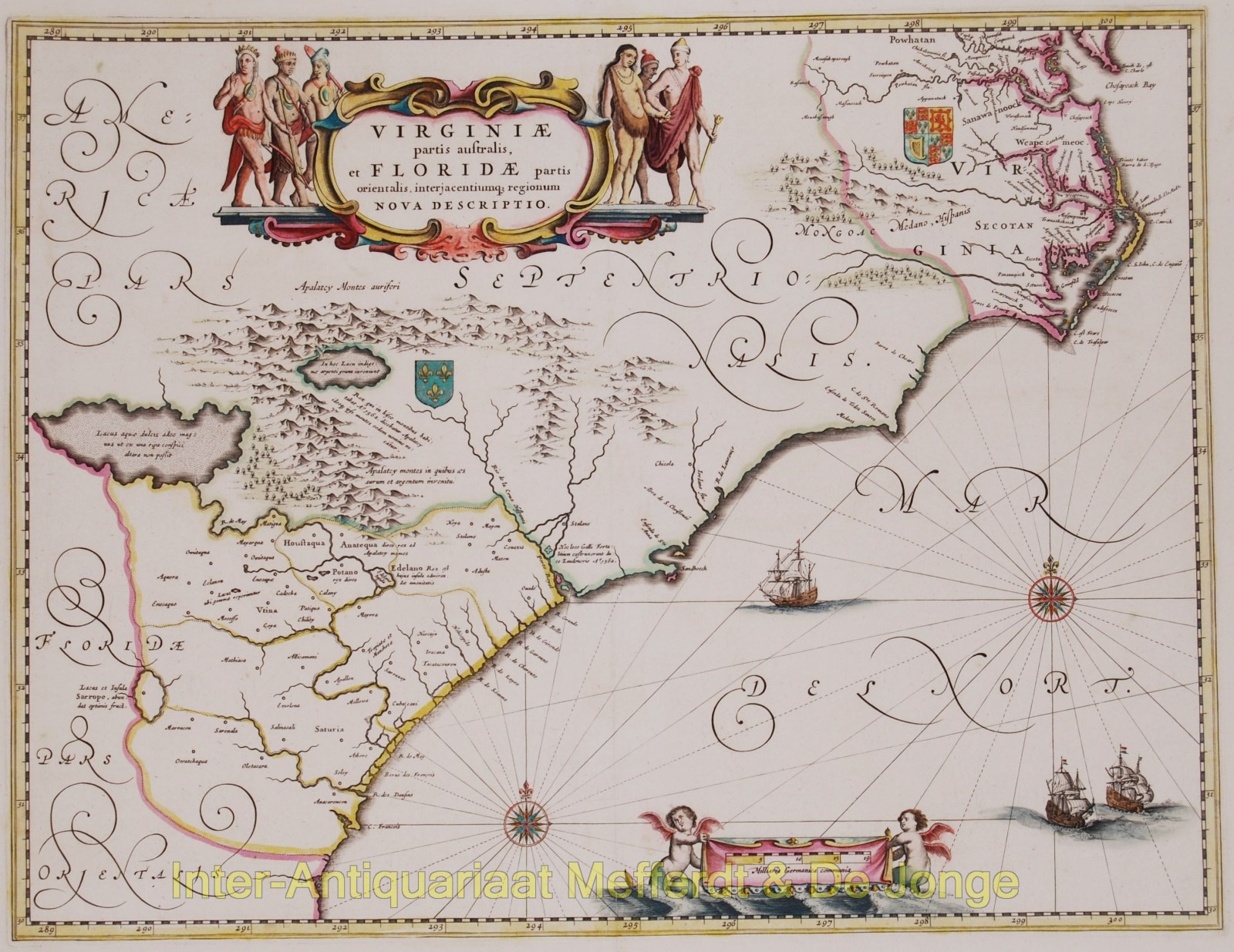
Virginiae Partis australis et Floridae partis Orientalis, interjacentiumque regionum nova descriptio
Important map because of its new reliable depiction of the cost line and the many new geographical names. Published by the house of Blaeu in Amsterdam approx. 1640.
Blaeu based his map on an a map by Hessel Gerritsz. from 1631 and updated it with information gathered during the various explorations of the area.
Two large fictious lakes with explanatory legends in Latin, still appear on the map. The British and French royal coats of arms indicate the territorial interests of the two nations at the time. A settlement by Irish planters in 1621 at Newport News in the north, near Chesapeake Bay is shown, and also Jamestown, further in stream.
The Carolina coast is improved with two large bays.
Original hand colouring. Size: 38,9 x 50,8 cm.
Price: Euro1.750,- (excl VAT/BTW)