

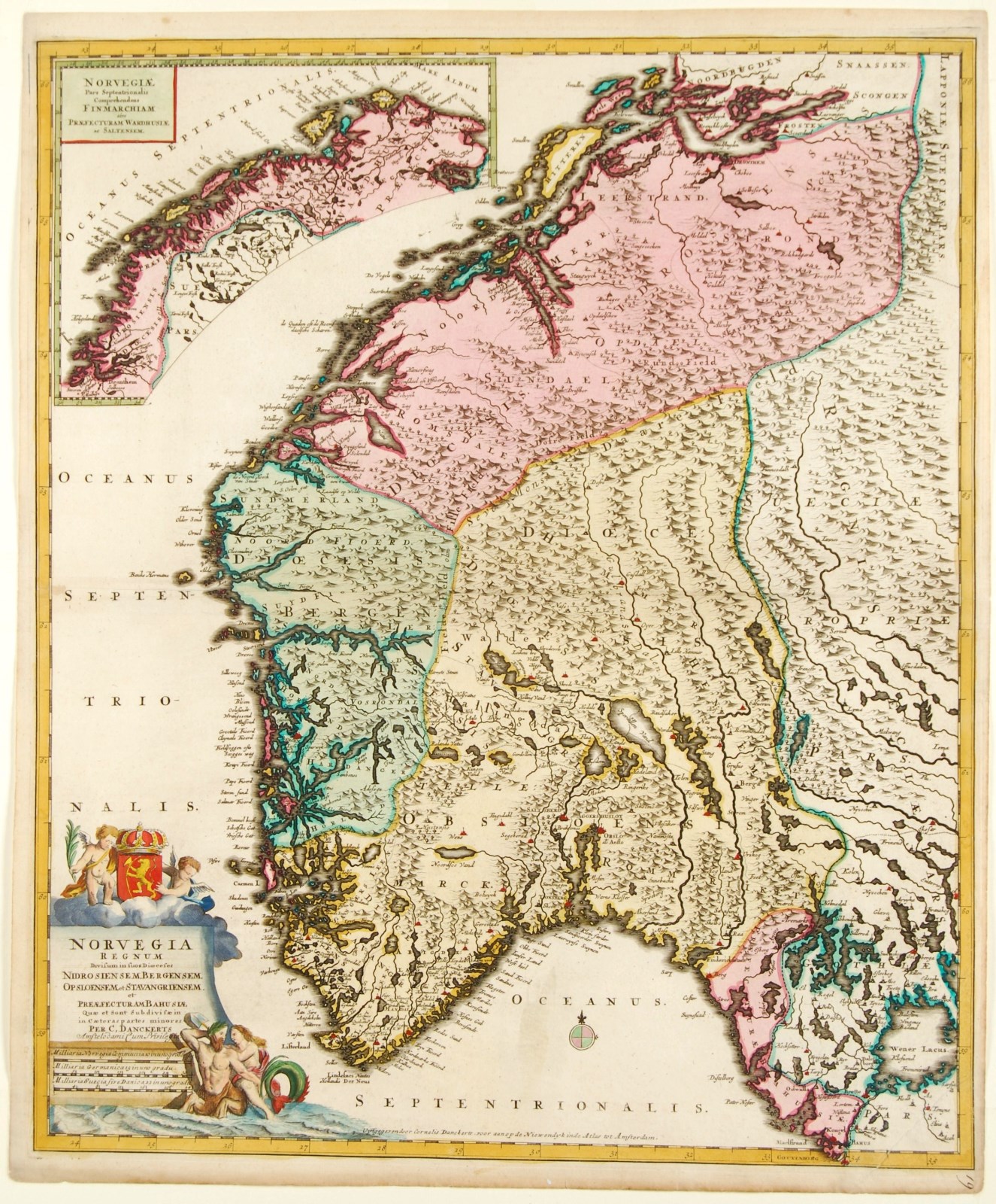
“Norvegia Regnum Divisum in suos Diocaeses Nidrosiensem, Bergensem, Opsloensem, et Stavangriensem. Et Praefecturam Bahusiae.” Engraved double-page map in beautiful original colour, published in Amsterdam approx. 1696 by Cornelis Danckerts. Size: 58 x 50 cm.
The maps shows us the southern part of the Kingdom of Norway divided into the Diocese of Nidaros (today’s Trontheim), Bergen, Oslo, and Stavanger and the prefecture of Bohuslän (Båhuslen). There is an inset map of northern Norway in the upper left corner showing the Finnmark region.
The 17th century saw a series of wars between Denmark–Norway and Sweden. The Kalmar War between 1611 and 1613 saw 8.000 Norwegian peasants conscripted. Despite lack of training, Denmark–Norway won and Sweden abandoned its claims to the land between Tysfjord and Varangerfjord. With the Danish participation in the Thirty Years’ War in 1618–48, a new conscription system was created in which the country was subdivided into 6.000 legd, each required to support one soldier. Denmark–Norway lost the war and was forced to cede Jämtland and Härjedalen to Sweden. The Second Northern War in 1657 to 1660 resulted in Bohuslän being ceded to Sweden. The Danish monarch elevated himself to absolute and hereditary king of Denmark (including Norway) in 1661, eliminating the power of the nobles. A new administrative system was introduced. Departments organized by portfolio were established in Copenhagen, while Norway was divided into counties, each led by a district governor, and further subdivided into bailiwicks. About 1,600 government officials were appointed throughout the country.
This map was made when Ulrik Fredrik Gyldenløve was viceroy of Norway. It is embellished by a depiction of Neptune and a mermaid below the title cartouche and crowned with the Norwegian coat of arms.
The Danckerts family were notable print and map sellers, and engravers in Amsterdam for nearly a hundred years, between 1630 and 1727.
Between 1680 and 1700, Justus an his three sons Cornelis, Theodorus, Justus II published several editions of their Danckerts Atlas. Their maps were in demand for the wonderful decorative quality of their engraving rather than for their accuracy.
Price: Euro 725,-