

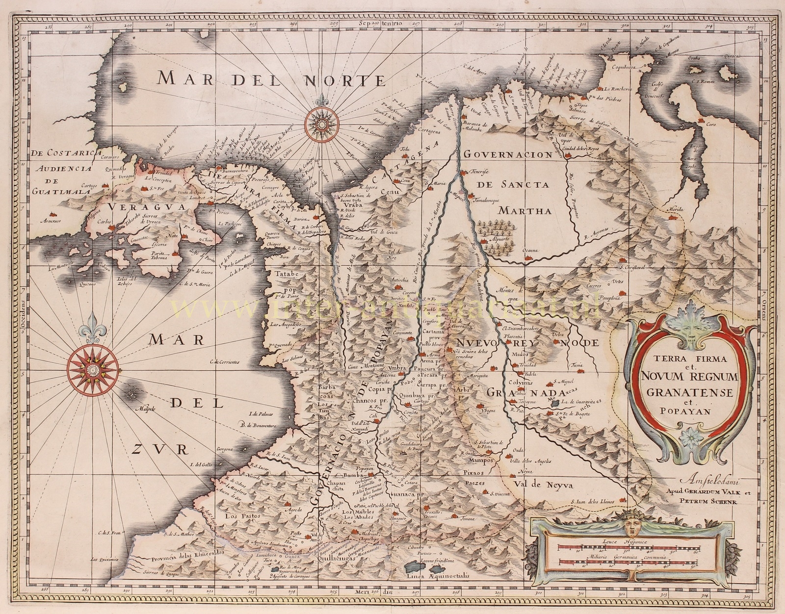
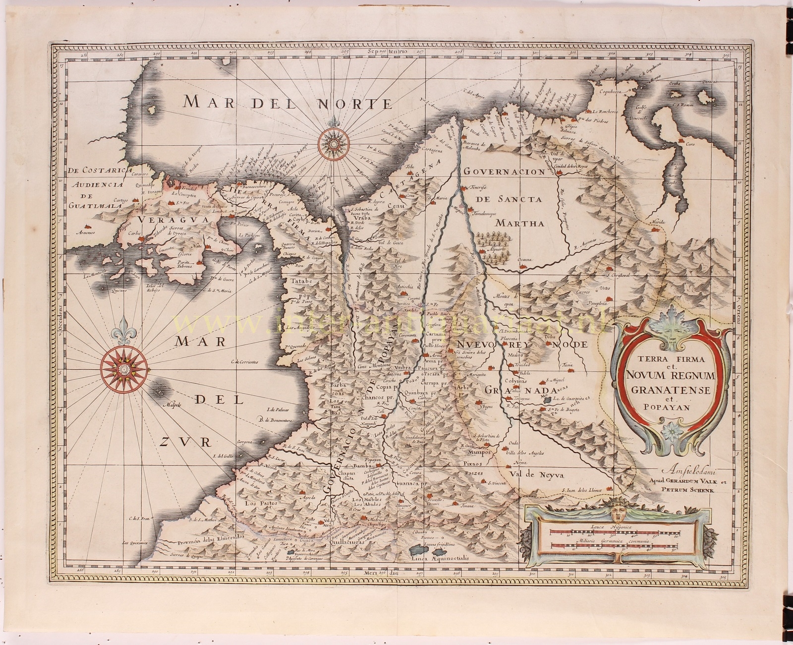
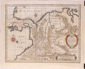
“Terra Firma et Novum Regnum Granatense et Popayan“, copper engraving published in Amsterdam by Gerard Valck and Petrus Schenk in 1700. With original hand colouring. Size: 38 x 50 cm.
Decorative map of the northern Andes and adjacent territories, nowadays Columbia, part of Ecuador extending south to the Esmereldas province, and Venezuela extending east nearly to Caracas. It shows the course of the Magdalena River and its major tributaries.
The region was named “Terra Firma” by the Spanish, which means “firm land” or “solid ground”, in contrast to the nearby Caribbean islands which were seen as less stable.
In the 16th century the region was divided into two administrative entities: the “Novum Regnum Granatense ” [New Kingdom of Granada], which included present-day Colombia, Ecuador, Panama, and parts of Venezuela; and “Popayan”, which included parts of Colombia and Ecuador.
During the colonial period, the region was an important center of Spanish economic activity, particularly in gold and silver mining.
The map was originally engraved by Jan Jansson, the copperplate was later acquired by Valck & Schenk, who added additional grid lines. The Valk & Schenk edition is by far the more scarce edition of the map.
Price: Euro 375,-