


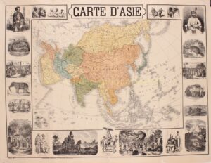
LARGE 19TH CENTURY FIGURATIVE MAP OF ASIA
“Carte d’Asie”, lithograph in colours made by L. Mertens and published around 1870 by Théodore Lefèvre, bookseller in Brussels. Size: 62,5 x 83,5 cm.
Before the Industrial Revolution in the mid-to-late 19th century, demand for oriental goods such as porcelain, silk, spices, and tea remained the driving force behind European imperialism. The Western European stake in Asia remained confined largely to trading stations and strategic outposts necessary to protect trade. Industrialization, however, dramatically increased European demand for Asian raw materials; with the severe Long Depression of the 1870s provoking a scramble for new markets for European industrial products and financial services in Africa, the Americas, Eastern Europe, and especially in Asia. This scramble coincided with a new era in global colonial expansion known as “the New Imperialism“, which saw a shift in focus from trade and indirect rule to formal colonial control of vast overseas territories ruled as political extensions of their mother countries.
Western imperialism in Asia intensified as European powers sought to expand their empires, exploit resources, and establish control over strategic territories. A period characterized by increased economic penetration, political dominance, and cultural influence.
France extended its colonial empire in Southeast Asia, and established French Indochina including Vietnam, Cambodia, and Laos.
Japan underwent rapid industrialization and modernization during the late 19th century, transforming into a major power in Asia. The Meiji Restoration (1868) marked a period of reforms that enabled Japan to resist Western imperialism and eventually adopt imperialistic policies itself.
It is the time of the Great Game, where the British and Russian Empires rivalled over influence in Central Asia, primarily in Afghanistan, Persia, and Tibet. The two colonial empires used military interventions and diplomatic negotiations to acquire and redefine territories in Central and South Asia. Russia conquered Turkestan, and Britain expanded and set the borders of British colonial India.
This large map of Asia captures the political boundaries of that moment in time:
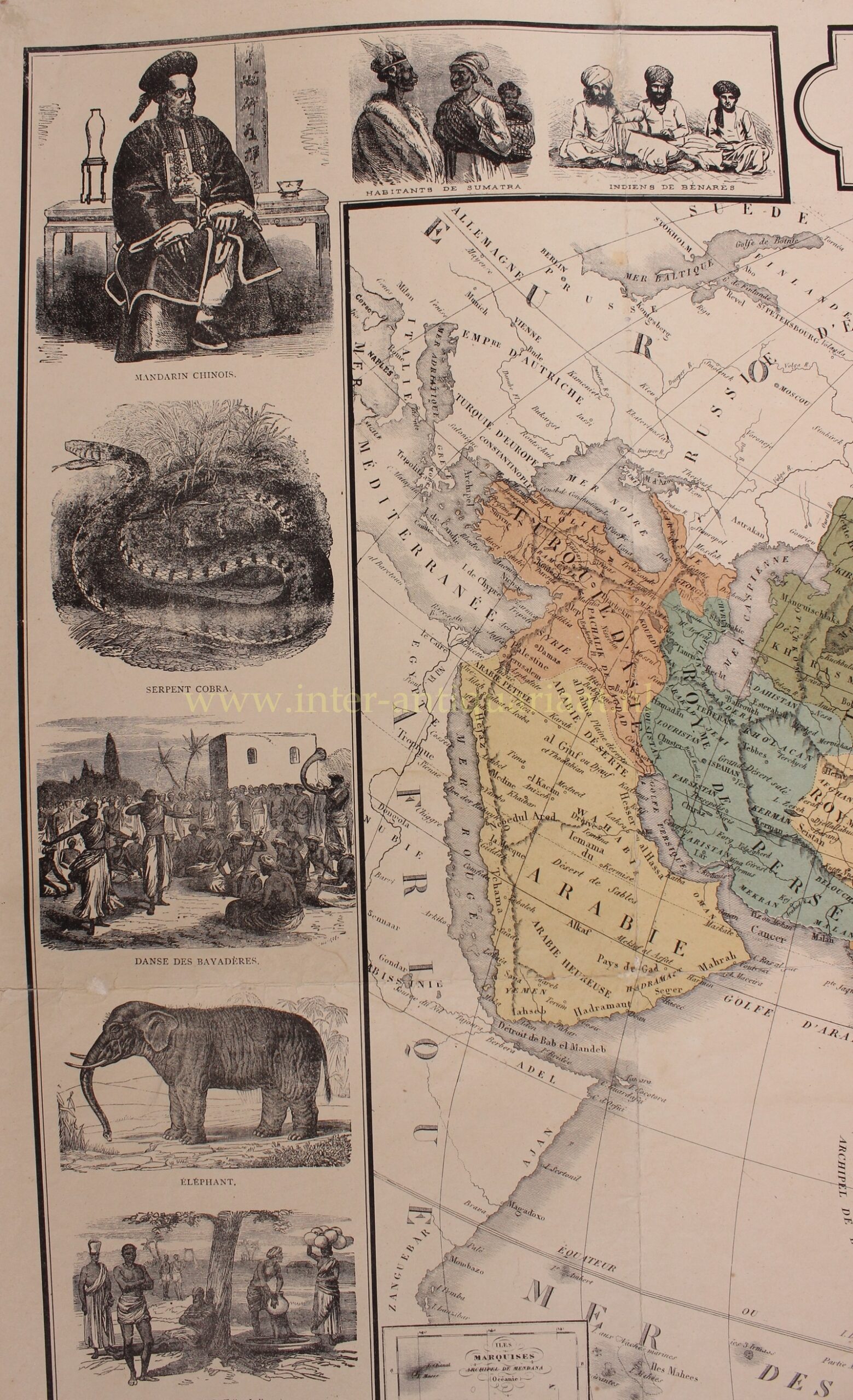
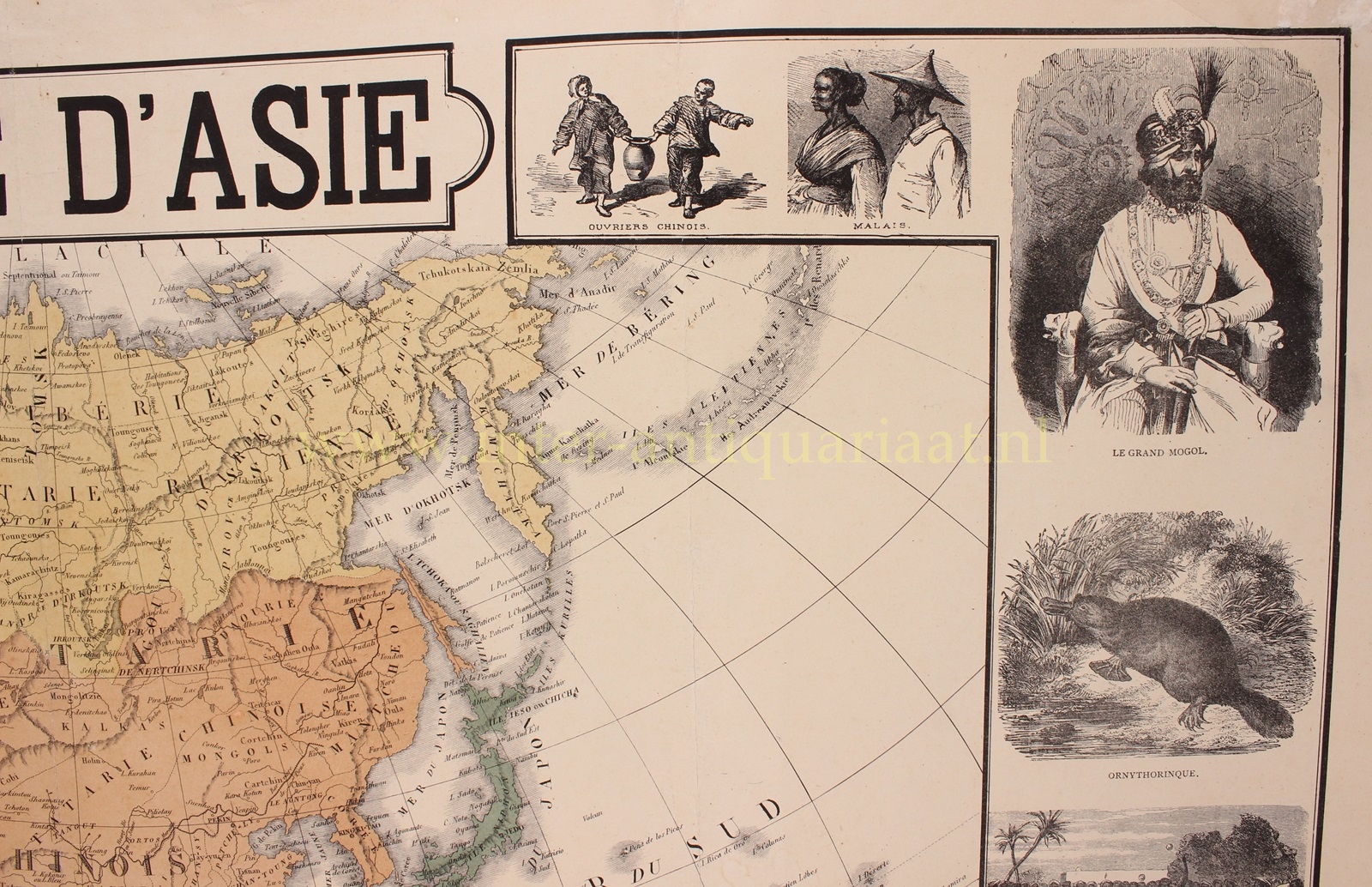
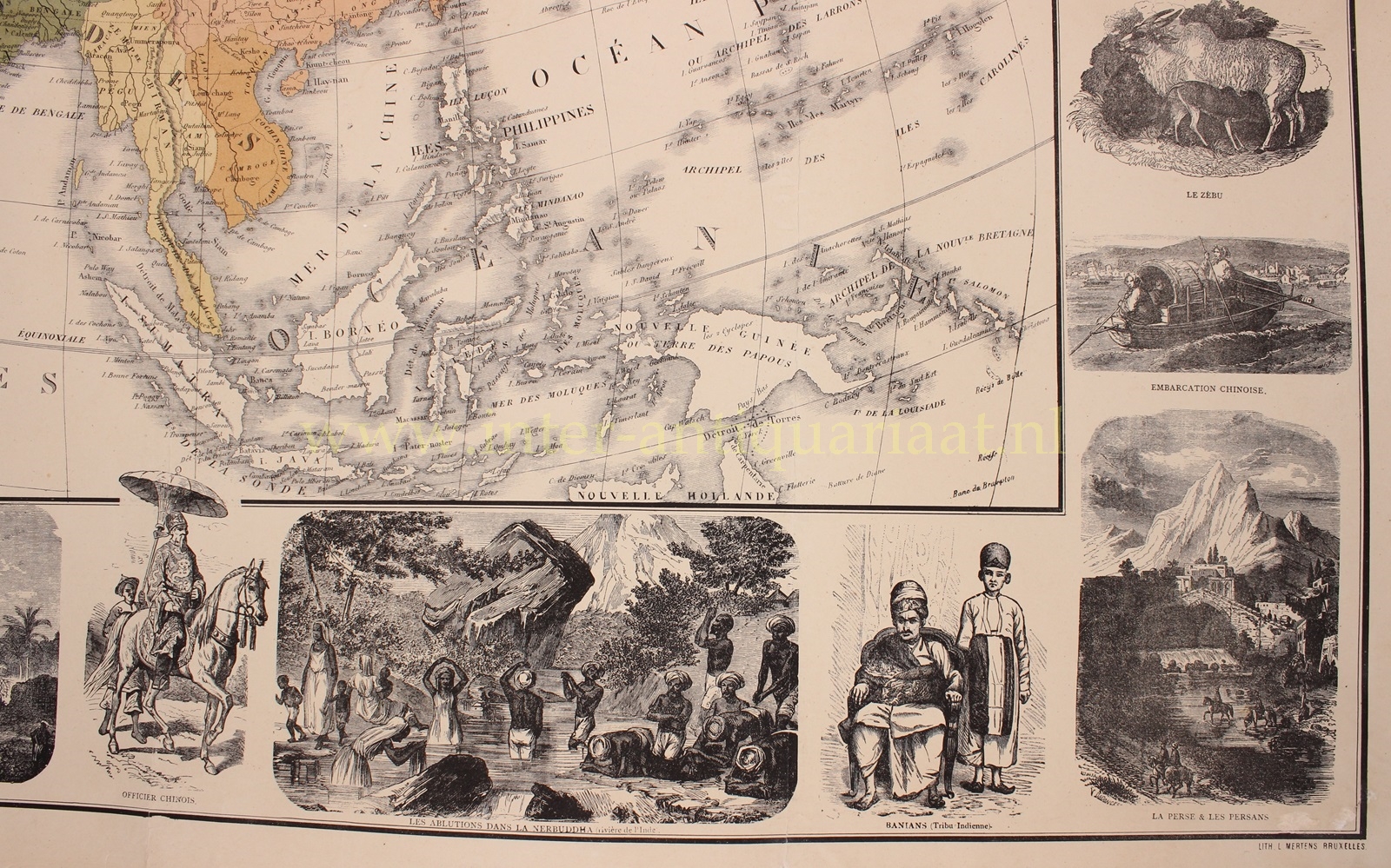
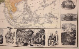
Arabia (incorporating modern day Saudi Arabia, Yemen, Oman, and the Gulf States), “Turkish Asia” including Ottoman Syria, the Kingdom of Persia (Qajar Iran), the Kingdom of Kabul (Afghan Empire), Balochistan (part of modern day Pakistan), Hindustan (the Indian Subcontinent), Russian Tartary (Siberia), Independent Tartary (Russian Turkestan), the Birman Empire (including Siam and modern day Malaysia), French Indochina (with Cambodia, Cochinchina/Vietnam), the Chinese Empire and Japan.
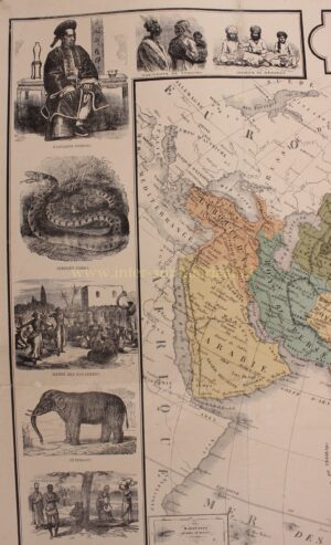
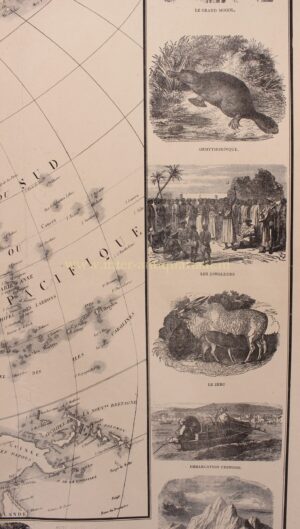
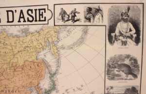
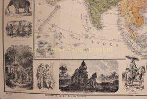
The map is surrounded by an interesting representation of Asia: Chinese workers, Malay people, the Grand Mughal of India, a platypus (the egg laying mammal), jugglers, a zebu (camel cow), a Chinese junk, “Persia and the Persians”, “Banians” (Indian merchants), ritualistic cleansing in the Narmada River in India, a Chinese officer, an Indian deity, Parsis (a Persian community in Gujarat, India), “The Priests of Buddha”, Gondi people (India), an elephant, “dance of the Bayadères” (India), a cobra snake, a Mandarin Chinese, inhabitants of Sumatra (modern day Indonesia), Indians from Varanasi (Uttar Pradesh, India).
Price: Euro 1.450,-