

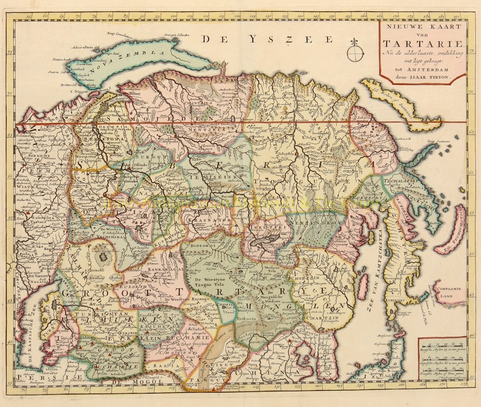
“Nieuwe kaart van Tartarie na de alderlaaste ontdekking in ‘t ligt gebracht ” [New map of Tartary shown after the very last discoveries], copper engraving made by J. Keizer in 1732 published in the “Nieuwe en Beknopte Hand-Atlas, bestaande in eene Verzameling van eenige der algemeenste en nodigste Landkaarten” [New and Concise Hand Atlas, existing of a collection of some of the most common and necessary maps], by Isaak Tirion of Amsterdam in 1740 or later. With original hand colouring. Size: 28,3 x 34,9 cm.
Tartaria or Tartary was a blanket term used in Western European literature and cartography for a vast part of Asia bounded by the Caspian Sea, the Ural Mountains, the Pacific Ocean, and the northern borders of China, India and Persia, at a time when this region was largely unknown to European geographers. In European sources, Tartary became the most common name for Central Asia that had no connection with the real polities or ethnic groups of the region; until the 19th century, European knowledge of the area remained extremely scarce and fragmentary.
Isaak Tirion (1705 – 1765) was a Dutch bookseller and publisher with his business in Amsterdam, initially on the Nieuwezijds Voorburgwal, later in the more prestigious Kalverstraat. He has published many books, recurring publications and magazines, including many topographical works.
Price: Euro 225,-