

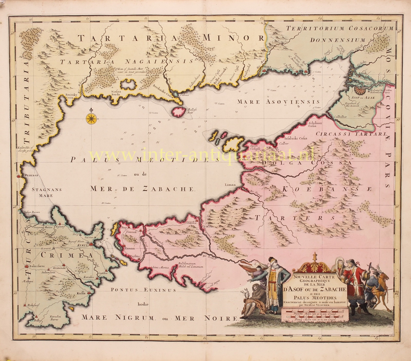
RARE MAP OF THE SEA OF AZOV
“Nouvelle Carte Geographique de la Mer d’Asof ou de Zabache & des Palus Meotides”, copper engraving published in Amsterdam by Nicolaes Visscher approx. 1690, original hand colouring with later additions. Size: 48,5 x 58 cm.
This rare map of the Sea of Azov and the surrounding area was published around the time of the Azov Campaigns, in which Peter the Great led two Russian military campaigns to capture the important Turkish port city of Azov which held a garrison of 7000 men. The Russians were successful, and were finally able to reach the Sea of Azov and the Black Sea in their attempt at becoming a maritime power.
The cartouche illustrates the view of Europeans about this distant country. Nowadays, the Sea of Azov is known for its sun during hot summers. The Dutch in the 17th century however, associated it with the north, therefore illustrating the cartouche with reindeers and people wearing fur coats.
The map was only published in a few composite atlases and is therefore scarse. There is a later edition of about 1740 with a Henrdrik de Leth publication line.
Price: Euro 495,-