

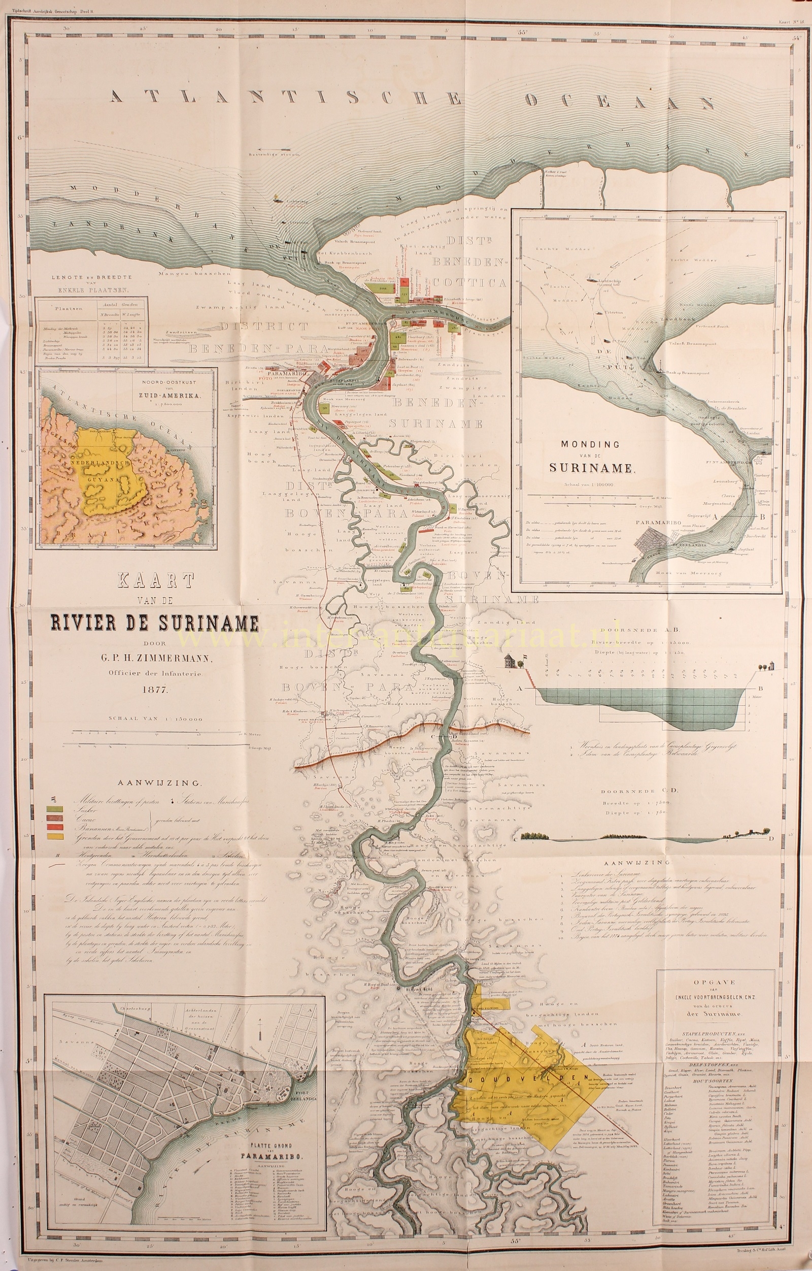
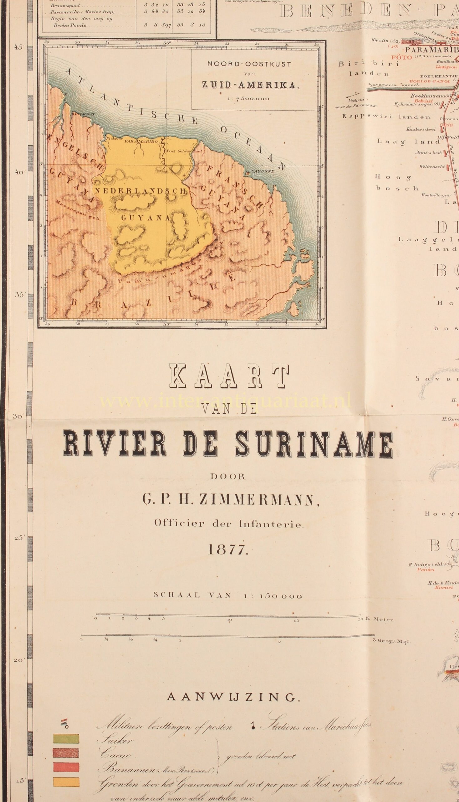
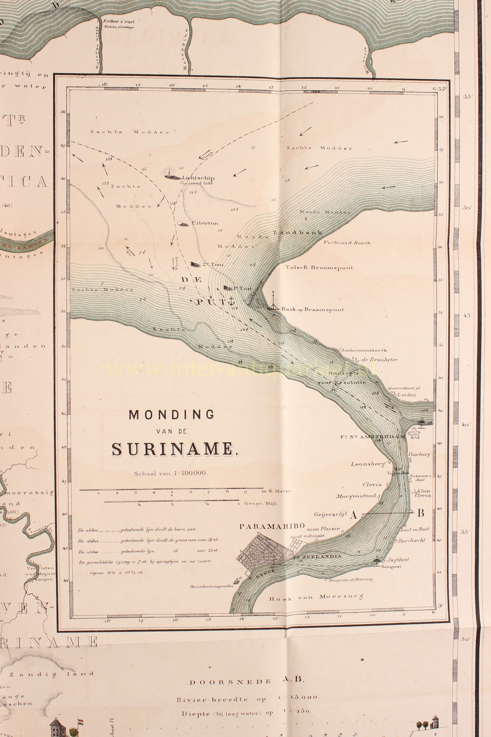
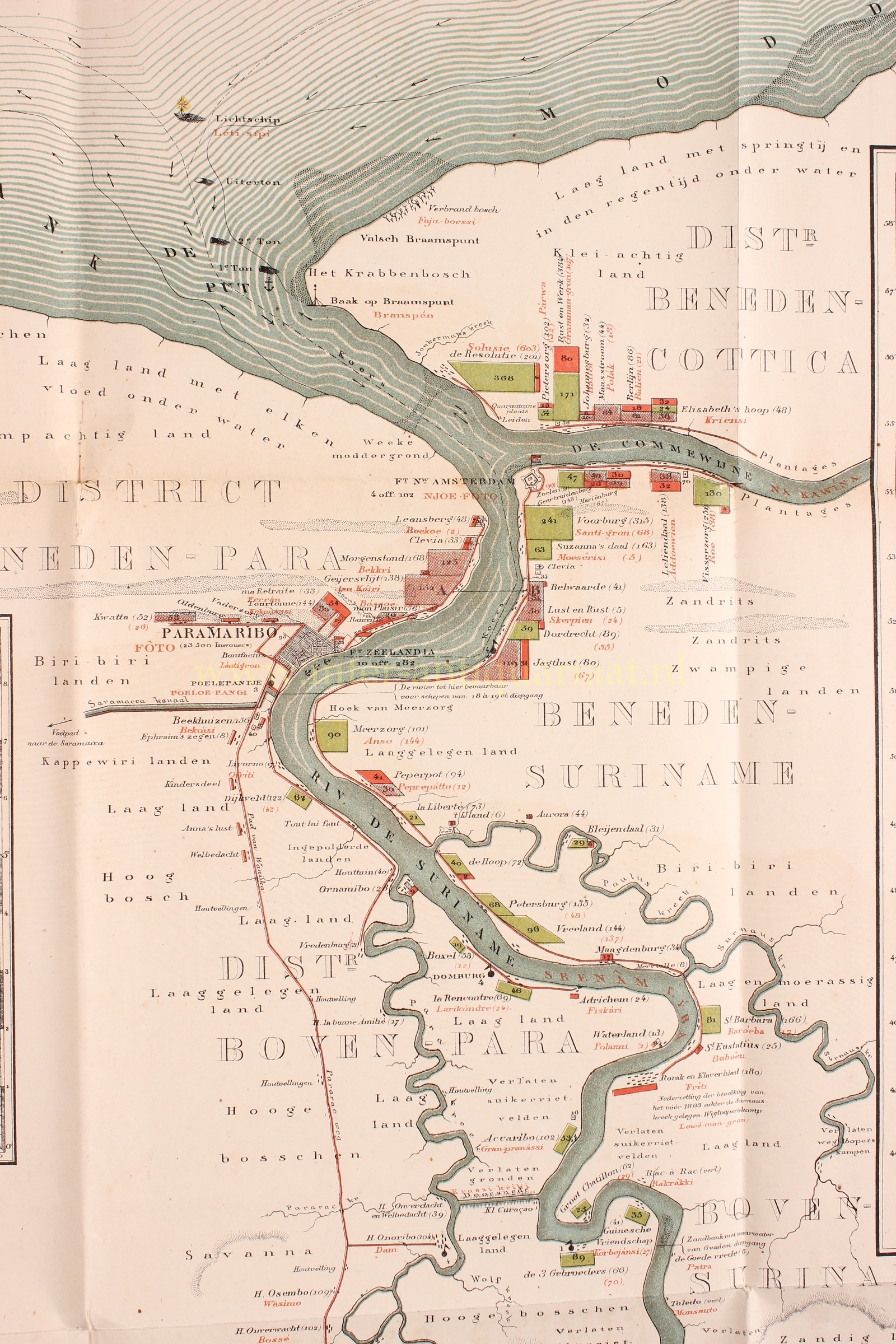
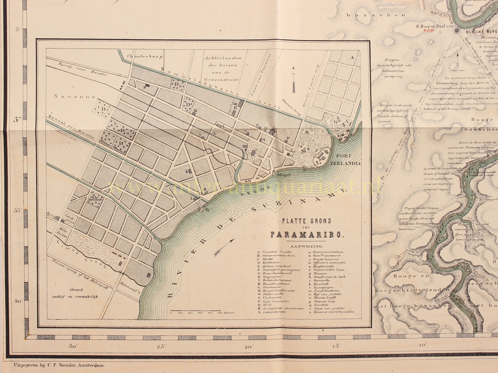
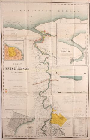

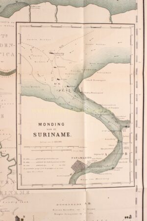
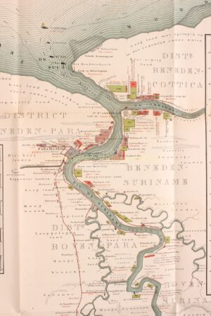
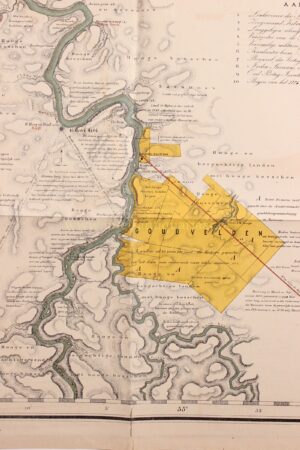
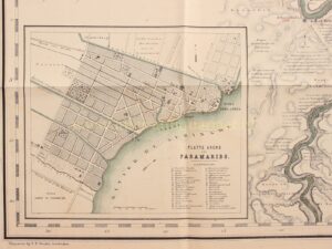
“Kaart van de rivier de Suriname” (map of the Suriname river) lithograph commissioned by infantry officer G.P.H. Zimmermann, published in Amsterdam by C.F. Stemler in 1877. Size approx. 100 x 64 cm. Including inset maps of the northeast coast of South America, Paramaribo, and the mouth of the Suriname River.
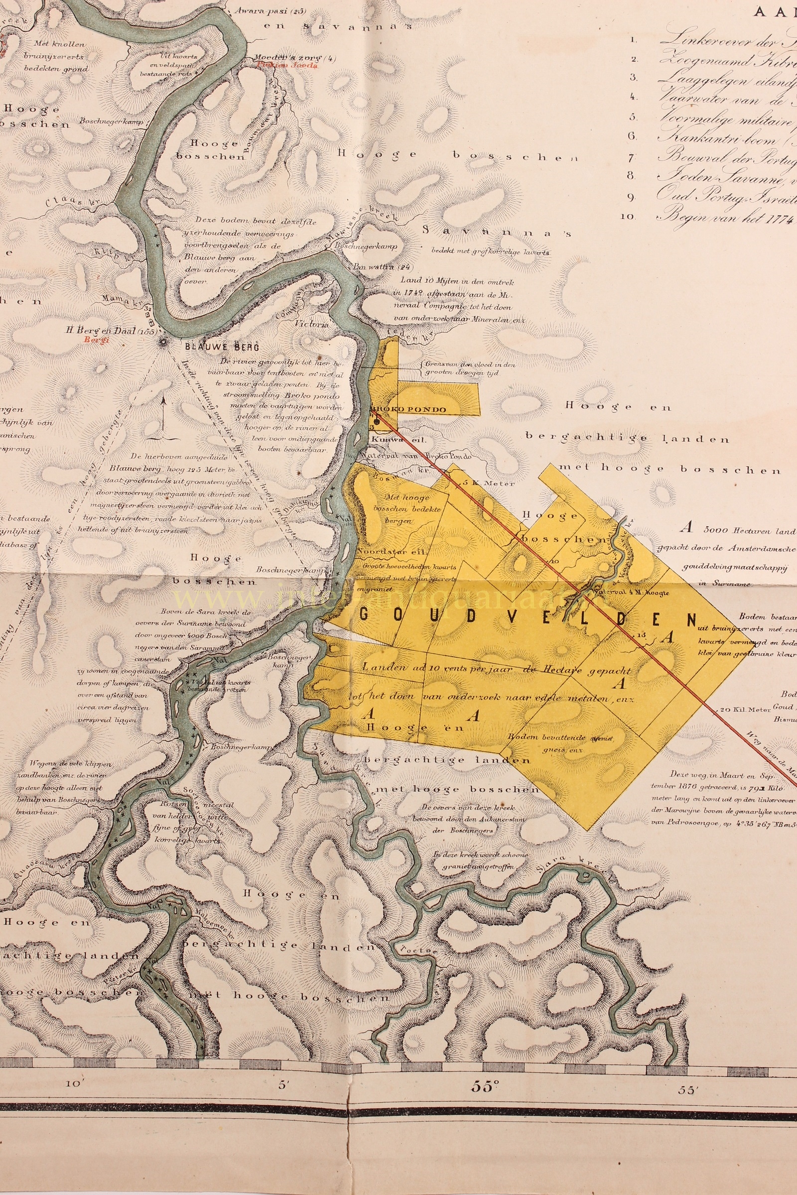
This map was based on a manuscript map drawn by W.J.F. Vermeulen, which is preserved in the Surinaams Museum in Paramaribo. The map covers the areas along the Suriname River from its mouth to the point where gold exploitation had just begun. The inset maps, depicting cross-sections of the river and showing products from the riverbanks, provide a good picture of the final phase of the plantation era.
The map indicates military occupations, plantations cultivated with sugar, cocoa, and bananas. “The communication routes mainly consist of narrow forest paths, maybe 4 to 5 paces wide, which become difficult to traverse after heavy rains and are only suitable for pedestrians and horses during the dry season, never for carriages. The names of places in the map are mentioned in red letters.”
The numbers provided on the map represent approximate hectares of cultivated land, depths at low tide, the number of people at posts or stations, the number of black and other indigenous populations at plantations and territories, and the number of immigrants and students at schools, all represented in red figures.
- G.P.H. Zimmerman, Beschrijving van de rivier ‘de Suriname’, Tijdschrift van het Nederlandsch Aardrijkskundig Genootschap 2 (1877), map no. 15;
- Koeman, Bibliography printed maps Suriname, no. 161, 238.
Price: Euro 575,-.