


LARGE ARAB 1960S MAP OF LOWER EGYPT
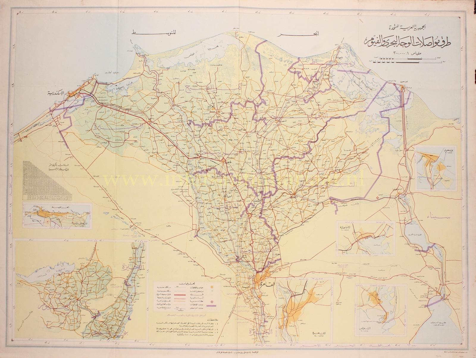
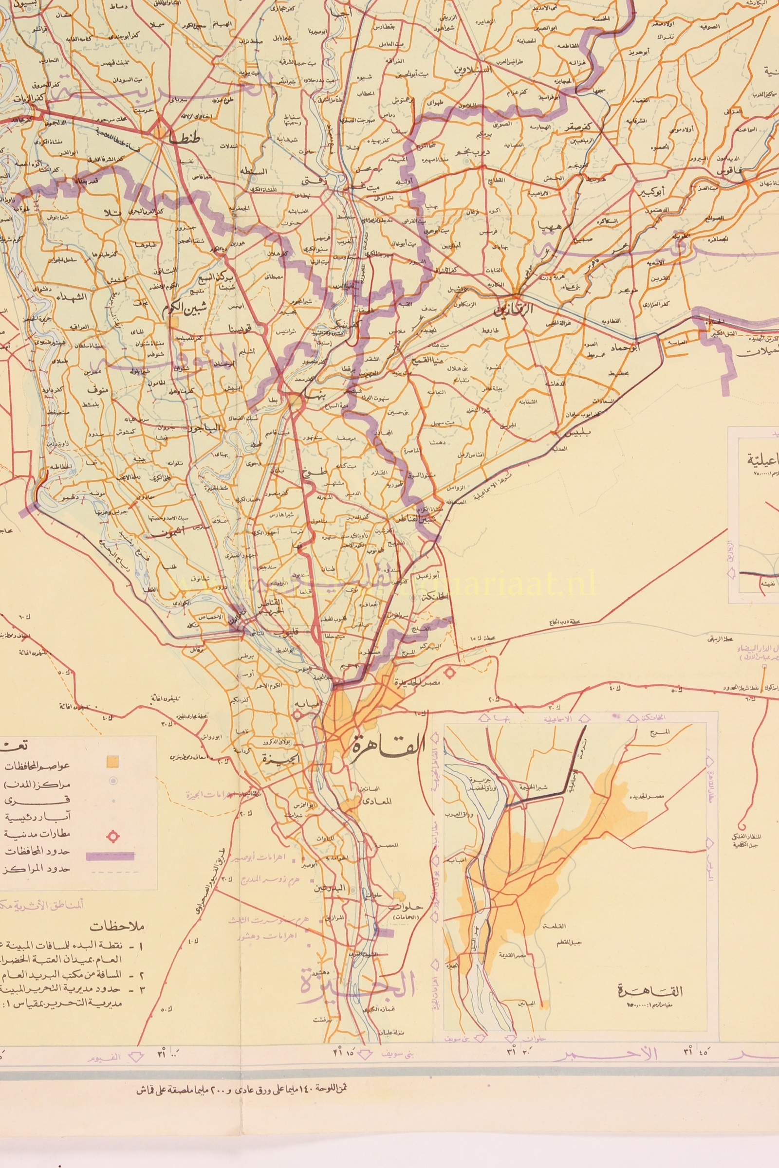
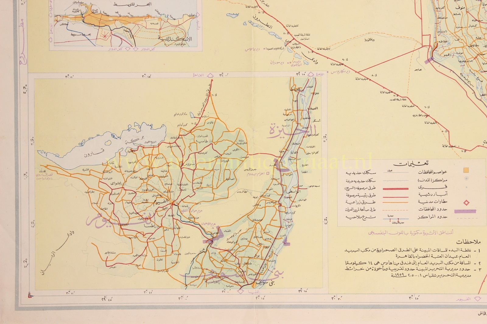
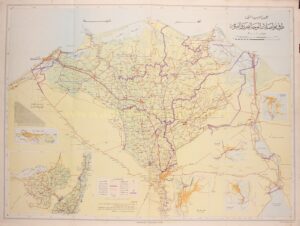
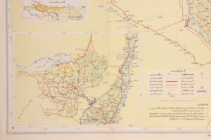
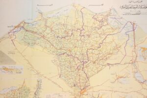
الجمهورية العربية المتحدة طرق مواصلات الوجه البحري والفيوم [“United Arab Republic – transportation routes in Lower Egypt and Fayoum.] Offset print published by the Egyptian Surveying Department in 1962. Size: approx.. 79 x 106.5 cm.
The United Arab Republic (UAR) was a sovereign state from 1958 until 1961. It was established as the first step towards a larger pan-Arab state, and initially a political union between Egypt (including the occupied Gaza Strip) and Syria. Syria seceded from the union in 1961. In 1962 Egypt became involved in the North Yemen Civil War (until 1970).
Egypt continued to be known officially as the United Arab Republic until September 1971 when it was formally dissolved.
The map shows insets of Alexandria, Cairo, Port Said, Ismailia, Suez and Fayoum. Railroads, narrow-gauge railways, paved highways, paved main roads, roads suitable for vehicles to pass, cities, villages and major wells are indicated. Archeological areas are written in purple.
Price: Euro 475,-