

“Accurata delineatio Ludovicianae vel Gallice Louisiane ol Canada et Florida…descriptae quae hodie nomine fluminis Mississippi vel St. Louis“. Copper engraving with original hand colouring with later additions. Size: 57,2 x 49,6 cm.
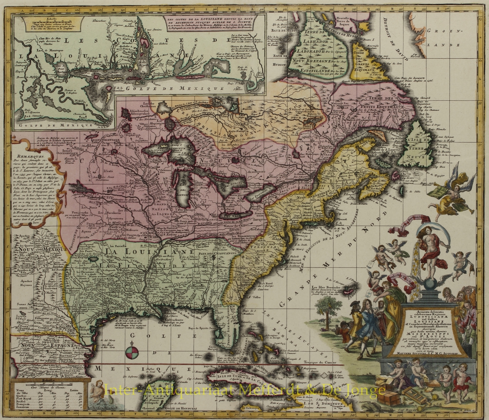
This fascinating map, published in 1730 by Matthaeus Seutter shows most of North America from the East coast to Spanish-controlled New Mexico. The French territory of Louisiana, which is really the focus of this map, spans the area between New Mexico and the Appalachian Mountains.
Seutter indicates the locations of European and Indian settlements, as well as major roads and geographical features throughout the continent. In the upper left-hand corner of the map, there is an inset map of the Louisiana coastline, from the Mississippi Delta to the Florida Panhandle.
In the lower right corner, the map title is surrounded by a cartouche that represents the infamous story of the “Mississippi Bubble,” a stock scandal that financially ruined many Europeans in the early 1700s. The cartouche shows wealthy, hopeful investors standing to the left of a statue of Faith, who is pouring riches out of a large cornucopia. The investors are eagerly buying shares of stock from winged cherubs. Several more cherubs are seated on the ground, cutting piles of paper into stock shares. To the right of the statue, a group of impoverished, cheated investors watches sadly as a cherub dangles an empty purse above them. Beneath the cheated investors, two small children are blowing soap bubbles.
Price: SOLD