

Amstelland – Yntema en Tieboel, 1767

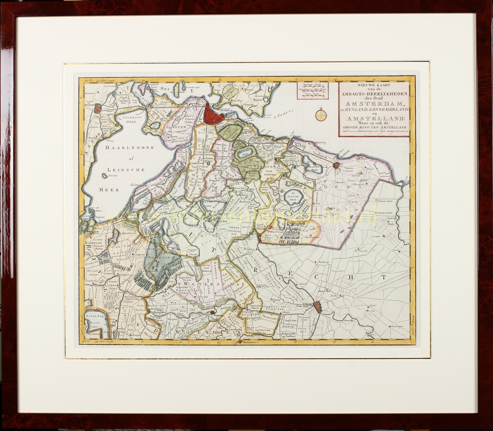

“Nieuwe Kaart van de Ambagts-Heerlykheden der Stad Amsterdam.” [New map of the manorial jurisdictions of the city of Amsterdam.] Copper engraving published in 1767 in Amsterdam by Yntema and Tieboel as part of “Amsterdam in zyne opkomst, aanwas, geschiedenissen, voorregten, koophandel, gebouwen, kerken, schutterye, gilden en regeeringe” [Amsterdam in its rise, growth, history, privileges, commerce, buildings, churches, civic guard, guilds and government] written by Jan Wagenaar. Coloured by a later hand. Size (plate): 35 × 43.7 cm (frame: 56 × 64 cm).
This map presents an overview of the “Heerlijkheden” (manorial jurisdictions) that in the eighteenth century fell under the authority of the city of Amsterdam, extending across Rijnland, Kennemerland, and Amstelland. It prominently features the so-called “Groote Ring van Amstelland” [Great Ring of Amstelland], indicated by a dotted line marking the geographical reach of Amsterdam’s jurisdiction.
Surrounding the city are the polder landscapes of Sloten, Ouderkerk, Amstelveen, Vinkeveen, Weesp, and Diemen, each carefully named. The map also depicts the lakes that still existed at the time, such as the Haarlemmermeer and the Bijlmermeer, along with the numerous drained polders that shaped the landscape around the capital.
Published as an illustration to Jan Wagenaar’s monumental history of Amsterdam, this map provides an administrative and topographical view of the territory over which the city exercised its judicial, economic, and water management authority in the eighteenth century.
Price: SOLD