ONE OF THE FINEST MAPS OF 17TH CENTURY AMSTERDAM
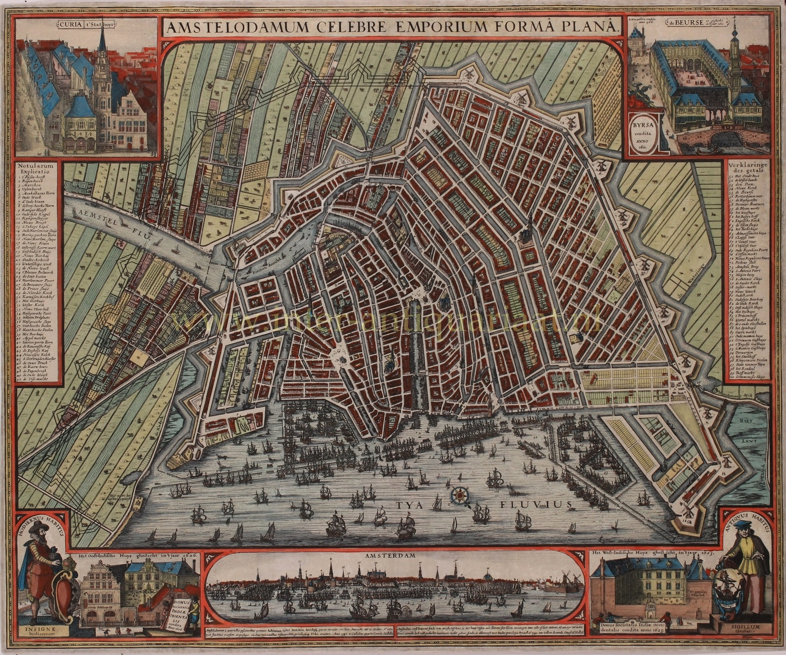
“Amstelodamum Celebre Emporium Forma Plana”, copper engraving made around 1643 by Claes Jansz. Visscher. Colored by a later hand. Size: 38 x 54 cm.
We see the city with its so called Third Expansion. Soon after the completion of this expansion, plans of the city appeared showing the outlines of a next expansion. The city’s fortifications were extended from the Leidsegracht across the Amstel river until the IJ waterfront. This gave the city its symmetrical outline. The planned rampart, complete with bulwarks, is shown here on the map, extending right through the still rural area outside the city.
In the top right corner we see the commodity exchange built by Hendrick de Keyser, founded in 1611. On the plinth next to it, there’s a staff beloning to Mercury, the god of commerce and merchants. In the background the city weigh house that stood on the Dam Square from 1566 (and was demolished in 1808).
Below the map a prospect of the city, under which we read: “Amsterdam, first inhabited by fishermen around the year 1280, was very small with a wooden fortress and towers. Destroyed and levelled to ground in the year 1300, but rebuilt again by its citizens and granted city rights in 1342 by William the Fourth, Count of Holland.”
In the lower corners we see a ‘current resident’ (left) in seventeenth-century, and former resident in medieval attire (right). The first, whose hands rest on a shield with the coat of arms of Amsterdam, looks at the Oost-Indische Huys (where the Amsterdam chamber of the Dutch East-India company was located). The second, with a hand on the city seal, stands next to the “West-Indische Huys , the headquarters of the Dutch West-India Company in Amsterdam.
Finally, in the top left corner, we see the old town hall that stood (on the site of the current Royal Palace) on Dam Square from the 14th century to 1652.
Literature: Marc Hameleers “Kaarten van Amsterdam 1538-1865”, nr. 24-2
Price: SOLD


