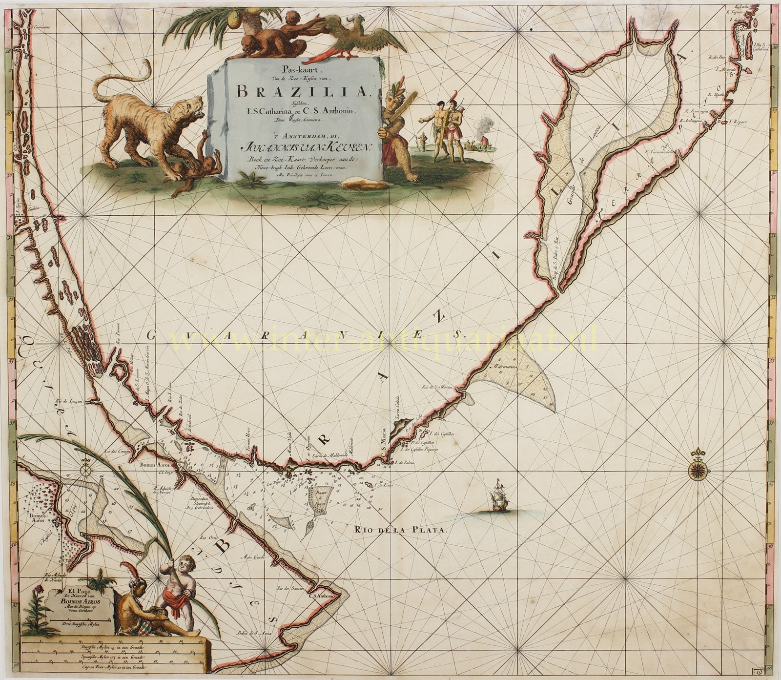
“Pas-kaart van de zee-kusten van, Brazilia, tusschen I.S. Catharina, en C.S. Anthonio,” copper engraving made by Jan Luyken after the design by Claes Jansz. Voogt for his sea atlas “De Nieuwe Groote Lichtende Zee-Fakkel,” published by Johannes van Keulen in Amsterdam after 1683. With original hand colouring. Size: 51.8 x 59.5 cm.
On this navigational chart, we see the mouth of the La Plata River, extending northward along the coasts of present-day Argentina, through Uruguay to Santa Catarina Island in Brazil.
A putto in the lower left holds a large reed to indicate the beginning of the inset map of the approach to Buenos Aires (“Boinos Airos“), placed above a scale of miles. The title cartouche is adorned with an exciting scene in which a jaguar is about to kill a monkey, while a cockatoo prepares to fly away, and a native looks on, his machete ready.
Dutch privateers in the 17th century attempted to gain access to valuable trade goods such as silver, sugar, and other resources exported by the Spanish and Portuguese from South America. The Dutch West India Company (WIC) launched attacks on Spanish and Portuguese ships and regularly tried to gain access to South American markets, including those of the Río de la Plata.
Although the Dutch failed to maintain long-term control over the Río de la Plata, they became notorious in the region. By the end of the 17th century, however, their influence in South America had declined, especially after the loss of Dutch Brazil in 1654, though their economic activities and rivalry with Spain continued to play a role.
In 1678 Johannes van Keulen (1654-1715) established himself in Amsterdam and in 1680 he obtained a patent from the States of Holland and West Friesland allowing him to print and publish maritime atlases and shipping guides. These were books of maps and descriptions of itineraries, used by helmsmen for safe navigation. The patent was a kind of protection against illegal copying of produced books and charts. This was especially important for the atlases which were made with extensive initial costs. Van Keulen named his firm ‘In de Gekroonde Lootsman’ (In the Crowned Pilot). Soon Van Keulen struck a deal with cartographer Claes Jansz. Vooght.
From 1681 onwards the “Nieuwe Groote Lichtende Zee-Fakkel” appeared, a five-volume atlas for which Vooght compiled the maps and which was illustrated by Jan Luyken. The five volume Zee-Fakkel made Johannes van Keulen famous. The Zee-Fakkel was published in 5 volumes between 1681 and 1684 containing over 130 new charts.
Literature: Atlantes neerlandici : bibliography of terrestrial maritime and celestial atlases and pilot books, published in the Netherlands up to 1880, dl. 4, p. 356, cat.no. [156]
Price: SOLD


