

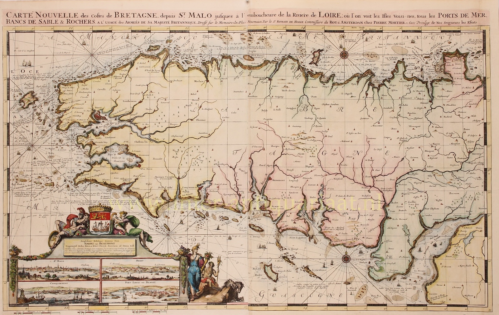
BEAUTIFUL MAP OF BRITTANY (BRETAGNE)
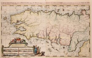
“Carte Nouvelle des Costes De Bretagne depuis St. Malo jusques a l’emboucheure de la Riviere de Loire“, copper engraving made by Romeijn de Hooghe and published by Pieter Mortier of Amsterdam in 1693. Coloured by a later hand. Size: 63 x 98 cm.
Elaborately etched and engraved chart of Brittany (Bretagne) between the town of Saint-Malo and the mouth of the Loire river. With inset views of Saint-Malo, Brest, Concarneau, and Port-Louis (where the French East India Company was established) on the Blavet river mouth.
From the 15th to the 18th century, Brittany reached an economic golden age. The region was located on the seaways near Spain, England and the Netherlands and it greatly benefited from the creation of a French colonial empire. Seaports like Brest and Saint-Brieuc quickly expanded, and Lorient, was founded in the 17th century. Saint-Malo then was known for its corsairs, Brest was a major base for the French Navy and Nantes flourished with the Atlantic slave trade. On its side, the inland provided hemp ropes and canvas and linen sheets.
The map is dedicated to Simon van Beaumont (a high ranking Dutch civil servant and diplomat. Van Beaumont was a pensionary in Middelburg, pensionary of Rotterdam, he sat in the States of Zeeland and of Holland respectively and was a representative of Zeeland in the States General.
The map is from the “Cartes marines a l’usage des armées du Roy de la Grande Bretagne”, the second part of the “Neptune François”, in which charts are larger and more lavishly decorated than those of any preceding book of this kind. This magnificent work was intended more as a show piece than something to be used by pilots at sea. (According to Cor Koeman it is “the most expensive sea-atlas ever published in Amsterdam in the seventeenth century”.)
This part of the atlas, which contains nine charts, constitutes “the most spectacular type of maritime cartography”. It was prepared for the use of William III who needed accurate information on the Channel coasts for his war plans against king Louis XIV of France. In 1694 he sent an expedition to attack several of the ports which are illustrated in the etched vignettes that decorate these charts. What has won their lasting fame, however, is the identity of their author: the artist-engraver Romeijn de Hooghe (1645-1708). Since he undertook all stages of production himself, the charts exhibit a rare harmony of design and execution. The allegorical subjects which characterise his designs are here transformed into dramatic cartouches.
Price: SOLD