

Dutch Republic – Carel Allard, c. 1690
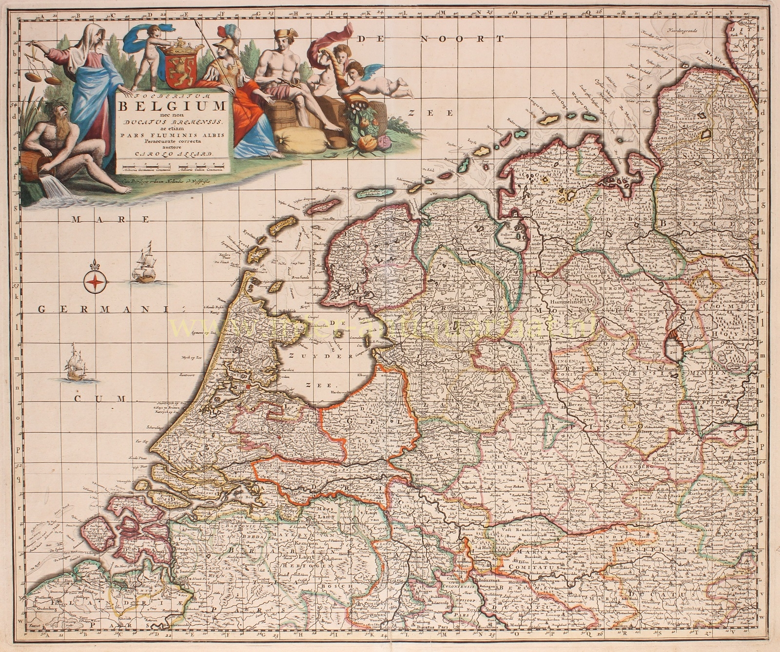
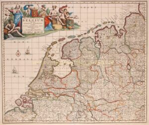
RARE MAP OF THE DUTCH REPUBLIC
“Foederatum Belgium nec non Ducatus Bremensis ac etiam fluminis Albis…” Copper engraving, published by Carel Allard in Amsterdam around 1690. With original hand colouring. Size: approx. 47 x 56 cm.
The Republic of the Seven United Netherlands, between 1588 and 1795, largely covered the territory of present-day Netherlands and consisted of eight sovereign states: Groningen, Friesland, Overijssel, Gelderland, Utrecht, Holland, Zeeland, and Drenthe. Each state governed its own territory. Representatives from seven states (excluding Drenthe) sent their delegates to the States General in The Hague. Regions outside the eight provinces but part of the confederation’s territory, the so-called Generality Lands, were mainly located in present-day Zeeuws-Vlaanderen, the current Dutch provinces of North Brabant, Limburg, and in the southeast of the current province of Groningen.
Remarkable for the small republic of maximum 2.5 million inhabitants was the success of Dutch global trade through the Dutch East India Company (VOC), the West India Company (WIC), and trade in the Baltic Sea, along with significant military successes against seemingly stronger countries such as Spain and England. The republic boasted a massive fleet (with 2000 ships larger than those of England and France combined), flourishing arts (Rembrandt, Ruysdael, Avercamp, Van Dyck, and many others), and sciences (including Hugo de Groot, Huygens, Van Leeuwenhoek), accompanied by relatively significant intellectual freedom for the time.
In the upper left corner of the map, the title is depicted in a richly decorated cartouche, surrounded by a river god, Lady Justice, the goddess of wisdom and arts Minerva, the god of trade Mercury, cherubs with a Horn of Plenty, and the coat of arms of the Republic. The map is has a grid and a degree scale along the edges.
The title of the map, “Foederatum Belgium,” is derived from “Gallia Belgica,” the northern part of Gaul between the Seine and the Rhine in Roman times. “Belgica” later became the Latin name synonymous with the Low Countries.
Price: SOLD