

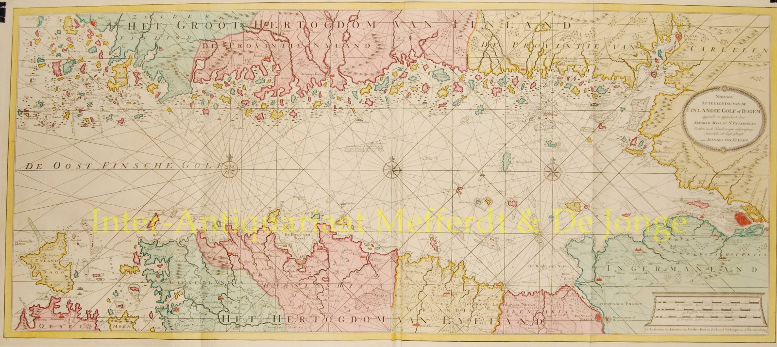
“Nieuwe Afteekening van de Finlandse Golf of Bodem”
Large copper engraving on two sheets after Abraham Maas published by Johannes Van Keulen in 1728 or later. Original hand colouring. Size: 50 x 113 cm. Folded as issued, excellent condition.
From the “Nieuwe Lichtende Zee-Fakkel” (New Shining Sea Torch) one of the most succesful maritime atlases from the seventeenth and eighteenth centuries. Of this atlas, first published by Johannes van Keulen in 1681, many editions and translations kept appearing until the end of the eighteenth century. Maps for the five/six volume Zee-Fakkel had been compiled by Claes Jansz. Vooght, “Geometra, Leermeester der Wis-Konst” (surveyor and math teacher).
The map was part of the atlas’ first volume containing charts and sailing instructions of the North Sea, the Zuider Zee, and the coasts of Denmark and Norway up to Archangel in the north of Russia, and from the Baltic and the Finnish Gulf to St. Petersburg.
Van Keulen could pride himself in being the publisher of the best updated maritime atlas available at the time.
The map credits Abraham Maas (1641-1729), a Dutch surveyor who was active in the Baltic Region and also in South America (on behalf of the Dutch West India Company) at the beginning of the 18th century.
Price: VERKOCHT