

Flanders – Abraham Ortelius, 1592
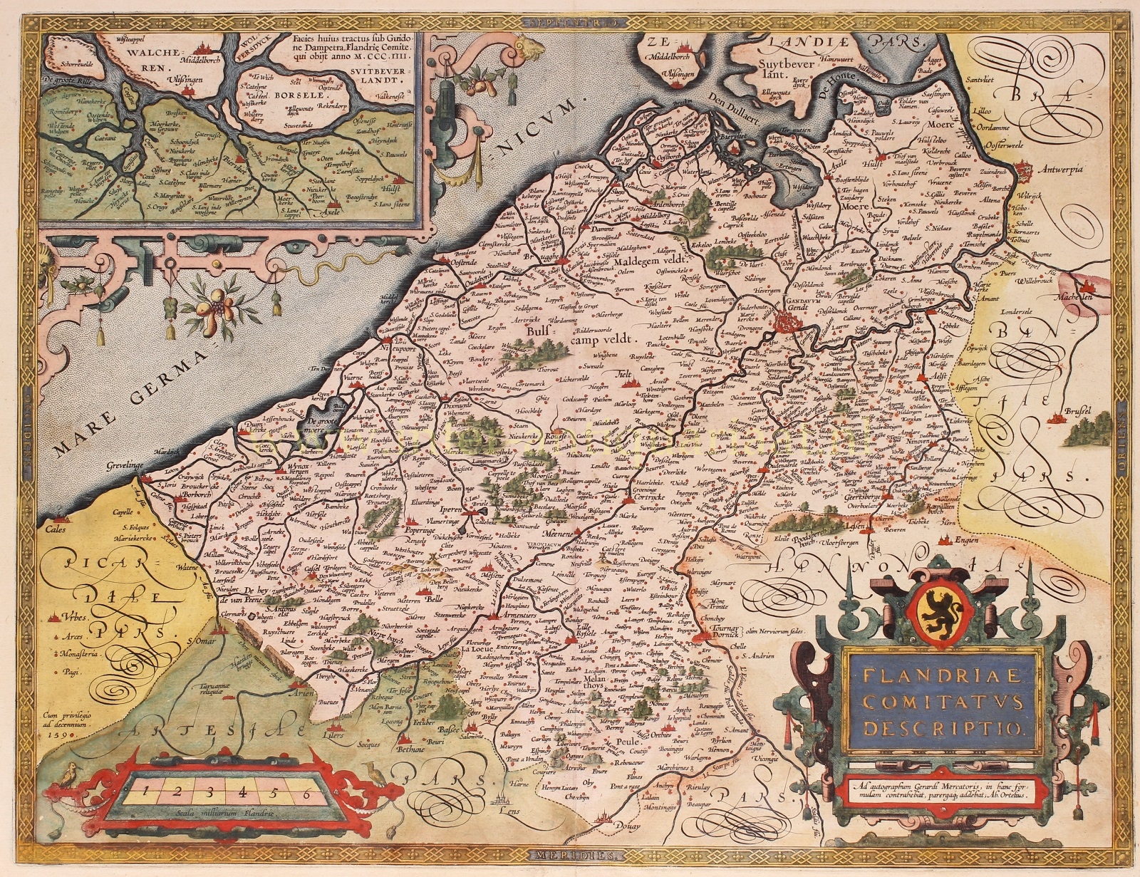
“Flandriae Comitatus Descriptio” [Desciption of the county of Flanders], copper engraving piblished in 1592 by Abraham Ortelius of Antwerp. 1st state. Verso: Latin. With original hand colouring. Size: 37,7 x 59,2 cm.
This was the third and final plate of the map of Flanders created by Ortelius for his monumental Theatrum Orbis Terrarum, the first ‘modern’ world atlas. This map was created based on a 1540 map by Gerard Mercator but with modifications by Ortelius.
In the top left corner, there’s an inset map of Zeelandic Flanders during the time of Count Guy of Dampierre and the Flemish Revolt (1297-1305) against France. After that conflict, Flanders eventually came under French rule again. At the time Ortelius published this map, the Eighty Years’ War was ongoing. It was a turbulent period. The Siege of Antwerp (1584-1585) had just occurred, and it was within a period known as the ‘Ten Years‘ (1588-1598), during which there were relatively many victories against Spanish troops. It’s as if Ortelius wanted to suggest that after the Flemish Revolt two centuries earlier, the people once again fell into line. By doing so, as a publisher, Ortelius might have seemed neutral in the eyes of the Spaniards. Especially, considering that the map was used long after the ‘Ten Years’ period.
During Ortelius’ time, there were no atlases as we know them today. Instead, there were individual maps for sailors and composite atlases made to order. These often consisted of maps of varying sizes, and on a diffirent scale.
Ortelius likely received the idea from cartographer Gerard Mercator, to gather geographical knowledge from various sources and distribute maps among a broad audience. This led to the concept of a ‘modern’ atlas: a collection of uniformly sized maps compiled into a book, specifically (re)engraved in copper for publication. The publisher would release multiple copies of the book, which was also a new concept.
The production of the atlas was a significant undertaking. For the first edition, Ortelius gathered the best material available to him. He had personally redrawn all 53 maps to a standard size and added descriptions of countries and places. Finally, he included references to the original map sources, which was rather unusual in the sixteenth century. While mapmakers commonly used copperplates from predecessors, they rarely credited the sources.
Once the maps were drawn, Ortelius had them engraved into copperplates by Frans Hogenberg and his assistants Ambrosius and Ferdinand Aertsen. Gillis Coppens van Diets handled the printing. The atlas was named Theatrum Orbis Terrarum or Theatre of the World. The first edition appeared in Latin in 1570.
In 1571, the first Dutch edition was published. Notably, the texts were not direct translations from Latin but were specially written for a general, non-scientific audience. For example, Ortelius wrote that The Hague was the best village in Europe and that its inhabitants did not want walls because they preferred living in the best village rather than in a city like so many others.
Ortelius’ atlas was an immediate success. Although such an atlas was a significant investment for a buyer, especially with coloured maps, there were enough wealthy citizens eager to expand their knowledge of the world. Consequently, the first edition sold out quickly. Ortelius decided to create new editions with more maps. Translations into German, French, Spanish, and later into English and Italian were also published. These later editions, starting from 1579, were produced by the famous Antwerp printer Christoffel Plantijn.
Literature: Marcel van den Broecke (2011), “Ortelius Atlas Maps – An illustrated Guide”, nr. Ort76
Price: SOLD