

LARGEST ANTIQUE MAP OF JAVA
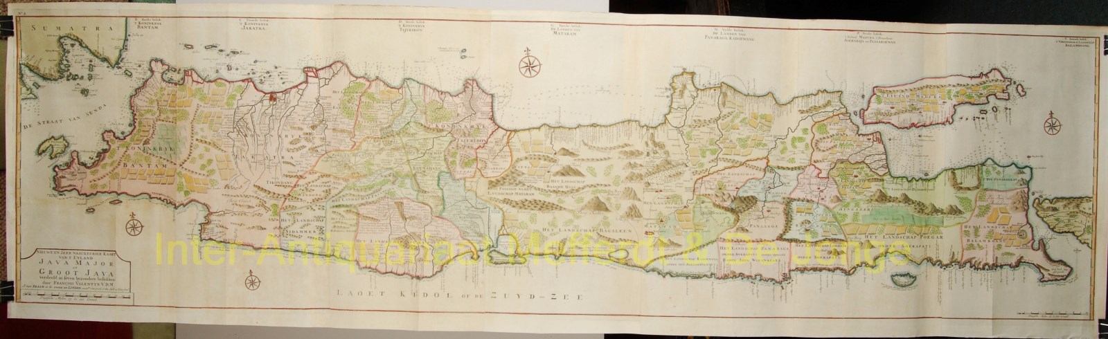
“Nieuwe en Zeer Naaukeurige Kaart van t Eyland Java Major of Groot Java Verdeeld in Seven Byzondere Bestekken”
Copper engraving from François Valentijn’s “Oud en Nieuw Oost Indien” published in Dordrecht in 1726. The map was drawn and engraved by Jan van Braam and Gerard onder de Linden. Printed on seven sheets, joined. Size 45,8 x 174 cm. Original hand colouring
This remarkable, large-scale map of Java measures almost six feet long. It is richly engraved with details of agricultural fields, roads, temples, and topography. The coastline is filled with soundings, anchorages, shoals and other navigational hazards. Batavia, which was the center of the Dutch trading empire in the East Indies, is depicted with a miniature bird’s-eye plan.
Valentijn (1666-1727) was a prominent historian of the Dutch East India Company who is best known for “Oud en Nieuw Oost Indien”, his vast illustrated account of the Dutch trading empire in Asia. He twice traveled to the East Indies and served as Calvinist minister to Ambon between 1686 and 1694. In preparing this monumental work, he was given privileged access to the previously secret archives of the VOC, containing transcripts and copies of important earlier Dutch voyages.
While Valentijn’s maps and diagrams were prized possessions, his scholarship, judging by 21st century standards was unscrupulous. Valentijn’s use of the products of other scientists’ and writers’ intellectual labour and his passing it off as his own, reveals a penchant for self-aggrandisement.
Price: SOLD