

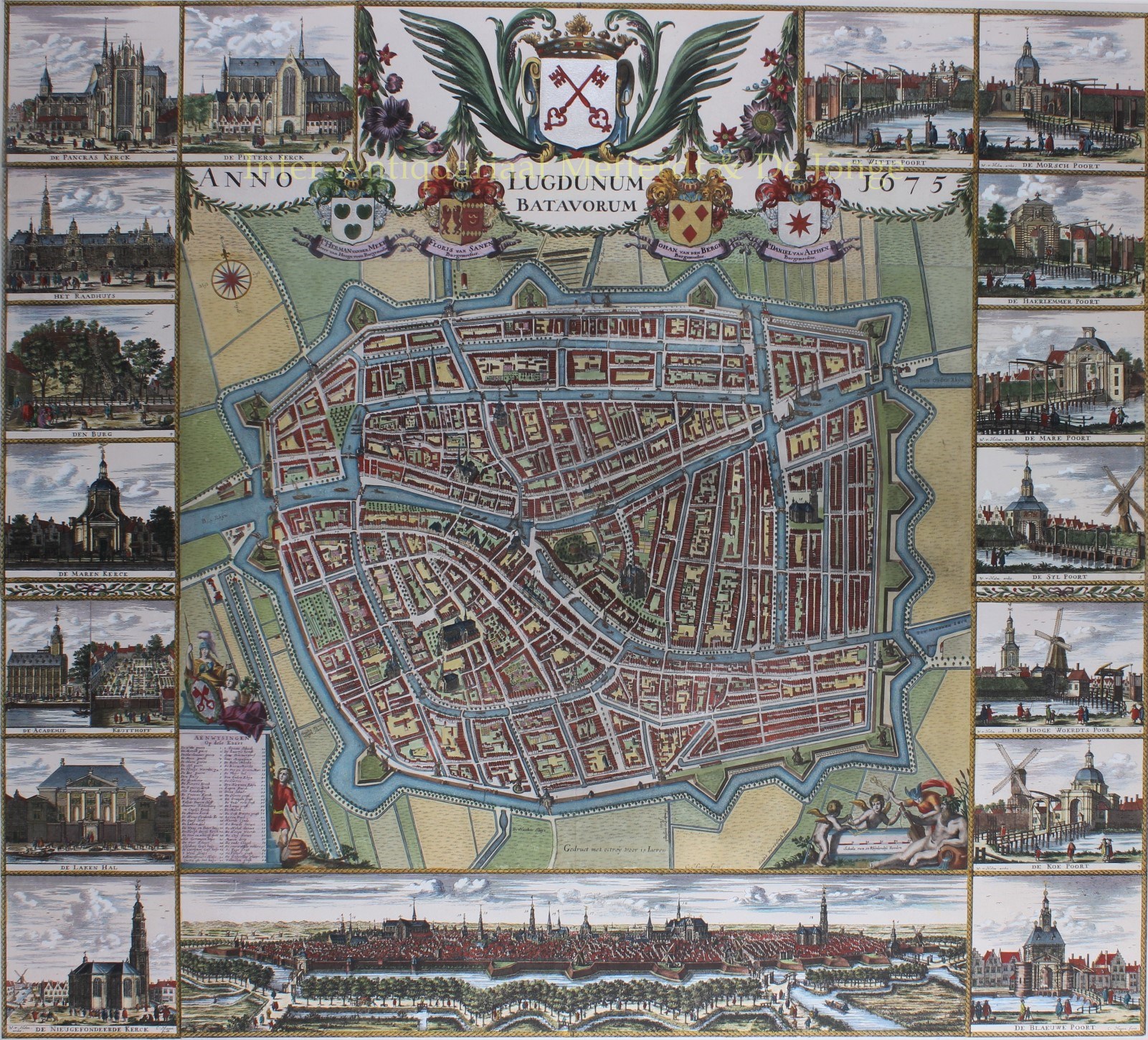
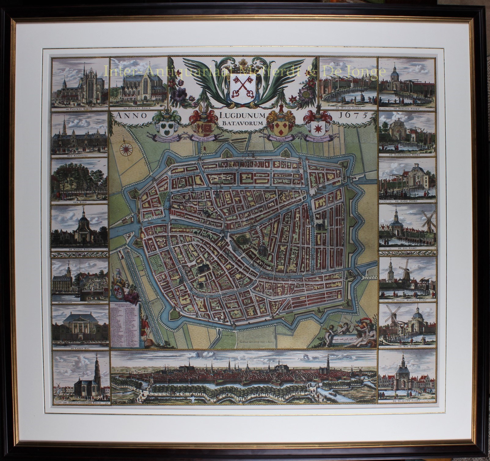
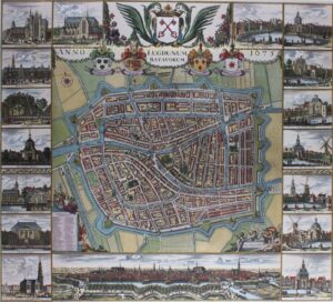
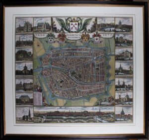
BEROEMDE WANDKAART VAN LEIDEN
“Lugdunum Batavorum 1675.” De befaamde zgn. ‘Kleine Hagen‘. Gravure gedrukt van meerdere koperplaten. “Afgemeten en Afgeteykent door Johan Douw De Jonge” en gegraveerd door Christia(e)n (van) Hagen. Later met de hand gekleurd. Afm. (prent) ca. 84 x 94 cm, lijst 108 x 116 cm.
Wandkaart van Leiden, plattegrond met een panorama van de stad gezien vanuit het zuiden. Links met afbeeldingen van Pieters Kerk, “Pancras-” ook wel Hooglandse Kerk, universiteit met hortus, Lakenhal, de door geldgebrek nimmer verder dan de fundamenten gebouwde Nieuw Gefundeerde Kerk, stadhuis, burcht en Mare Kerk. Rechts de Witte Poort, Morspoort, Hogewoerdsbinnenpoort, Koepoort, Blauwpoort, Rijnsburger- of Haarlemmerpoort, Marepoort en Zijlpoort. Bovenaan de door festoenen verbonden wapens van de stad en van de vier regerende burgemeesters. Op de kaart zijn cartouches met allegorische figuren afgebeeld met genummerde aanwijzing van namen van straten en gebouwen.
Aan het eind van de 16de- en in de eerste helft van de 17de-eeuw werd de bebouwing in het middeleeuwse stadsdeel sterk verdicht. Door overbevolking, verschuivingen in de sociale samenstelling van de bevolking en functieverandering van huizen en grachten, werden erven en binnenplaatsen volgebouwd met achtersteegjes; de zgn. poorten. De daaraan gelegen arbeiderswoningen waren zeer klein en vaak van slechte kwaliteit. Om te kunnen voorzien in het steeds nijpender gebrek aan ruimte werd de stad in de eerste helft van de 17de eeuw in een aantal uitleggen fors uitgebreid. Voor een deel zijn dit voor de hand liggende opvullingen van relatief kleine percelen tegen de oude stadsgrens aan. Bij al deze uitbreidingen heeft het stadsbestuur met wisselend succes geprobeerd de inrichting van de kavels en de bebouwing aan regels te onderwerpen. De uitgangspunten daarbij waren een mengsel van stedenbouwkundige, sociale, milieutechnische en welstandelijke argumenten. Door de grote aantallen arbeiders en kleine ambachtslui, werd er in de nieuwe wijken vooral voor hen gebouwd. De stad probeerde door de aanleg van brede, voorname grachten als de Oude Vest ook voornamere bebouwing te stimuleren, maar de eenvoudige en eenvormige kleine en middelgrote huizen beheersten het straatbeeld.
Na voltooiing van de stadsuitbreidingen werd in 1667 opdracht verleend voor het vervaardigen een nieuwe grote kaart van Leiden. Op dat moment heeft de stad ca. 65.000 inwoners. In overeenstemming zowel met de nieuwe omvang als met de vermaardheid van Leiden, moest het een waardig stuk propaganda worden.
De landmeter van Rijnland J(oh)an Dou (1615-1682) heeft meer dan anderhalf jaar nodig voor de ontwerptekening klaar is. Voor het graveren en uitgeven wordt eerst de bekende Joan Blaeu gecontracteerd, maar door een grote brand die Blaeu’s drukkerij in vlammen doet opgaan, wordt bijna al het werk verricht door Christiaen van Hagen (ca. 1635-1688).
De grote plattegrond met daaromheen de belangrijkste gebouwen (de zgn. ‘Grote Hagen’, hier te zien op onze site) is af in 1670. Omdat men zeer content was met het resultaat, verscheen een aantal jaren later de hier beschreven verkleinde versie van de kaart die bovendien werd uitgebreid met afbeeldingen van de stadspoorten.
Literatuur: Euro. Pelinck, “De Kaart van Hagen” – in Leids Jaarboekje 1954 pp. 113-127
Prijs: VERKOCHT