

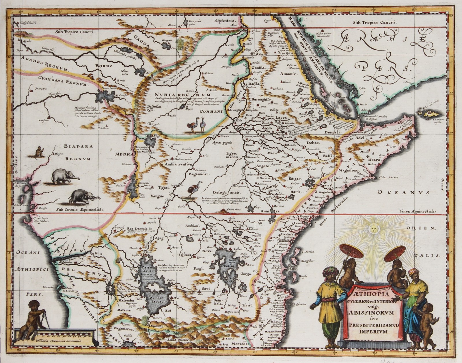
MAP OF ABISSINIA
“Aethiopia Superior vel Interior vulgo Abissinorum“. Copper engraving published aprox. 1670 by Olfert Dapper in his Naukeurige Beschrijvinghe der Afrikaensche gewesten, with original hand colouring. Size. 29 x 37,5 cm.
Attractive map of central Africa, covering the area from the Bight of Benin to the Indian Ocean and from Arabia and the Red Sea to Mozambique. It includes two decorative cartouches and is embellished with elephants, monkeys, and ostriches. While the African coast exhibits considerable advances over earlier maps of the region, the interior of Africa exhibits a cartography primarily based on the literature of antiquity.
The map is smaller edition of Blaeu´s map of Africa from around 1630. Bleau derived most of the interior details from classical texts such as the Geographia of Claudius Ptolemeus. The map follows the Ptolemaic model with regard to the course of the White Nile and its source in two great lakes – the Zaire Lacus (Zembre Lacus) and the Zaflan Lacus, themselves in the foothills of the Mountains of the Moon or Lunae Montes, located at the base of the map. The Blue Nile, which has its source is modern day Ethiopia, is expressed as a complex network of rivers and valleys bearing little resemblance to reality – though the observer will note that many of the place names, Amara, Tigre, Dobas, and Dangali, do in fact reflect real places and are still in use today. Blaeu also draws a lake at the source of the Niger River, set just north of the West African Kingdom of Biafara, but fails to properly connect the river to its southern extension – which is vaguely noted.
Price: SOLD