

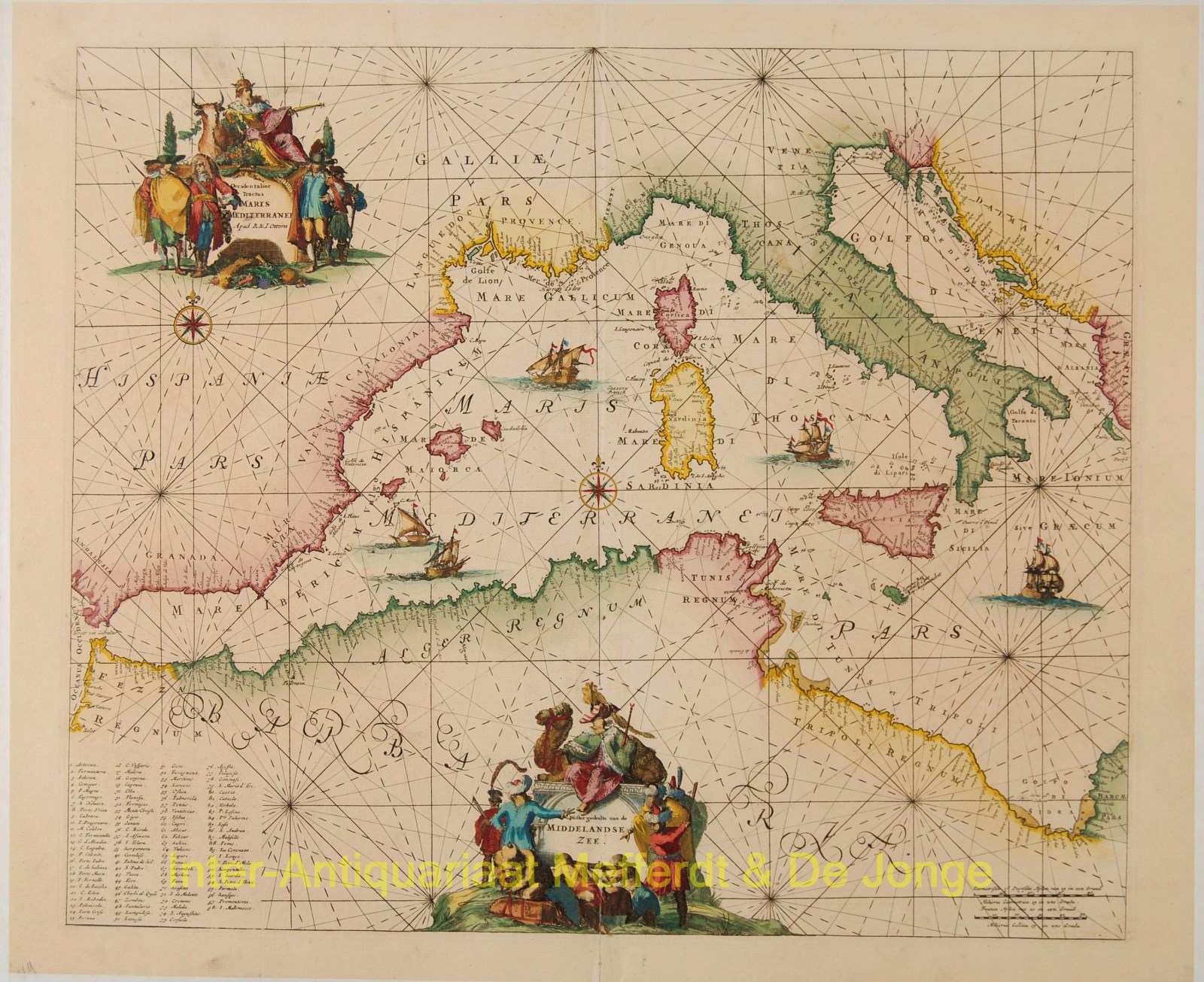
“Occidentalior Tractus Maris Mediterranei. Wester Gedeelte van de Middelandse Zee”
Copper engraving with original hand colouring. The map was first published in 1680 by Frederick de Wit, then by Louis Renard. This copy was published in Amsterdam in 1745 by Reinier and Joshua Ottens in their Atlas der Zeevaart. Size: 47 x 56 cm. Very nice copy.
Wonderful sea chart of the western Mediterranean, extending from the the Adriatic Sea to the Straits of Gibraltar.
Classical Portolano style sea chart, showing exclusively coastal details. Two ornate cartouches and multiple sailing ships, compass roses and rhumb lines.
Price: SOLD