

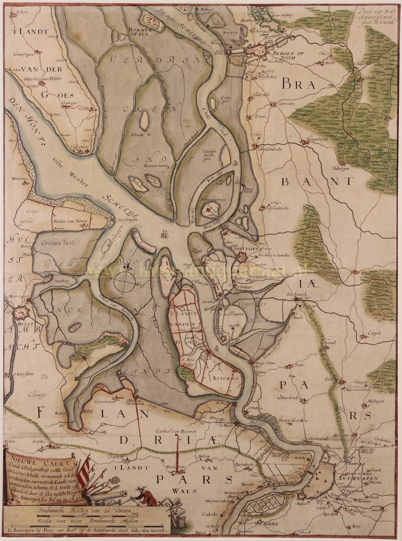
“Nieuwe Caert Vande Ghelegentheit van Oost en Wester Schelde vertoonende ock de verdroncken overwaterde Lande nieu aengewassen schoren en de kreeke oft killen in en door de selve tussche Bergen en Antwerpen soo het nu is, 1631” (New chart of the location of East and West Scheldt, also showing the flooded, now underwater land, newly emerged shoals, and creeks or inlets of the river between Bergen and Antwerp as it is now, 1631). Copper engraving published by Pieter Verbist in Antwerp in 1642/43. 1st state of 5. With original hand colouring. Size: 54 x 40 cm.
The map depicts the Scheldt river in the final phase of the Eighty Years’ War, the conflict between the Spanish Empire and the Dutch Republic, which was founded in 1588.
The depicted region shows the various connections between the East and West Scheldt, polders with their drainage systems, marshes along the Scheldt, and heathland with dunes in the northeast; hatching was applied to the map indicating riverbanks. The cities are situated within their fortifications, with indications of their most important churches; the villages are represented as a church tower with a few houses.
At the time of its release, accurate maps played a significant strategic role in warfare. Therefore, multiple versions or states of this map exist, each with small modifications. As the conflict progressed, attacking troops, artillery positions, the names of commanders, and flooded areas were mapped and updated accordingly.
Price: SOLD