

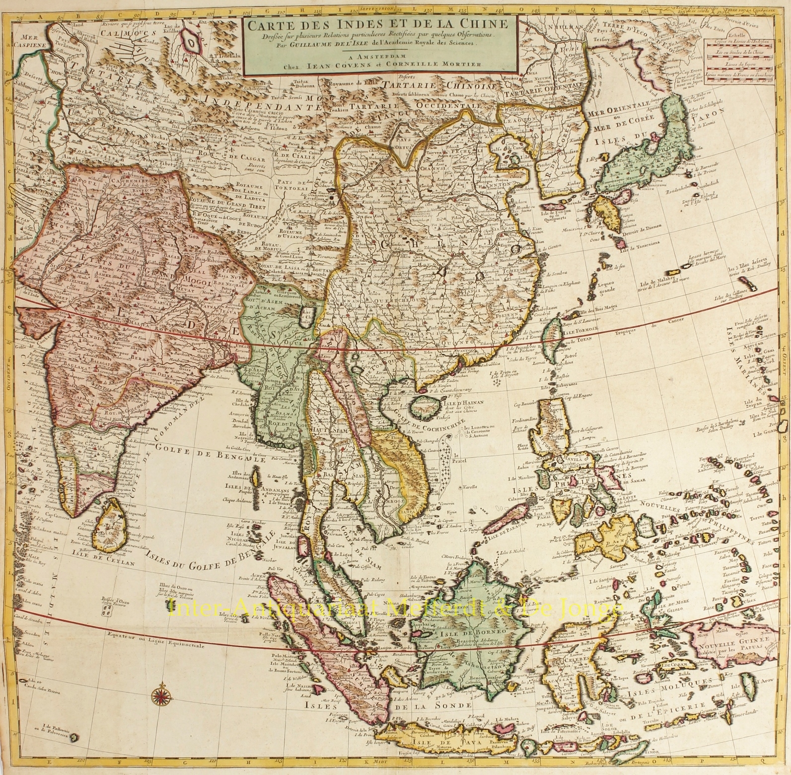
“Carte Des Indes et de la Chine…“,copper engraving on two joined sheets of paper, made by Guillaume De l’Isle, published in Amsterdam Johannes Covens and Cornelis Mortier around 1730. Coloured by a later hand. Size: Afm. 61,1 x 62,6 cm.
The map was published as part of De L’Isle’s “Atlas Nouveau, Contenant Toutes Les Parties Du Monde, Ou sont exactement Remarquées les Empires, Monarchies, Royaumes, Etats, Republiques &c.”
Fine large map of Southeast Asia. The region had been traveled extensively by Europeans with their trade routes, especially the islands of the Philippines and the East Indies.
Japan is connected on the map with the island of Hokkaido (“Terre d ‘Yeco ou d’Eso“) to the Asian mainland and the Sea of Japan is called “Mer Orientale ou Mer de Coree“. Although Korea is far too wide, it is correctly represented as a peninsula. The mythical, but nonexistent, “Lac de Chiamay“, the supposed origin of the rivers Irrawaddy, Dharla, Menam, Brahmaputra and Mekong is located in the north of Burma. The map is also full of cities, roads, rivers and topography.
Price: SOLD