

MAP OF SOUTHERN AFRICA
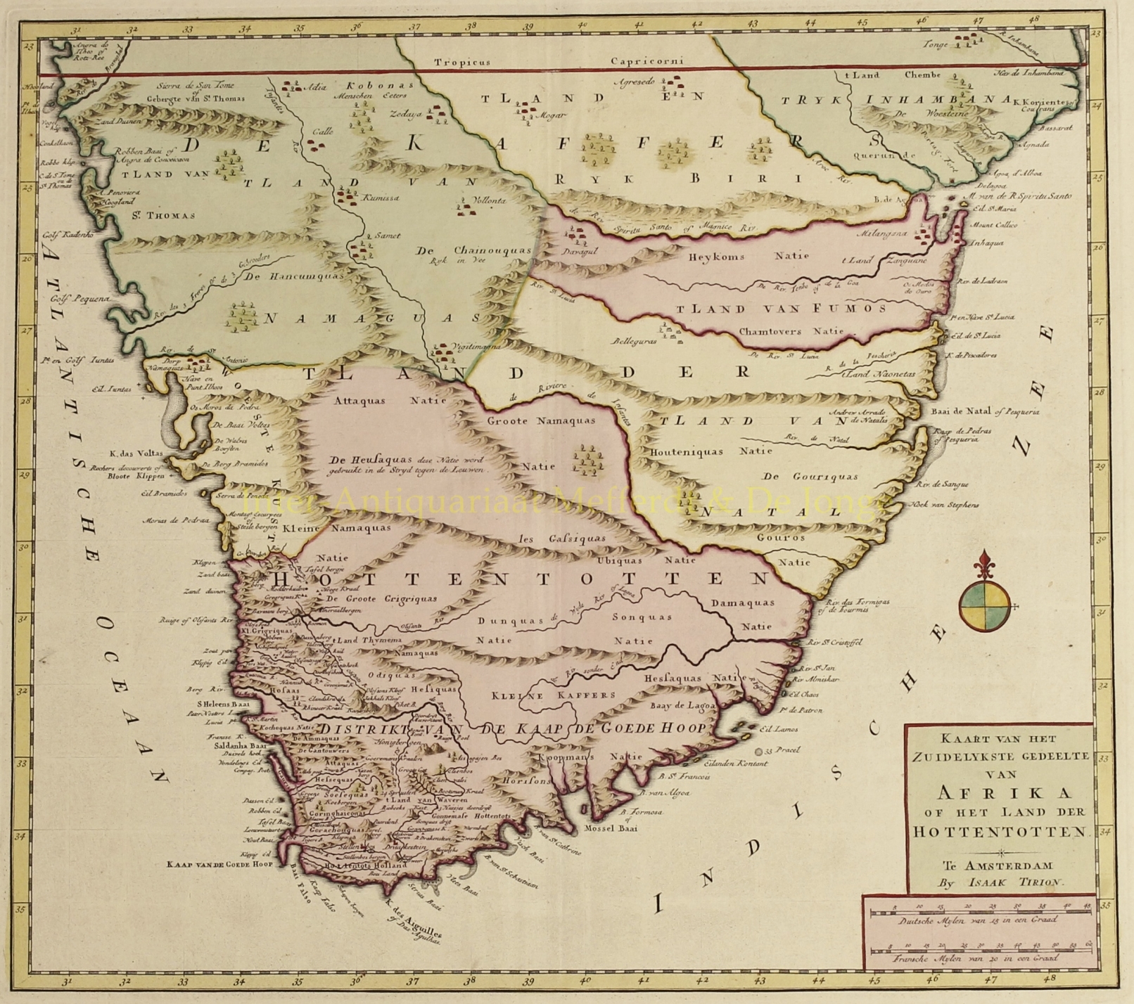
“Kaart van het Zuidelykste gedelte van Afrika of het Land der Hottentotten” copper engraving published as part of the “Nieuwe en Beknopte Hand-Atlas, bestaande in eene Verzameling van eenige der algemeenste en nodigste Landkaarten“, by Isaak Tirion in Amsterdam in 1740 or later. With original hand colouring. Size: 32.5 x 46.5 cm.
Fine map of Africa, south of the Tropic of Capricorn full of information, particularly on the Dutch settlements in the vicinity of Cape Town. The coastline from Cape Agulhas to the east is a bit distorted and the interior features are largely conjectural with the fictitious city of Vigitimagna located in the heart of the map. Numerous tribes are shown, often with interesting descriptions (in Dutch). The Kobonas are noted as being cannibals, the Heusaquas are “used in the struggle against the lions” and the Chainouquas have lots of cattle.
In the late 16th century, Portuguese, French, Danish, Dutch and English ships regularly stopped over in Table Bay en route to the Indies. They traded tobacco, copper and iron with the local Khoikhoi (Hottentots) in exchange for fresh meat. In 1652, Jan van Riebeeck and others of the Dutch East India Company (VOC) were sent to the Cape to establish a way-station for ships travelling to the Dutch East Indies, and the Fort de Goede Hoop (later replaced by the Castle of Good Hope).
Isaak Tirion (1705 – 1765) was a Dutch publisher and book seller with a shop in Amsterdam. He published numerous books, periodicals and atlases.
Price: SOLD