

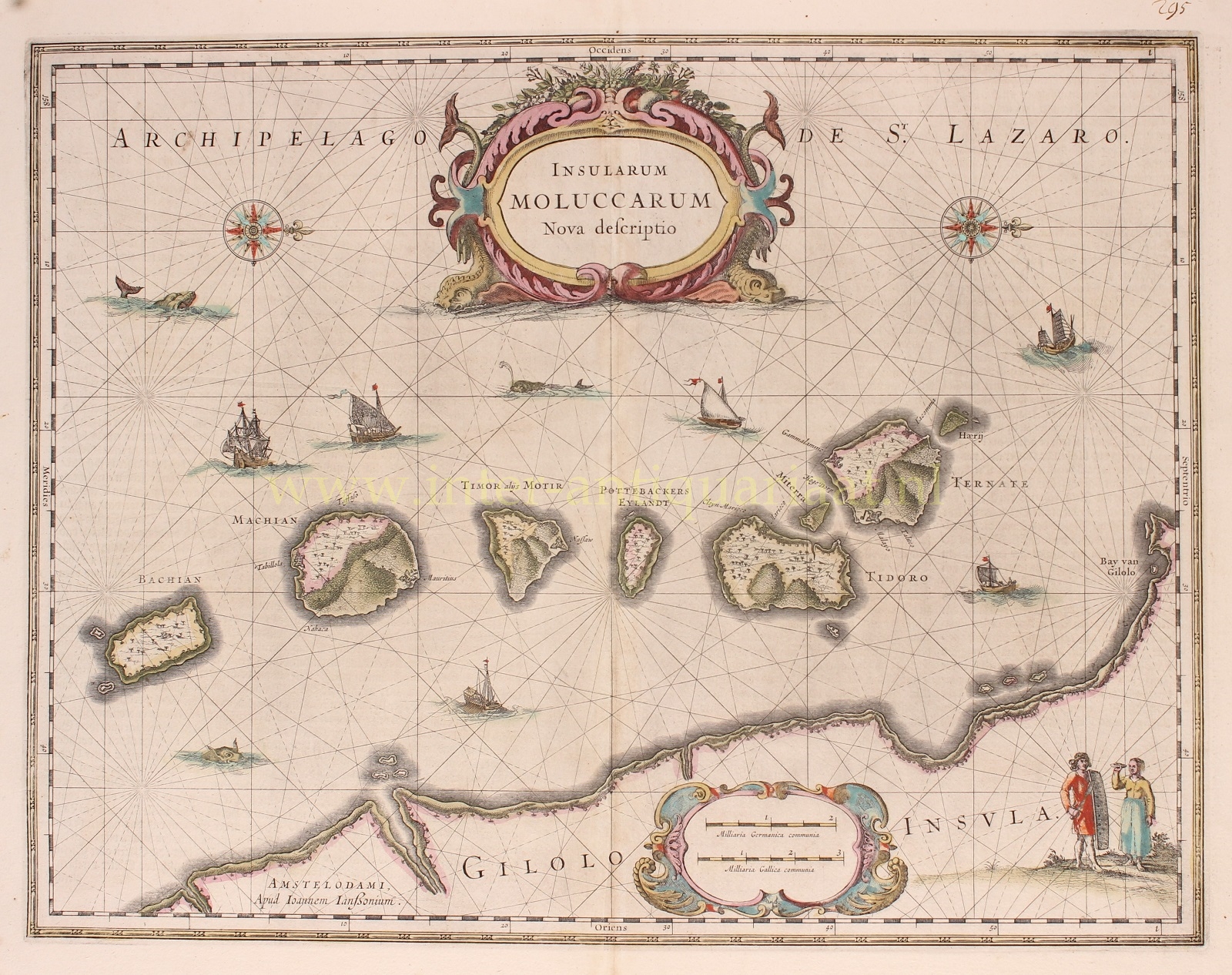
DETAILED MAP OF THE DUTCH-CONTROLLED SPICE ISLANDS
“Insularum Moluccarum Nova Descriptio”, copper engraving published in Amsterdam by Jan Jansson [Johannes Janssonius] c. 1660, with original hand colouring. Size: 38 x 49,5.
Fine map of the Spice Islands based on the description by Jan Huyghen van Linschoten. This map depicts the islands that provided, first the Portuguese and then the Dutch, with a monopoly on the lucrative spice trade. Each of the islands (Bacan, Makian, Moti, Mare -in Dutch times called “Pottebackers Eyland” [potters’ island], Tidore, Ternate and Hiri) is shown with groves of the prized clove and nutmeg trees and the location of their protective fortresses. Along the bottom of the map we see the coastline of Halmahera (in Dutch times known as Gilolo Island).
The lower right corner features a Moluccan couple in Europeanized native dress. Indicative of the area’s commercial importance, Jansson has filled the seas with both European and local ships and sea monsters roam the Molucca Sea.
Price: SOLD