

SURINAME – CHART OF THE RIVERS BERBICE AND COURANTYNE
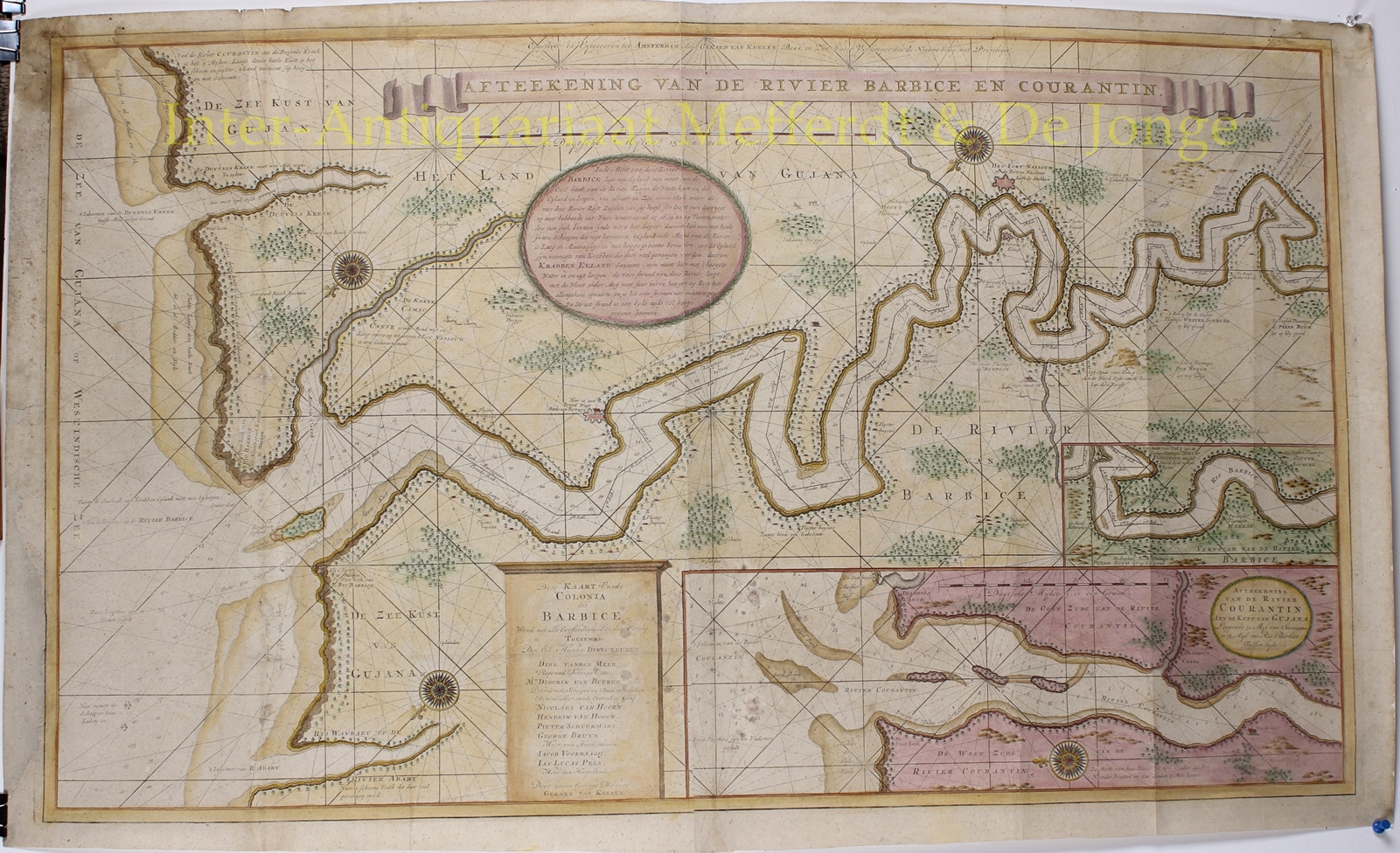
“Afteekening van de Rivier Barbice en Courantin…” [“Depiction of the rivers Berbice and Courantyne. This chart of the Colony is respectfully dedicated to its Directors, by their humble servant Gerard van Keulen“] Engraving from two copper plates printed between 1704-1726 in Amsterdam. The chart originates from the Van Keulen Zee-fakkel. Coloured by a later hand. Size: approx. 59 x 99 cm.
With at the bottom an inset of the Courantyne river estuary, “which is 32 miles from the Surinam and 7 ½ miles from the Berbice”. Also there is an inset of the continuation of the Berbice, as well as a round cartouche with sailing instructions for entering the Berbice. “Before entering the Berbice one will pass the swampy Krabben Eyland, where many carbs are caught.”
Numerous interesting details are mentioned. About the river Abary: “lots of beautiful fish to be caught here”. Alongside the Berbice “there is a firewatch and a litle fortress”. In many places “Plyster Huysies” [staging houses] are to be found in which one could spend the night when travelling on the river. Plantations are mentioned, as well as where bushes are, and orange- and lime trees.
As of 1929 the Courantyne is the eastern boundary of Guyana and western boundary of Surinam.
Price: SOLD