

Switserland – Johann Schmid + Christian Sommerlatt, 1840
REGENERATION PERIOD IN SWITZERLAND
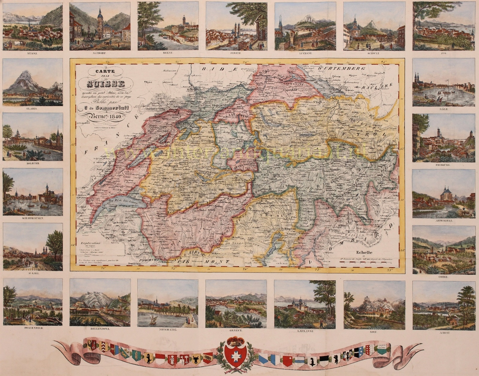
“Carte de la Suisse ajoutée au petit Atlas, avec la description des curiosités de ce pays.” [Map of Switzerland added to the Petit Atlas, with the description of the sights of this country] Lithograph made by Johann Schmid for the “Petit Atlas de la Suisse“, published by Christian Sommerlatt of Bern in 1840. Coloured by a later hand. Size: 43 x 54,5 cm.
In the wake of the July Revolution of 1830 the “restored” Swiss Ancien Régime was countered by the liberal movement. In the Protestant cantons, the rural population enforced liberal cantonal constitutions, partly in armed marches on the cities. This resulted in a conservative backlash in the Catholic cantons in the 1830s, eventually raising the conflict to the point of civil war by 1847.
This lovely map was made in those turbulent times. It shows Switserland surrounded by 22 town views of Zug, Basel, Freiburg, Appenzell, Chur, Aarau, Sion, Lausanne, Geneva, Neuchâtel, Bellinzona, Frauenfeld, St. Gallen, Schaffhausen, Solothurn, Glaris, Stanz, Altdorf, Bern, Zürich, Lucerne and Schwyz.
Below a garland with the national coat of arms flanked by those of the then 22 cantons.
Price: SOLD