DETAILED MAP OF USA AND CANADA
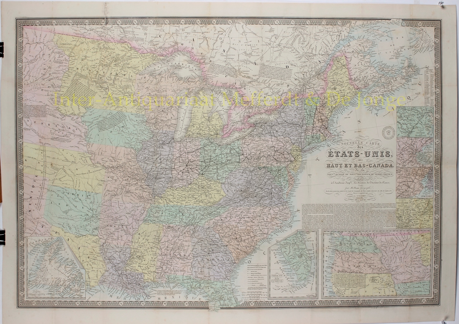
“Nouvelle Carte des Etats-Unis, des Haut et Bas-Canada, de la Nouv.le-Ecosse, du Bouv.au-Brunswick, de Terre-Neuve &c.” Engraving by Adrien Hubert Brué, published in Paris 1836 by A. Logerot. With original colouring. Size: 64 x 95 cm.
Large and scarce map showing the United States east of the Texas panhandle and Arkansas and Missouri River valleys, which are divided into the Ozark, Osage, Sioux, and Mandan Indian Districts. The map is beautifully engraved and incredibly detailed, particularly of the roads and railroads. Notations throughout concern the Indian tribes, river courses, and early western trails. Includes seven insets: Newfoundland, Southern Florida, Western United States, Philadelphia & Trenton vicinity, New York City vicinity, Boston vicinity and Baltimore & Washington. With a long reference – in French – to earlier cartographers of the region and lots of cartographic information throughout the map. All surrounded in a bold keyboard style border.
Brué was one of the most important French cartographers of the first half of the 19th century. His maps are characterised by precision, delicate shape, clarity and beautiful details. His work includes numerous historical and political maps. Probably influenced by Alexander von Humboldt’s work in Paris (including as president of the Société de Géographie de Paris) and his communicative way of conducting science, Brué’s maps distinguish themselves in their topicality. Brué was influenced by various exploratory travels, such as the expedition of Lewis and Clark and Humboldt’s trip to America.
Price: SOLD


