

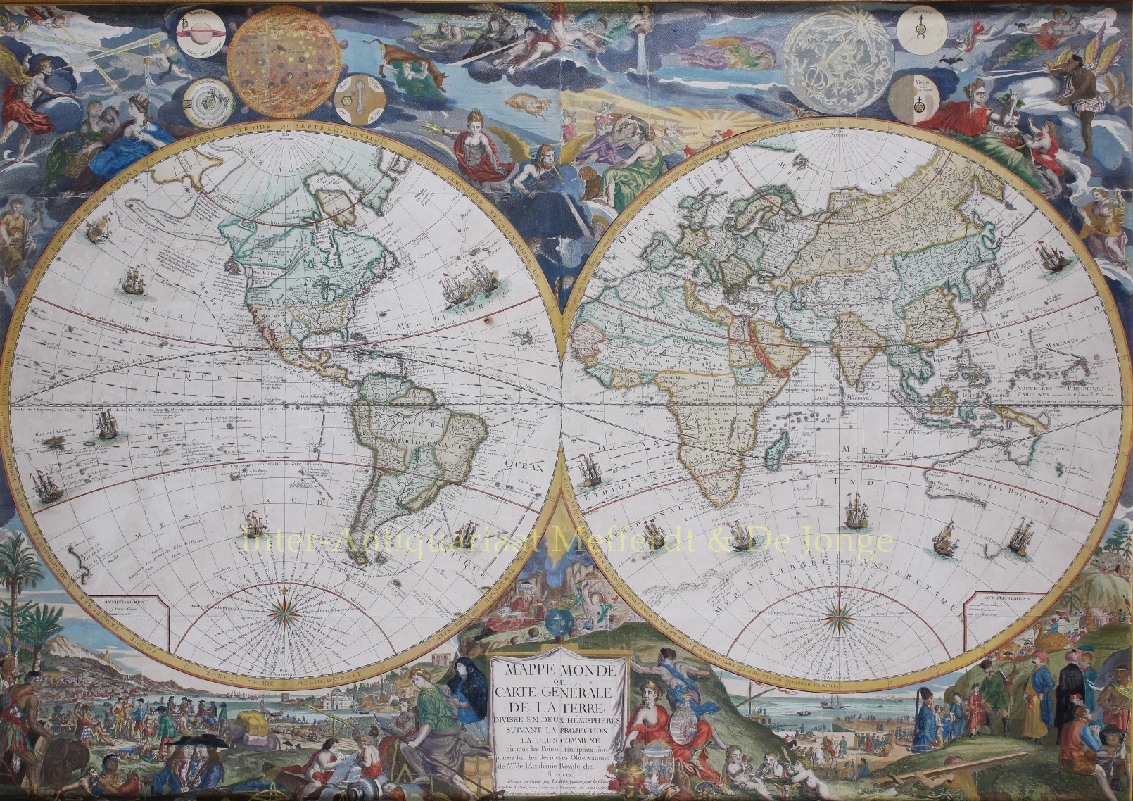
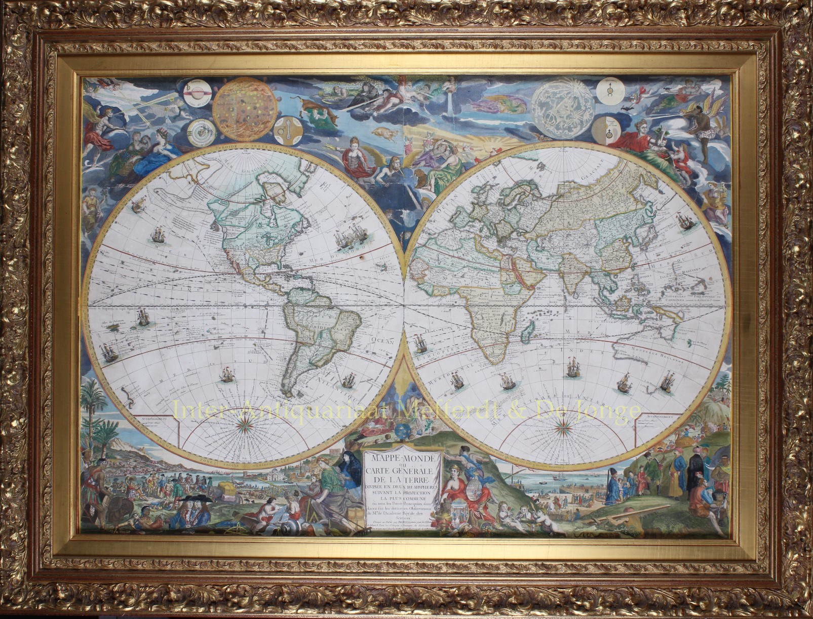
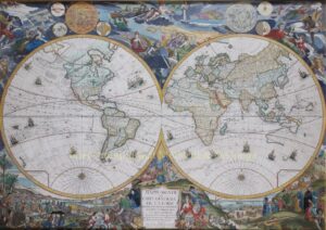
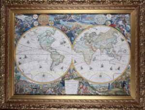
Wall map of the world – Louis Charles Desnos after Nicolas de Fer, 1760


ONE OF THE MOST ICONIC FRENCH WALL MAPS OF THE WORLD
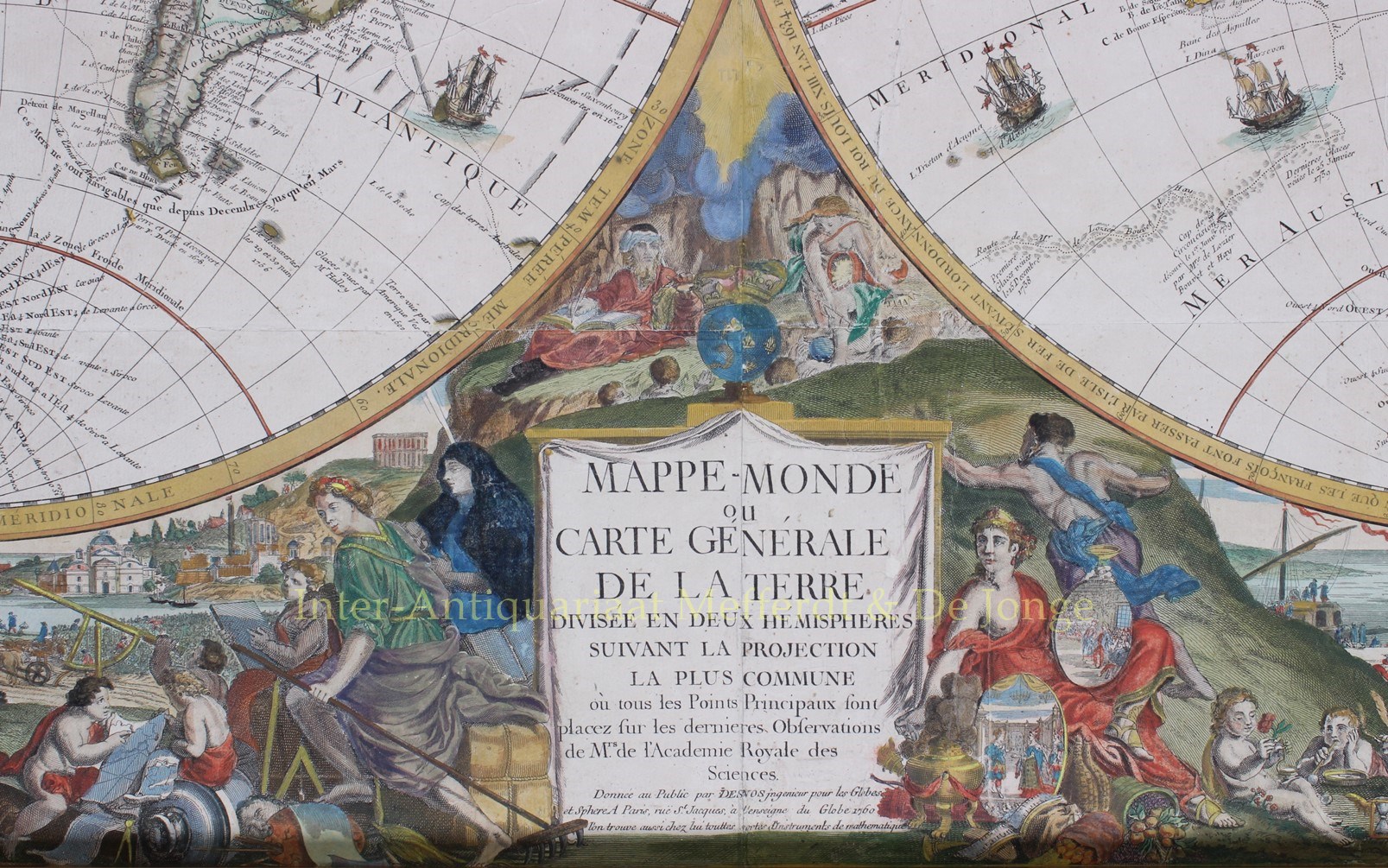
“Mappe-Monde ou Carte Generale de la Terre divisee en deux Hemispheres . . . “ Copper engraving by Hendrik van Loon and Nicolas Guérard, originally published by Nicolas de Fer in 1694, here in an edition of 1760 by Louis Charles Desnos. Coloured by a later hand. Size (plate): approx. 75 x 107 cm (frame 99,5 x 131,5 cm).
Nicolas de Fer, a prolific French cartographer, was active from the early 1690s until his death in 1720. He produced this outstanding four-sheet world map in 1694. The map itself was engraved by Hendrik van Loon but the work’s real merit lies in the decorative features which were designed and engraved by Nicolas Guérard. De Fer’s world map was extensively revised by his son-in-law Guillaume Danet in the mid-18th century, before being revised again by Desnos.
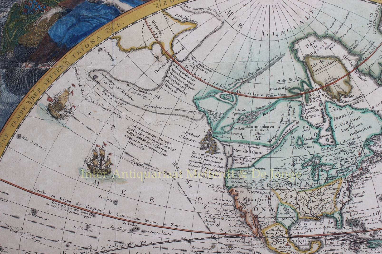
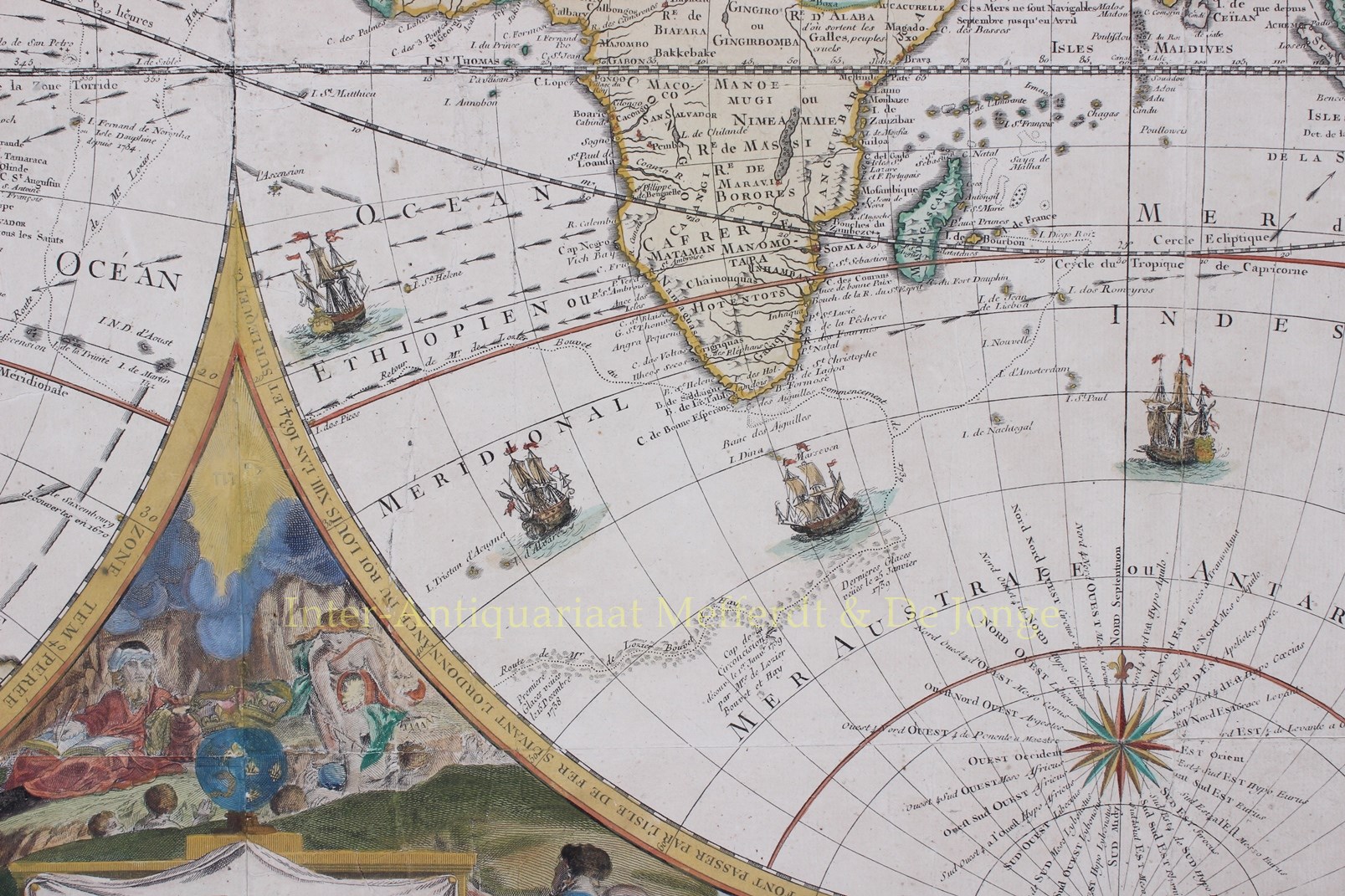
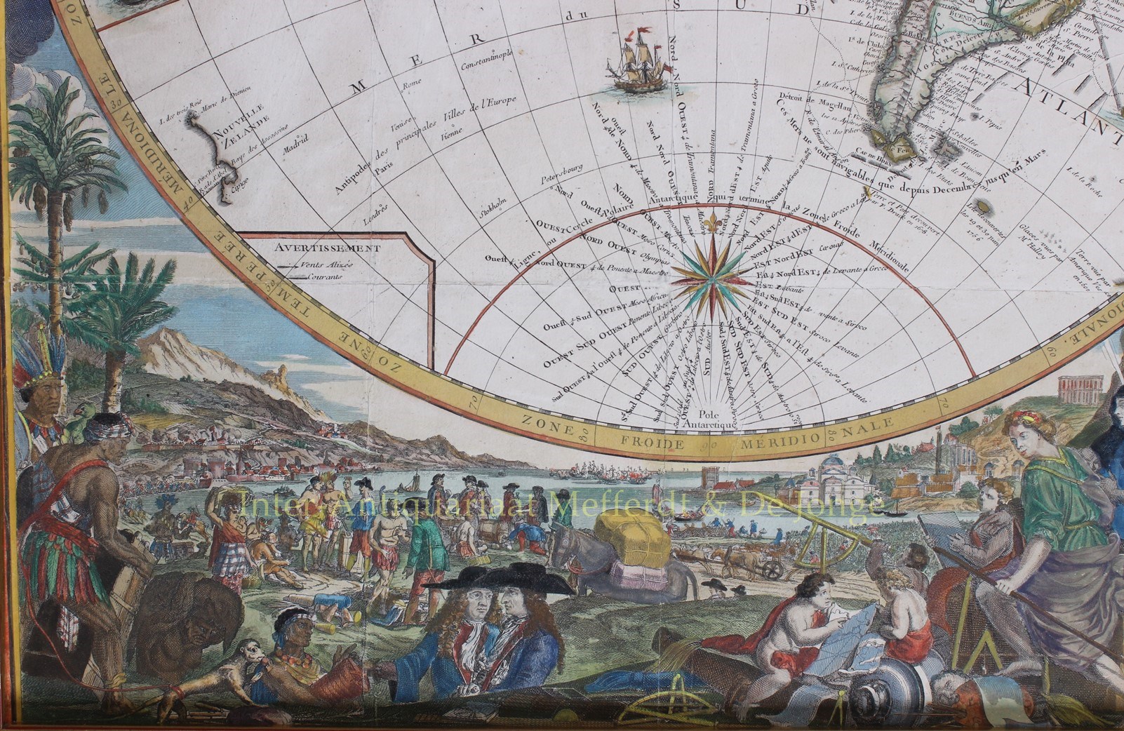
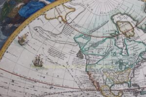
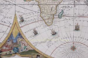
Compared to the first edition, 66 years earlier, the most significant cartographic update is in the Northwestern part of America, where it shows the Mer de l’Ouest, [Sea of the West] an imagined sea extending the navigable waters of the Pacific deep into the North American continent. Also a highly embellished depiction of the discoveries during Aleksei Chirikov’s voyage in 1741 is given. The prospect of both Northwest and Northeast passages are clearly depicted on the map, including a marvellous channel extending northeast from the Mer de l’Ouest. The depiction of Australia and New Zealand appears in the style popularized by the Dutch, which endured until Cook’s Voyages, which commenced shortly after the publication of this map.
The map also tracks the circumnavigations of a number of earlier explorers, including Ferdinand Magellan, Willem Schouten, George Anson, and Isaac Lemaire. Other explorations are mentioned by Bouvet de Lozier, Nicholas de Frondat, Álvaro de Mendaña, Pedro de Queirós, Francis Drake and Edmond Halley.
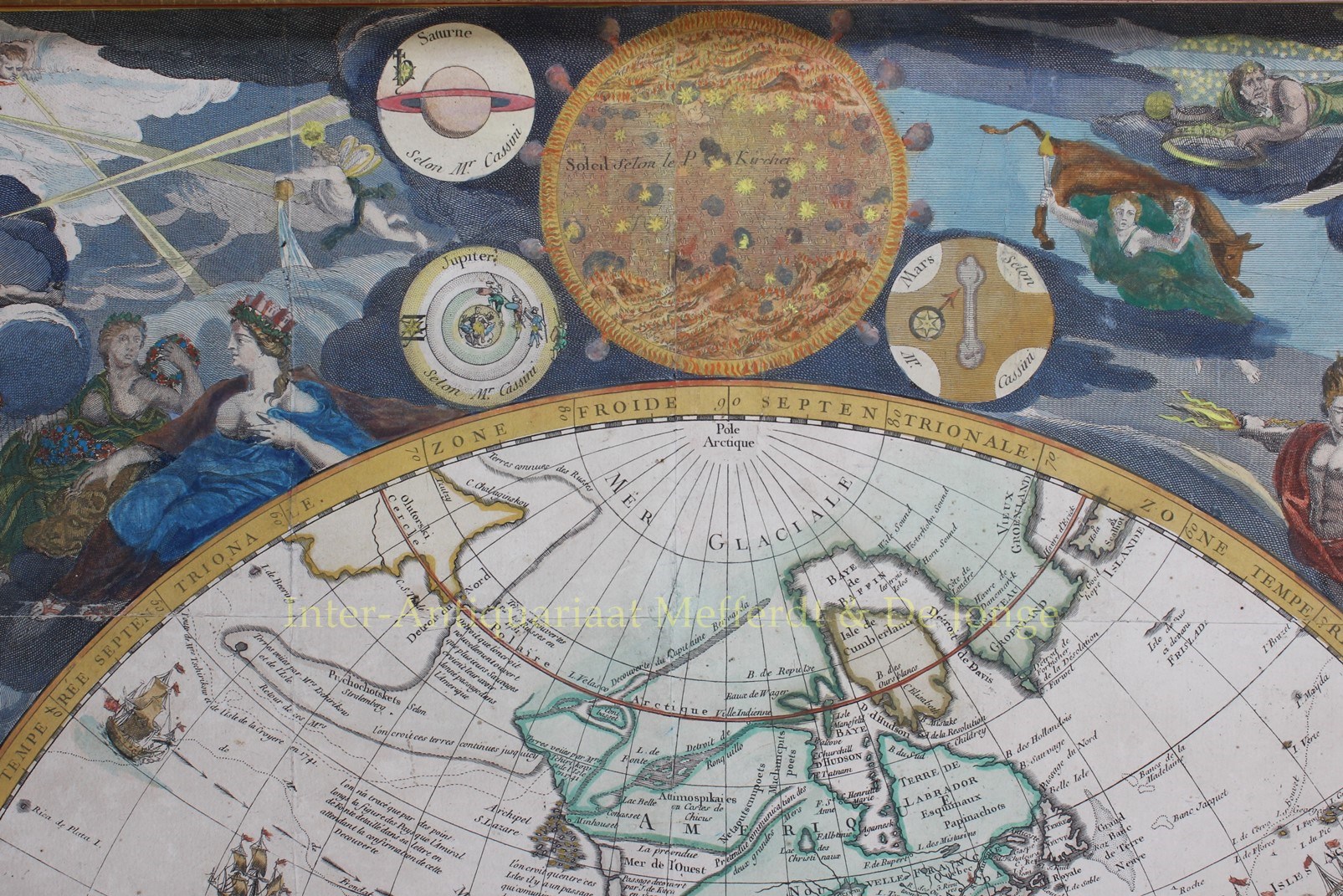
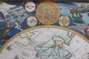
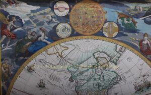
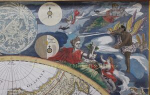
The two hemispheres, as the expanded title relates, were constructed from the observations made throughout the world by gentlemen of the Royal Academy in Paris.
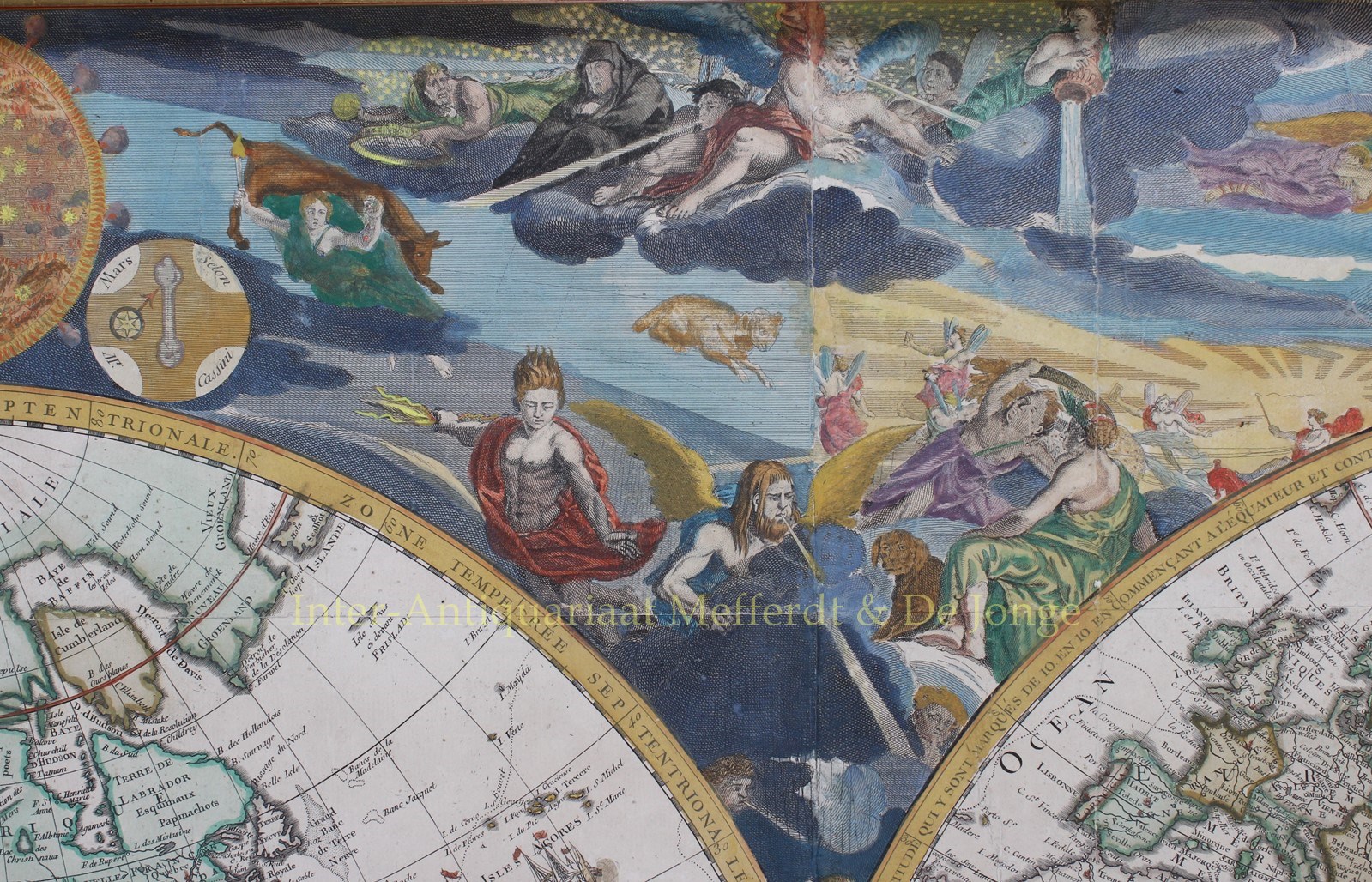
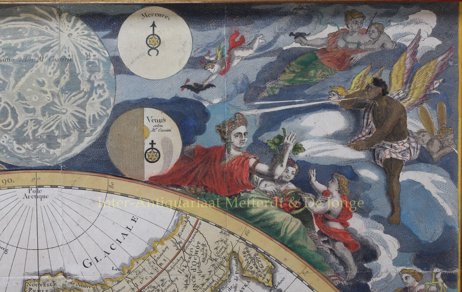
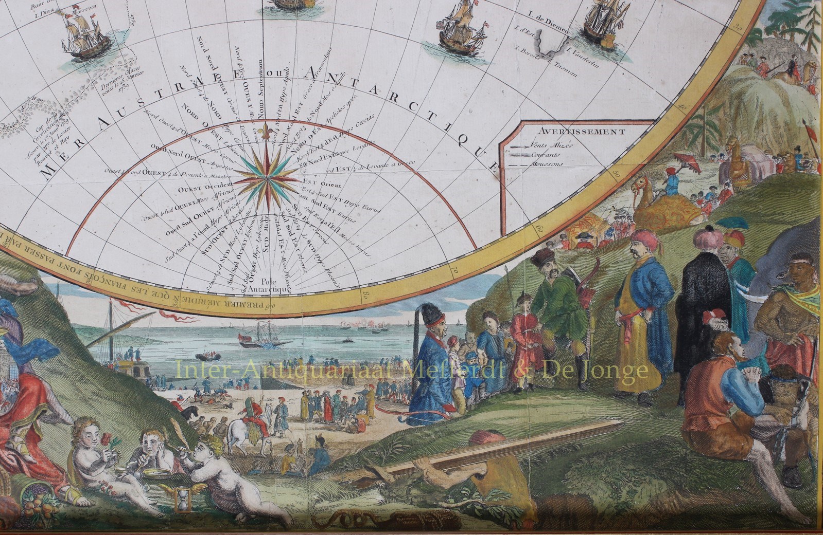
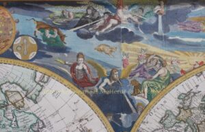
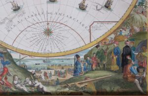
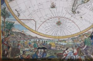
The top and bottom borders are engraved in great detail. Along the top are pictures of Saturn, Jupiter, Mars, Venus after observations by Cassini, and two visual plans of the sun and moon. An expansive tableau displays gods and goddesses, zodiacal figures, winds and mythological scenes. The lower part of the map has scenes depicting mankind in all activities of trade, commerce, exploration, construction, scientific discovery, art and pleasure.
Literature: Rodney Shirley “Mapping of the World”, no. 560.
Price: SOLD