
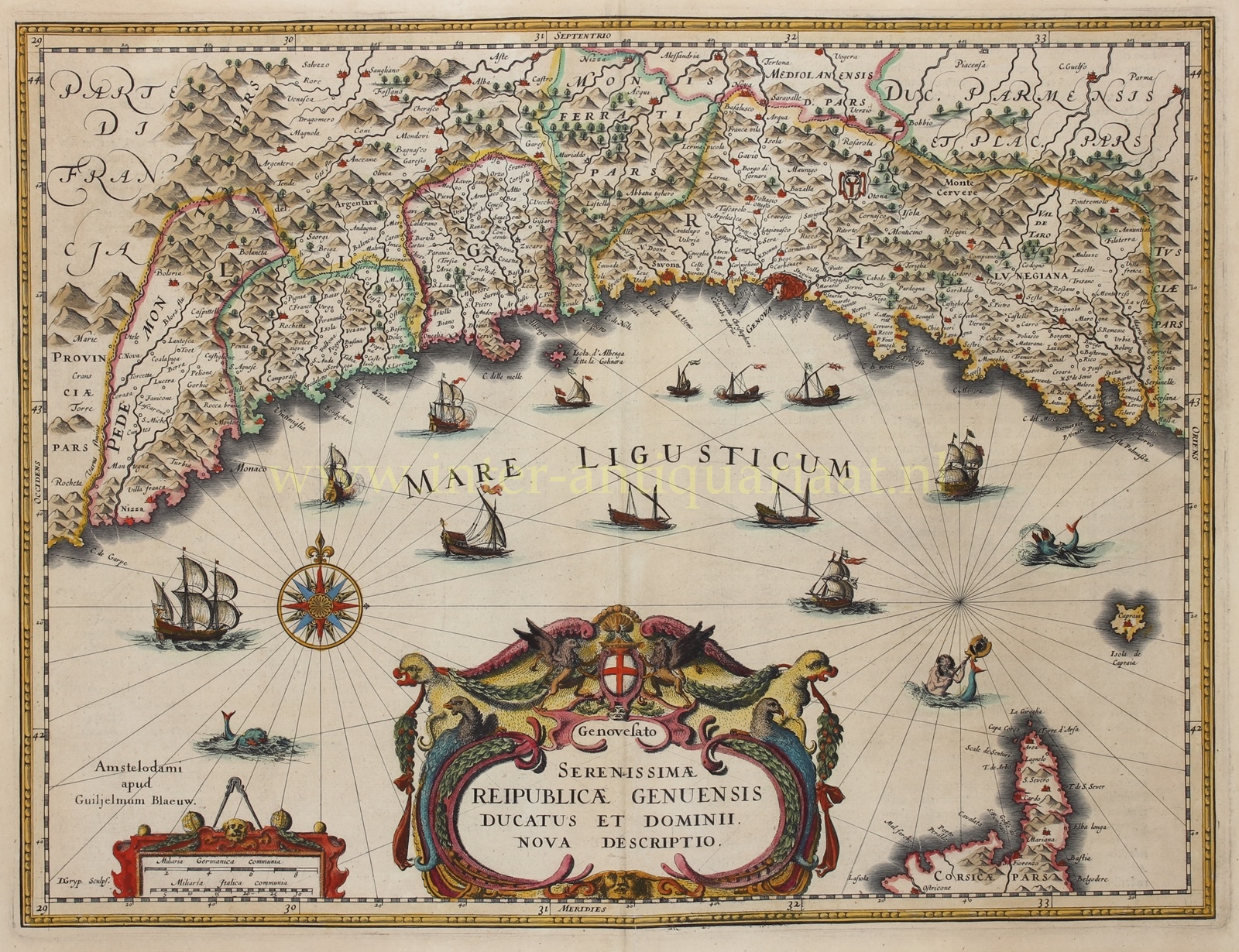
Ligurië, Republiek Genua – Willem Blaeu, ca. 1640
FINE MAP OF THE GENOESE TERRITORY – LIGURIA “Serenissimae Reipublicae Genuensis Ducatus Et Dominii Nova Descriptio” [new description of the…
Lees verder€625
FINE MAP OF THE GENOESE TERRITORY – LIGURIA
“Serenissimae Reipublicae Genuensis Ducatus Et Dominii Nova Descriptio” [new description of the duchy and dominion of the most serene Republic of Genoa], copper engraving made by Dirck Grijp and published by Willem Baeu around 1640. Original hand colouring with later additions. Size: 37 x 49 cm.
The Republic of Genoa had been a wealthy and powerful republic for centuries ruled by a group of aristocratic merchant families. It had built up a vast maritime empire and colonial holdings across the Mediterranean, including parts of Corsica, Sardinia, and territories in the eastern Mediterranean. The map illustrates Genoa’s maritime focus with various ships and sea monsters.
In 1528, Carlos I of Spain conquered Genoa during the Italian Wars, and it remained a part of Spain in the following centuries, with Genoese banks prospering from 1557 to 1627. Genoa’s golden age would end in 1627 with the Thirty Years’ War, when France invaded Italy and besieged the city.
In 1656–57, an outburst of plague killed as many as half of the population
Price: Euro 625,-