
Oost-Friesland – Willem Blaeu, ca. 1640
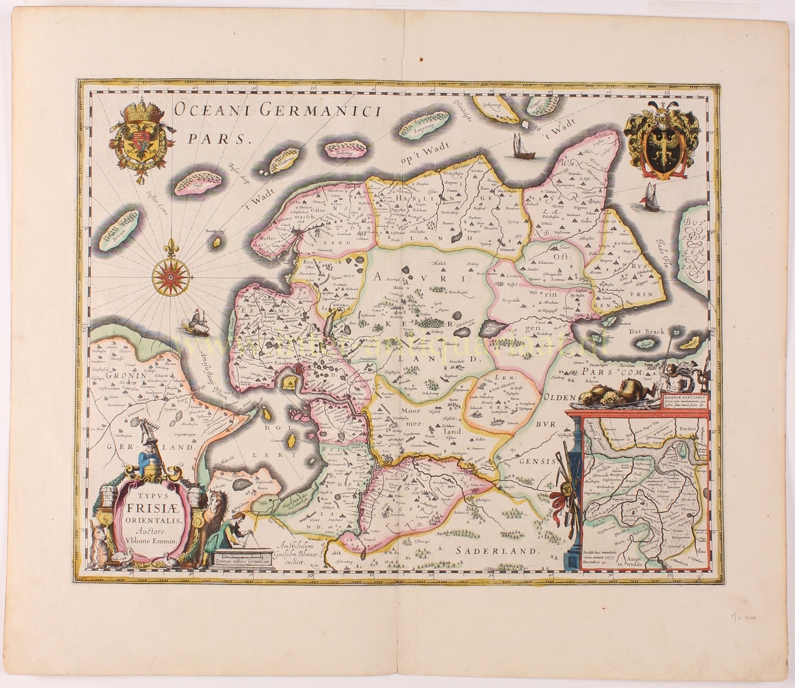
“Typus Frisiae Orientalis” with an inset map of “part of Rheiderland before the flood,” copper engraving published by Willem Blaeu…
Lees verder€450
“Typus Frisiae Orientalis”
East Frisia was a county within the Holy Roman Empire. It had a degree of autonomy and was ruled by the Cirksena family. Its strategic location along the North Sea made it an important region for trade and maritime activities. Emden, the main port city on the river Ems, played a crucial role in trade, particularly with the Dutch Republic, England, and other North Sea regions.
The map is based on the work of the East Frisian historian and geographer Ubbo Emmius (1547-1625) who’s “Rerum Frisicarum historiae libri 60” [60 books on the Frisian history] contained a detailed map of East Frisia.
The upper left corner shows the coat of arms with the double headed eagle and imperial crown of the Holy Roman Empire. In the upper right there’s the coat of arms of Emden with the eagle of the Cirksena family. `
Since the Middle Ages, chronicles have regularly reported storm floods in the present-day Dollart area. In the sixteenth century, the city council of Groningen considered the name Dollart to be derived from the “dolle aard” [mad nature] of the sea. This characterization proved accurate. Various tidal waves over the centuries led to the flooding of the prosperous Rheiderland. When exactly this happened is unclear. In the seventeenth century, it was believed that the Dollart flooded due to a tidal wave in 1277 (hence the annotation with the inset map), but archaeological findings today show that the area was actually well protected from the advancing sea until the fifteenth century. Parts of Rheiderland were regularly flooded by tidal waves, but the final blow came in 1509. On the night of September 25 a flood ended the habitation of the Dollart area; hundreds of people and thousands of cows lost their lives.
In 1806 East Frisia was annexed by the Napoleonic Kingdom of Holland and later became part of the French Empire. After the Napoleonic Wars East Frisia was occupied first by Prussian and then by Russian soldiers and in 1813 was it was re-annexed by Prussia. However, in 1815, Prussia had to cede East Frisia to the Kingdom of Hanover, which itself was annexed by Prussia in 1866.
Price: Euro 450,-