

Indonesia, Strait of Bali, East Java and Madura – Laurie and Whittle, 1794
€495
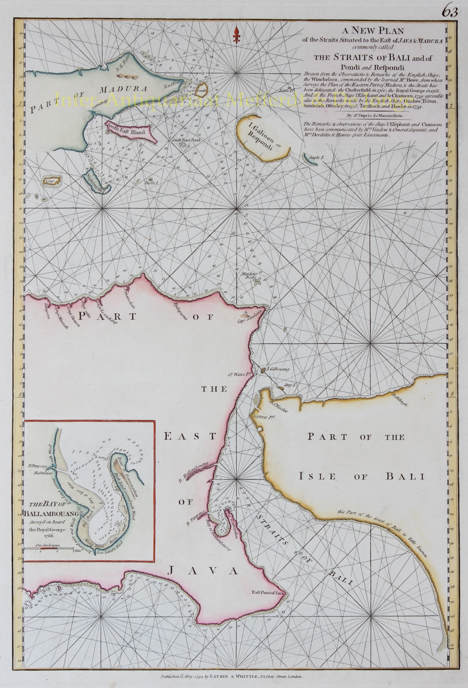
DETAILED BRITISH SEA CHART OF THE STRAIT OF BALI, EAST JAVA AND MADURA, 1794
“A New Plan of the Straits Situated to the East of Java & Madura commonly called The Straits of Bali and of Pondi and Respondi”, copper engraving published in London by Robert Laurie and James Whittle on 12 May 1794, and included in their nautical atlas The East-India Pilot, or Oriental Navigator. Coloured by a later hand. Size: approx. 35.6 × 50.8 cm.
This detailed eighteenth-century nautical chart depicts the eastern tip of Java, the western part of Bali and the islands east of Madura. At its centre is the Strait of Bali, the narrow stretch of water separating Java from Bali and providing a passage between the Indian Ocean and the seas to the north of the islands.
This region was of considerable importance to European maritime trade. The straits east of Java provided access to the trading centres of the Indonesian archipelago. Navigation, however, was far from straightforward: unfamiliar coastal waters, strong currents, reefs and shoals made accurate nautical charts essential. Throughout the eighteenth century, existing hydrographic information was therefore continually supplemented by new observations made by passing ships.
The chart shows the coastlines of East Java and West Bali, the eastern part of Madura and several smaller islands, including present-day Sapudi, identified on the chart as Galioen or Respondi. Numerous depth soundings, marked rocks and shoals, and an extensive network of rhumb lines provided mariners with the information needed to plot their courses and navigate safely through the various straits.
At lower left is a separate inset chart of the Bay of Ballambouang, present-day Pangpang Bay, on the eastern coast of Java. This plan was based on surveys carried out in 1766 aboard the British ship Royal George. The inset shows the narrow entrance to the bay, the surrounding coastline and detailed depth soundings throughout the navigable waters.
The original chart was compiled by the French hydrographer Jean-Baptiste d’Après de Mannevillette (1707–1780), who had published his influential nautical atlas Le Neptune Oriental in 1745. For the substantially enlarged second edition, published in 1775, he incorporated a wealth of new hydrographic information. This chart of the Strait of Bali was among the additions.
As explained in considerable detail in the title panel at upper right, Mannevillette drew upon observations made by several British and French vessels. An important contribution came from the British ship Winchelsea, commanded by Captain Thomas Howe, whose surveys formed the basis for the depiction of eastern Madura and the adjoining straits. Additional information was obtained from the British ships Chesterfield (1760) and Royal George (1766), as well as the French vessels L’Éléphant and Le Chameau (1759). Observations made by several other British ships in 1758 and 1759 were also incorporated.
The chart appeared in an English version published by Robert Sayer and John Bennett in 1778, who included it in their East-India Pilot, or Oriental Navigator. In 1794, it was reissued by their successors, Laurie and Whittle. The combination of British and French hydrographic information illustrates how navigators and cartographers of different nationalities contributed to the development of increasingly accurate nautical charts for voyages to Asia.
Price: Euro 495,-
