

Delft – Dirck van Bleyswijck + Pieter Mortier, 1703
€12.500
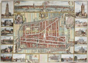
KAART FIGURATIEF OF DELFT – PICTORIAL WALL MAP WITH CITY PROFILE AND BORDER VIEWS
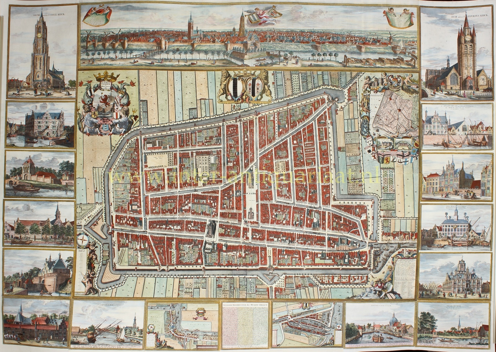
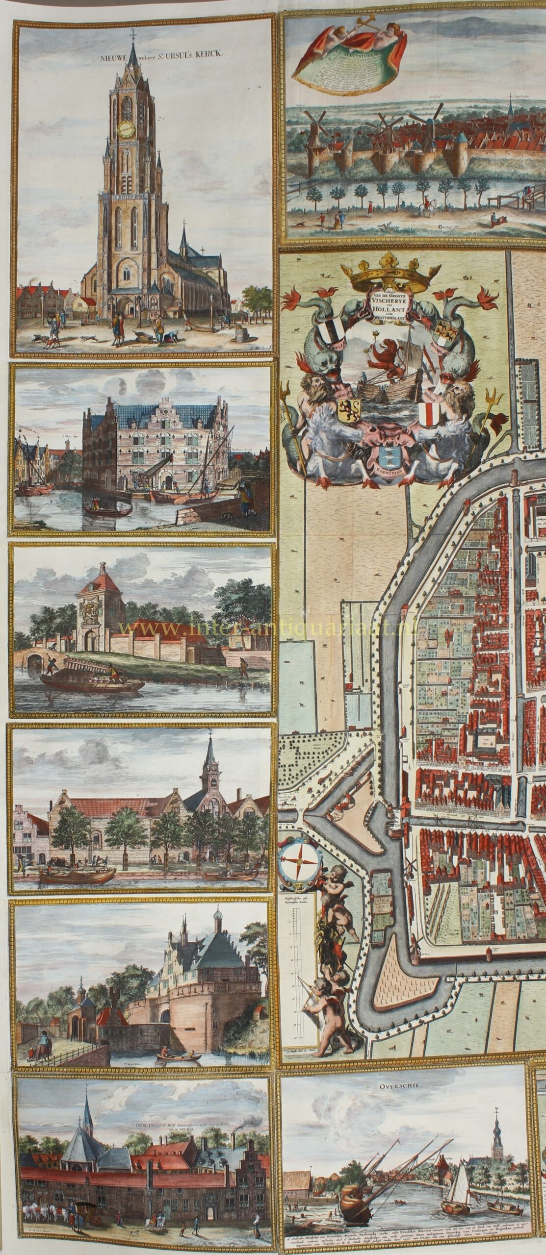
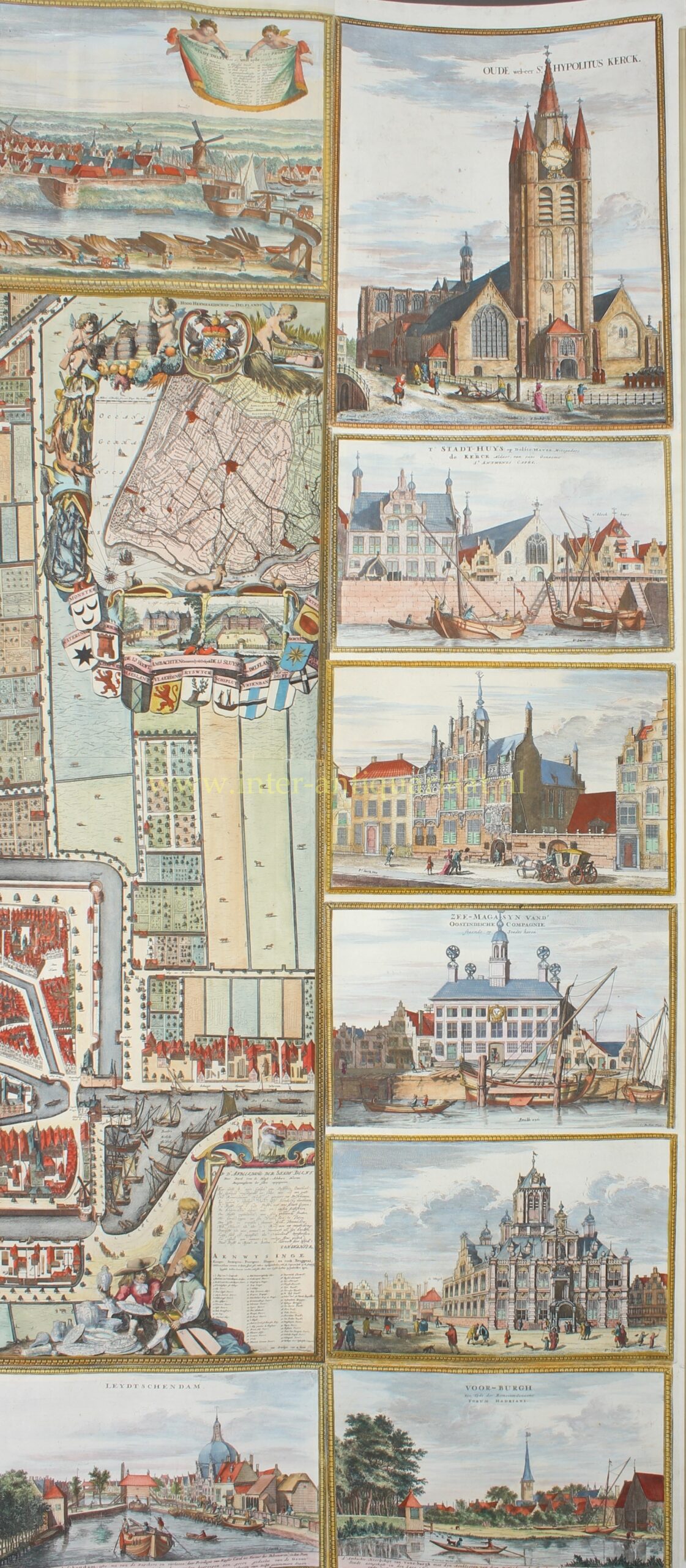
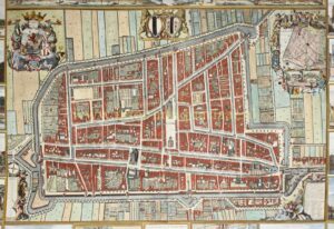
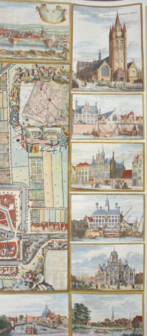
“Kaart Figuratief van Delft” [Pictorial Map of Delft], monumental wall map composed of the plan of Delft, printed from four copper plates, together with a selection of the accompanying border prints. The plan was made from surveys by Jacob Spoors and drawings by Johannes Verkolje (1650–1693), and engraved by, among others, Johannes de Ram (1648–1693) and Coenraet Decker (1650–1685). First published by Pieter Smith in Amsterdam in 1678, here in the second state of 1703, published by Pieter Mortier. The surrounding prints were issued separately from 1678 onwards. Coloured by a later hand and assembled in this configuration (a ‘marriage’). Size (overall) 128.5 × 182.5 cm.
The Kaart Figuratief ranks among the most ambitious Dutch city plans of the seventeenth century. An entire team of surveyors, draughtsmen, engravers, lettering engravers and printers worked on the project. It was supervised by Dirck Evertsz. van Bleyswijck (1639–1681), historian of Delft and, from 1675, burgomaster of the city. Van Bleyswijck did not simply want to produce a practical city plan. Delft was to be presented as a prosperous, well-governed and distinguished city of Holland.
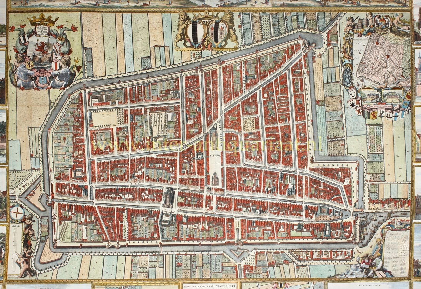
Surveyor Jacob Spoors was charged with producing the actual plan. He took the much smaller city plan by Joan Blaeu of 1649 as his starting point, but resurveyed Delft and brought the topography up to date. This was necessary: the Delft Thunderclap of 1654, the explosion of a gunpowder magazine in the middle of the city, had destroyed a large part of Delft.
Johannes Verkolje drew the churches, houses, windmills and other buildings. As a result, the map combines the geometric structure of a ground plan with the visual immediacy of a bird’s-eye view. Almost every house is shown individually. Not only churches, city gates and public buildings can be recognised, but also numerous smaller details: courtyards, gardens, arbours, trees, posts and even garden statues. Delft lies spread out beneath the viewer like a magnificent miniature city.
Northeast is at the top. The city is enclosed by its ramparts, bastions and moats, while beyond the fortifications the division of the surrounding polder landscape is meticulously recorded. Within the city, the Oude Delft, Nieuwe Delft and the other canals and streets form an almost tangible urban fabric.
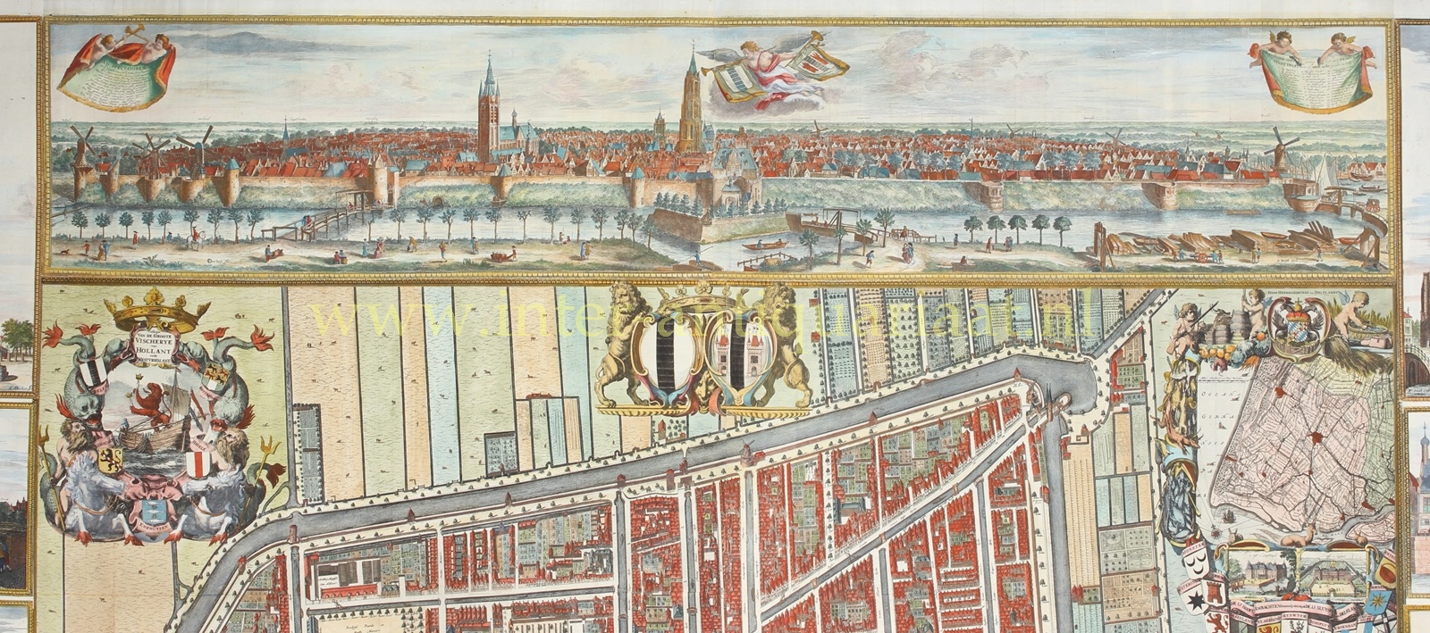
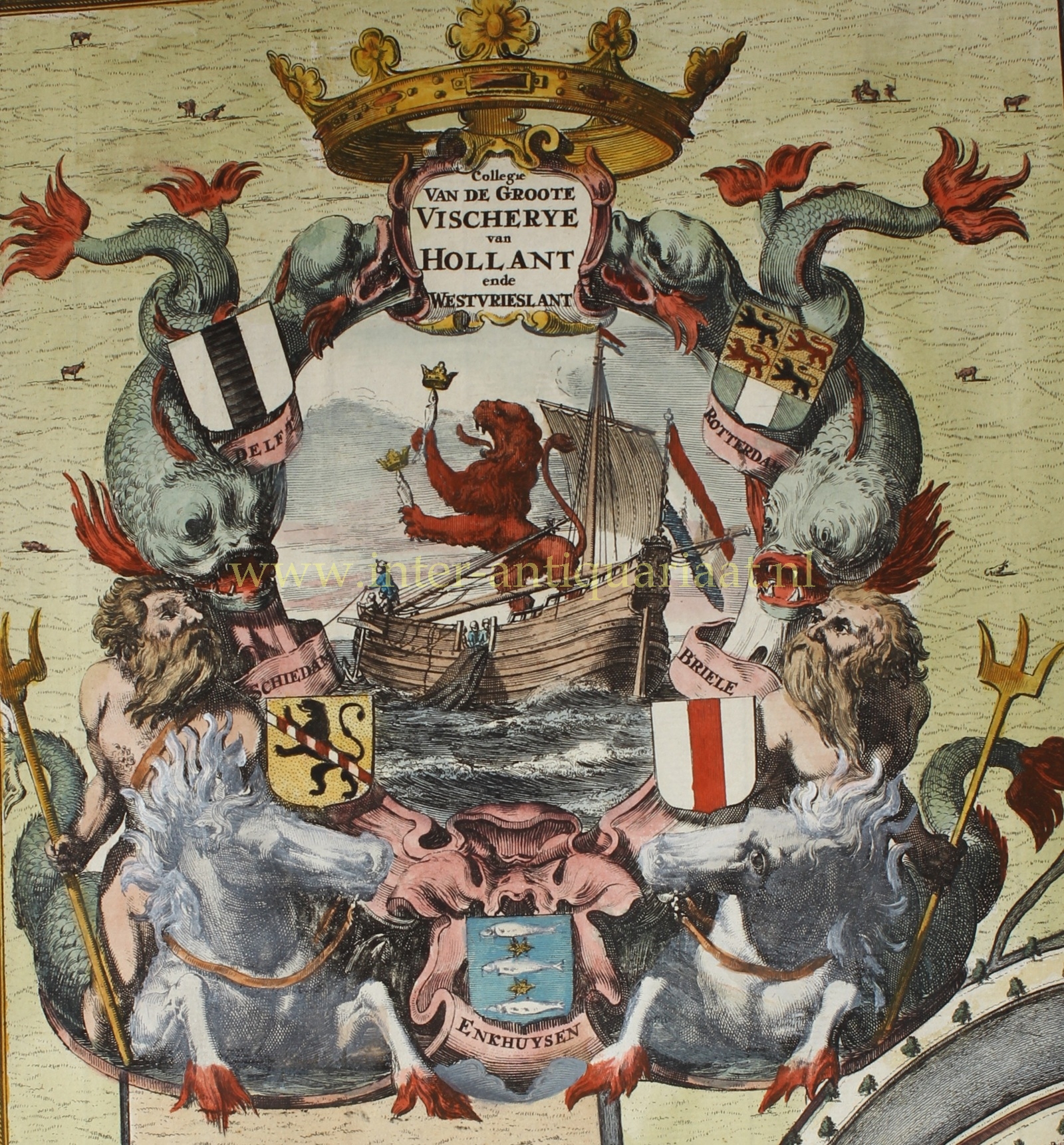
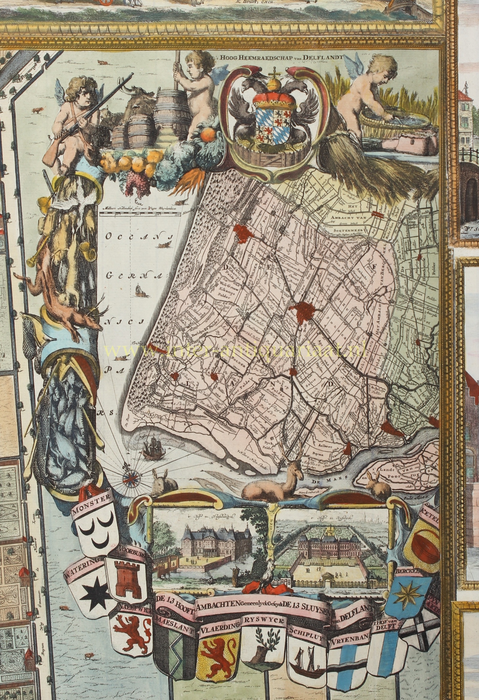
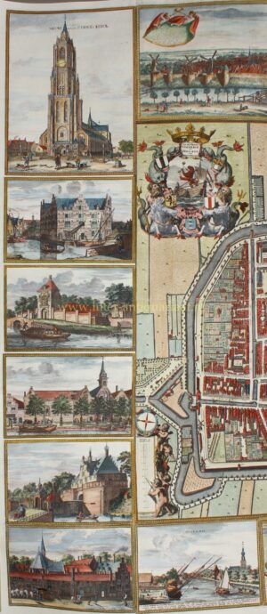
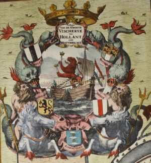
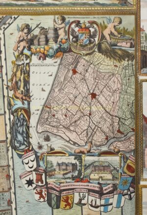
Nothing was left to chance outside the actual map image either. At upper left, an elaborate allegory refers to the College of the Great Fishery of Holland and West Friesland, surrounded by the coats of arms of the principal herring towns. At the top, the old and new arms of Delft are displayed between lions. At upper right is a map of the Hoogheemraadschap van Delfland, surrounded by representations of agriculture, hunting and fishing and by the coats of arms of its principal districts.
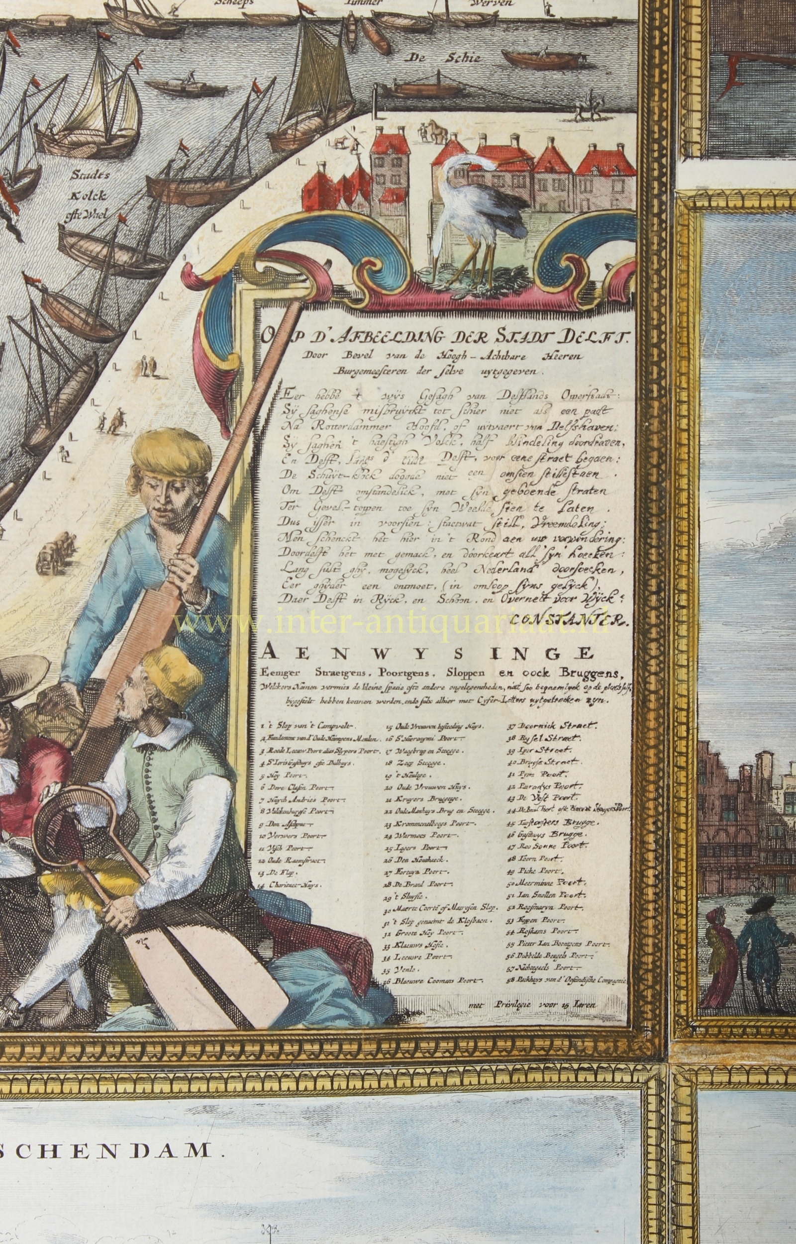
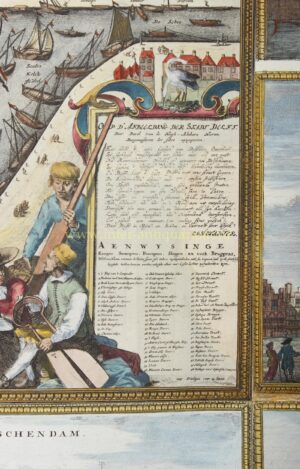
At lower right on the plan, Constantijn Huygens praises Delft in a fourteen-line poem. The hurried traveller who merely passes through the city on the way to Rotterdam or Delfshaven is urged to pause:
“staet wat still, Vreemdeling” [“pause a while, stranger”] and then to explore Delft at leisure: “Doordelft het met gemack, en doorkeurt all’syn’ hoecken.” [Explore Delft at your ease, and examine all its corners.]
Beside the poem, men display one of the city’s most important export products: its celebrated Delftware. Map, city description and allegories thus serve the same purpose: Delft is presented not only geographically, but also as a centre of trade, industry and urban civilisation.
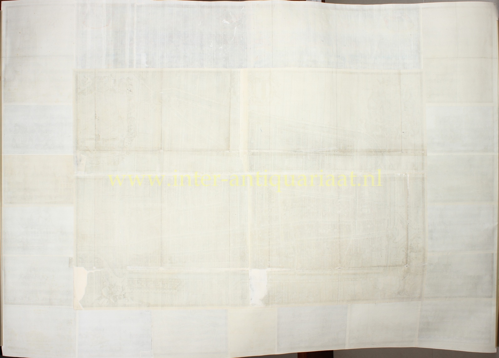
The four copper plates used for the city plan presented considerable technical difficulties during production. Copper engravings were printed on damp paper, which shrank as it dried. Consequently, the four impressions did not automatically fit together perfectly; moreover, the engraved images themselves proved not to align flawlessly in every place. Assembling such a map was therefore highly specialised work. Master map-mounter David Reerigh ultimately succeeded in producing an acceptably joined map.
For the original wall map, the city plan was supplemented by an extensive series of separately printed views. When all the components were assembled, they formed a wall decoration covering almost four square metres. The border prints were, however, also distributed separately and could be mounted in different configurations.
This example is one such alternatively assembled wall map (a ‘marriage’). Not all the border prints originally produced for the Kaart Figuratief have been used. Instead, a substantial selection has been mounted around the plan, resulting in a somewhat more compact but still monumental composition measuring more than 1.8 metres across.
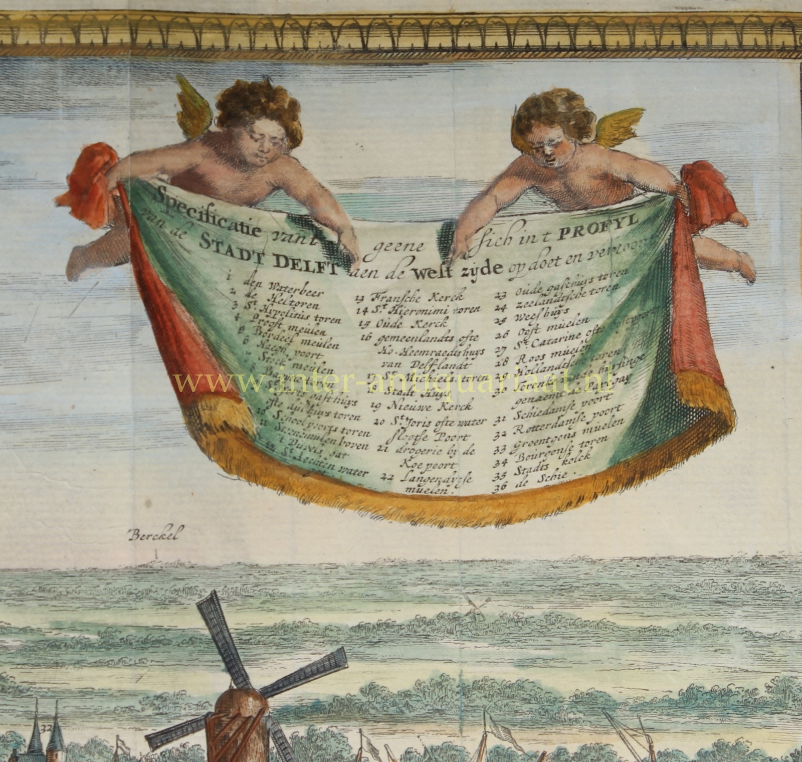
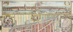
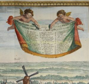
Above the plan, extending across almost its entire width, is a handsome profile of Delft seen from the west, designed by Verkolje and engraved by Coenraet Decker. The walled city stretches like a long ribbon across the horizon, with the towers of the Nieuwe Kerk and Oude Kerk as its principal landmarks. In the foreground are the fortifications, roads, trees and waterways.
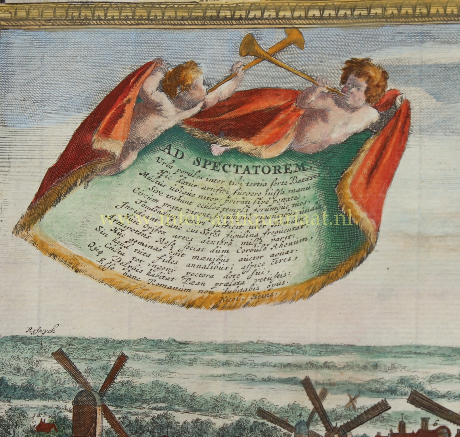
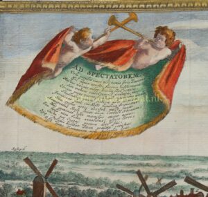
Allegorical figures float above this city profile. On the left, two putti hold aloft the Latin poem “Ad Spectatorem” [To the Viewer], in which Delft is praised for its buildings, fertile surroundings, artistic industries and learning. Even China is invoked in connection with Delftware, while a playful comparison between Delft and Delphi places the city within the world of classical antiquity. In the centre, Pheme sounds the praises of Delft; to the right is the key by which dozens of buildings in the city profile can be identified.
Along both sides are separate views of buildings and places. In this example these include representations of the Nieuwe Kerk and Oude Kerk, as well as views of other public buildings such as the Town Hall and the Gemeenlandshuis. Delft’s economic hinterland is represented as well. We see, for example, the warehouse of the Dutch East India Company in Delfshaven, while further down Voorburg is also depicted.
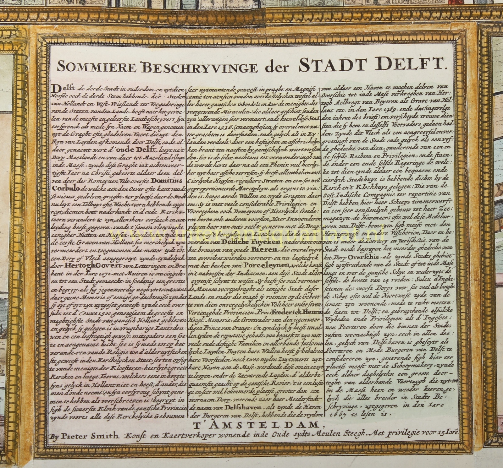
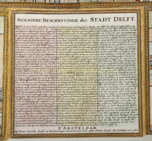
The lower border links Delft even more explicitly with the settlements along its waterways. Here are a view of Overschie, a plan of Overschie, a plan of Delfshaven and a view of Leidschendam. Between these representations appears the printed “Sommiere Beschryvinge der Stadt Delft” [Concise Description of the City of Delft].
This short description of the city reveals how Delft’s history and significance were understood in the seventeenth century. The city’s origins are traced back to the Roman commander Corbulo and his canal, after which the growth of the medieval town is recounted. The great city fire of 1536 is described, after which, according to the author, Delft rose from its ashes like a phoenix, more splendid than before. The city’s principal industries are then praised: first the cloth trade, followed by brewing and finally the manufacture of its celebrated ‘porcelain’. Delfshaven, the Dutch East India Company, the herring fishery and the unusual administrative relationship between Delft, Delfshaven and Overschie are likewise discussed at length.
In 1703, the Delft city authorities decided to reissue the successful map. For this second state, the old copper plates of the city plan were updated. The extension to the Armamentarium dating from 1691–1693 was added, the surroundings of the Nieuwe Kerk were altered, and the Roosmolen disappeared from its former position on the city wall. The map therefore does not represent a single precise historical moment: some details derive from the surveys and drawings of 1675–1678, while others reflect the situation around 1703.
The Kaart Figuratief is therefore far more than a city plan. It is a seventeenth-century portrait of Delft: the city mapped, viewed in profile, described and praised. Its churches and houses, government, trade, Dutch East India Company, pottery industry, waterways and surrounding settlements together form a grand visual statement of the city’s identity.
Literature: H.L. Houtzager, G.C. Klapwijk, H.W. van Leeuwen, M.A. Verschuyl and W.F. Weve, “De Kaart Figuratief van Delft” (1997).
Price: Euro 12.500,-
