

Poland, Lithuania – Homann Heirs, 1750
€425
POLAND AND LITHUANIA BEFORE THE PARTITIONS OF POLAND, 1750
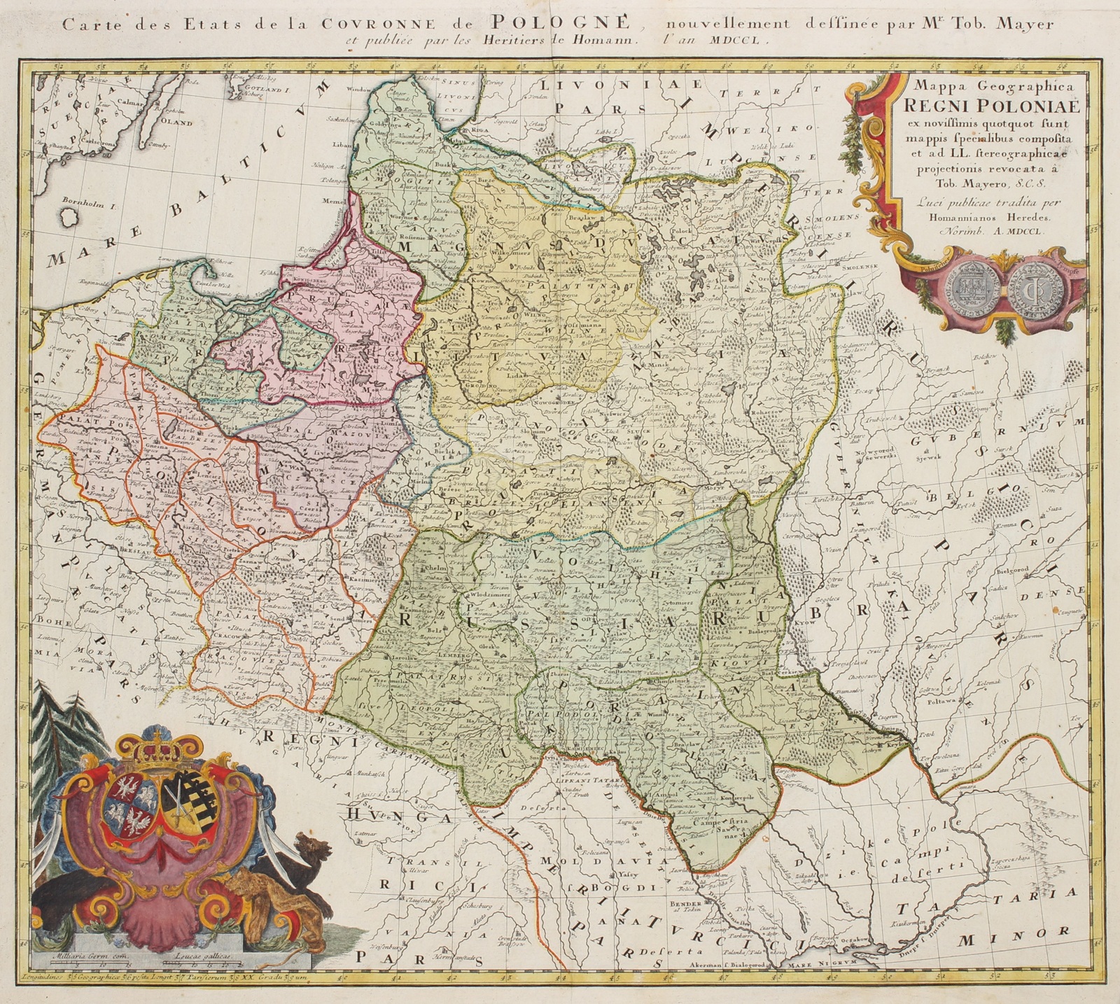
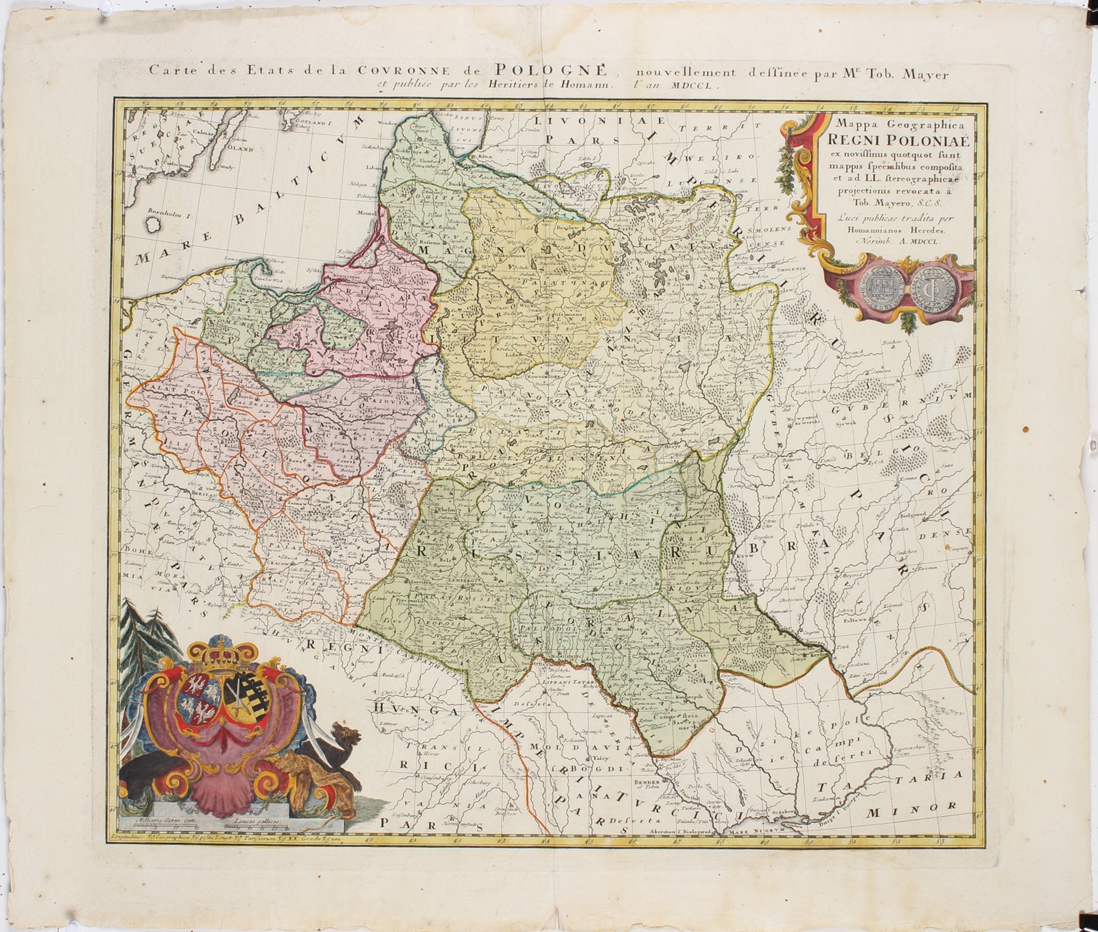
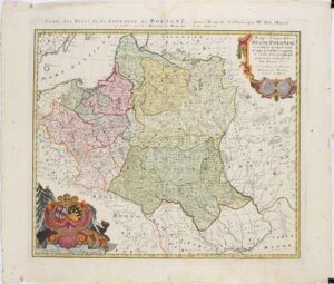
“Mappa Geographica Regni Poloniae …” [Geographical Map of the Kingdom of Poland]. Copper engraving by Tobias Mayer, published by the heirs of Johann Baptist Homann in Nuremberg in 1750. Original hand-colouring with later additions. Size: 46 × 54.5 cm.
This beautiful and detailed map depicts the vast Polish–Lithuanian Commonwealth in the mid-eighteenth century, more than twenty years before the First Partition of Poland in 1772. At the time, the Kingdom of Poland and the Grand Duchy of Lithuania together formed one of the largest states in Europe. Their territory encompassed much of present-day Poland, Lithuania, Belarus and Ukraine.
The map extends from the Baltic Sea in the north to the Carpathian Mountains and Moldavia in the south, and from Brandenburg, Silesia and Bohemia in the west to the Russian territories in the east. Cities such as Warsaw, Kraków, Danzig (Gdańsk), Vilnius and Lemberg (Lviv) are shown, along with hundreds of smaller towns and villages. The Vistula (Weichsel), the Neman (Memel), the Dnieper and numerous other rivers, together with forests, lakes and mountain ranges, form the geographical framework. Different colours distinguish the provinces, voivodeships and neighbouring territories.
The map was compiled by the German mathematician, astronomer and cartographer Tobias Mayer (1723–1762), who became renowned for his astronomical calculations and his contributions to improving geographical positioning. For this map, he combined existing regional maps and brought together their geographical information using a stereographic projection.
In the upper right corner is an elaborately decorated title cartouche featuring the obverse and reverse of a Polish tympf, a type of silver coin dating from the seventeenth century. In the lower left corner is a coat of arms surmounted by a royal crown, combining the arms of Poland-Lithuania and the Electorate of Saxony. The Saxon arms refer to the reigning King Augustus III of Poland (1733–1763), who was also Elector of Saxony.
During the three Partitions of Poland in 1772, 1793 and 1795, Russia, Prussia and Austria divided the territory among themselves. As a result, Poland-Lithuania disappeared from the political map of Europe as an independent state.
Price: Euro 425,-
