

Leuven (Louvain) and surroundings – Willem Blaeu, 1635-1643
€325
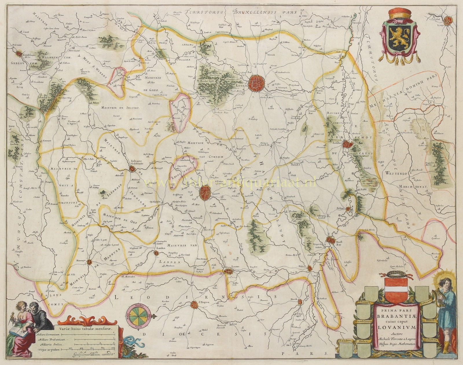
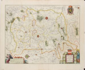
LEUVEN (LOUVAIN) AND SURROUNDING AREA IN THE DUCHY OF BRABANT, C. 1640
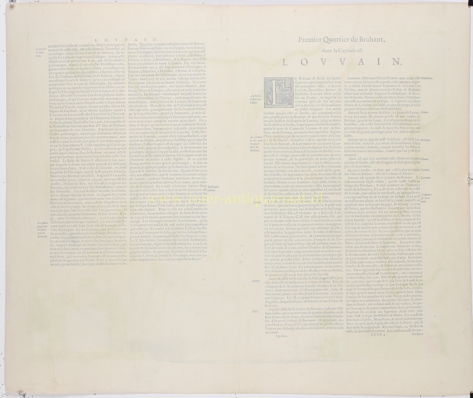
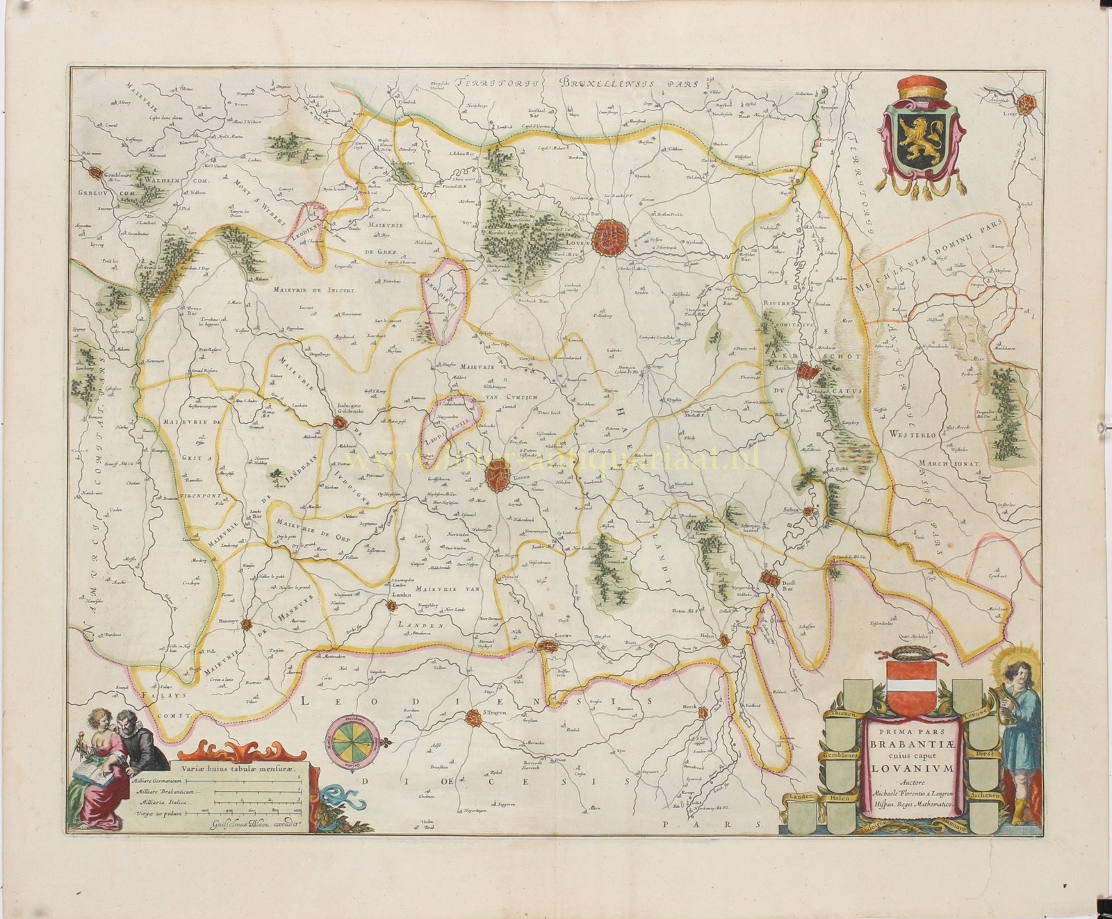
“Prima pars Brabantiae cuius caput Lovanium” [The first quarter of Brabant, with Leuven as its capital], copper engraving after a map by Michael van Langren, published by Willem Blaeu in Amsterdam, c. 1635–1643, as part of the French-language edition of his atlas “Le Théâtre du Monde ou Nouvel Atlas”. Original hand colouring. Size (map image): approx. 41 × 52.4 cm.
This richly decorated map depicts Leuven (Louvain) and much of present-day Flemish Brabant during the first half of the seventeenth century, when the region formed part of the Spanish Netherlands. It provides a detailed representation of the so-called Quarter of Leuven, one of the four administrative and judicial districts into which the historic Duchy of Brabant was divided.
The map covers an extensive area surrounding Leuven, including Aarschot, Diest, Tienen, Zoutleeuw, Landen, Halen, Zichem, Jodoigne (Geldenaken), Hannut (Hannuit) and Gembloux (Gembloers). Numerous smaller towns, villages, hamlets, lordships, abbeys and castles are also carefully indicated. Rivers such as the Dyle (Dijle), Demer and Gete, together with roads, forests and wooded hills, define the landscape. Unusually, the map is oriented with west at the top.
Of particular interest is the inclusion of Scherpenheuvel, which developed into one of the most important Catholic pilgrimage destinations in the Southern Netherlands during the early seventeenth century. Under the patronage of Archdukes Albert and Isabella, a monumental pilgrimage church was constructed here and consecrated in 1627.
The map is embellished with two finely engraved cartouches. In the upper right corner appears the coat of arms of the Duchy of Brabant, featuring a golden lion on a black field. The elaborate title cartouche in the lower right corner is surrounded by heraldic shields representing Leuven and the principal towns of the district. The smaller shields have been left blank. In the lower left corner, a decorative scale cartouche depicts figures examining a map, accompanied by several distance scales.
The original map was drawn by Michael Florent van Langren (1598–1675), a versatile cartographer, mathematician and astronomer who served as Royal Cosmographer and Mathematician to King Philip IV of Spain. In addition to mapping the Southern Netherlands, Van Langren gained recognition for his astronomical research and his attempts to develop a reliable method of determining geographical longitude. In 1645, he published one of the earliest detailed maps of the Moon.
The Amsterdam publisher Willem Blaeu (1571–1638) incorporated Van Langren’s map into his celebrated atlases. The map continued to be published under his son Joan Blaeu and appeared in several editions. It is a fine example of seventeenth-century Dutch cartography, combining geographical precision with exceptionally elegant and decorative engraving.
Price: Euro 325,-