

Madrid – Soviet map, 1984
€1.250


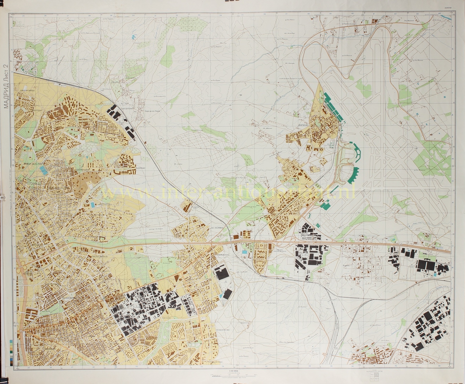


SECRET SOVIET MILITARY MAP OF MADRID, 1984
“МАДРИД” [Madrid], colour offset print on four sheets, issued in 1984 by the Military Topographic Directorate of the General Staff of the Soviet Union. Size: two sheets 82 × 121.5 cm and two sheets 82 × 102 cm.
A rare four-sheet Soviet military map of Madrid, produced at the height of the Cold War. From the 1940s onwards, the Military Topographic Directorate of the Soviet General Staff undertook a vast global mapping programme, systematically recording cities—both within and beyond the Soviet sphere—with remarkable precision. These maps were intended for operational planning and strategic analysis, and are distinguished by their combination of technical accuracy and a highly analytical reading of the urban environment.
The four sheets together form a complete and coherent image of Madrid and its surroundings. The city is presented as a complex but clearly organised entity, situated on the Castilian plateau along the Manzanares River. The surrounding terrain—gently undulating, intersected by river valleys and infrastructure corridors—is carefully rendered, with soils, vegetation, and water systems all precisely noted. Even hydrological conditions, including seasonal fluctuations, are described in the accompanying text, reflecting their relevance for mobility and planning.
Within the city, the emphasis lies on structure and access. Madrid is depicted as a historically layered metropolis, with a dense, irregular core centred on the Puerta del Sol and successive expansions ranging from radial-ring to more rectilinear layouts. The older quarters are characterised by tightly packed buildings and narrow, winding streets, while later developments introduce broader avenues and larger blocks. At the edges, modern residential districts, industrial zones, and dispersed suburbs extend into the surrounding landscape.
Infrastructure is treated with particular clarity. The railway network—with its stations, yards, and service facilities—is mapped in detail, as is the road system connecting Madrid in all directions. Barajas International Airport is prominently shown, with its runways and supporting installations carefully delineated. Notably, a schematic metro plan is included, integrating subterranean transport into the overall conception of the city.
Industrial and logistical capacity forms a key focus. Madrid is identified as a major centre of engineering, metalworking, and chemical industry, alongside extensive light and food production. Industrial sites are precisely located, including facilities of potential military relevance, such as aviation and radio-electronic industries. The accompanying text explicitly highlights the presence of military production and equipment manufacturing, underscoring the city’s strategic significance.
Administrative and civic infrastructure is recorded with equal precision. Government buildings, ministries, embassies, communication networks, and medical institutions are systematically identified. The map also documents energy supply, water management, and gas distribution, including power generation and storage infrastructure. Even secondary features—such as green spaces and agricultural use at the urban fringe—are incorporated into this comprehensive survey.
This map exemplifies the distinctive Soviet approach to cartography, in which the city is understood as an integrated system of infrastructure, production, and control. Its combination of scale, detail, and analytical scope makes it an exceptional document of Cold War military geography.
Only after the collapse of the Soviet Union in 1991 did the extent of this cartographic programme become fully apparent. Despite efforts to destroy the material, a significant number of maps reached the West. Today they are valued as rare and compelling records, offering a unique insight into how a geopolitical rival analysed and interpreted the structure of Western cities.
Price: Euro 1.250,- (4 sheets)
