

Duisburg – Soviet map, 1978
€950

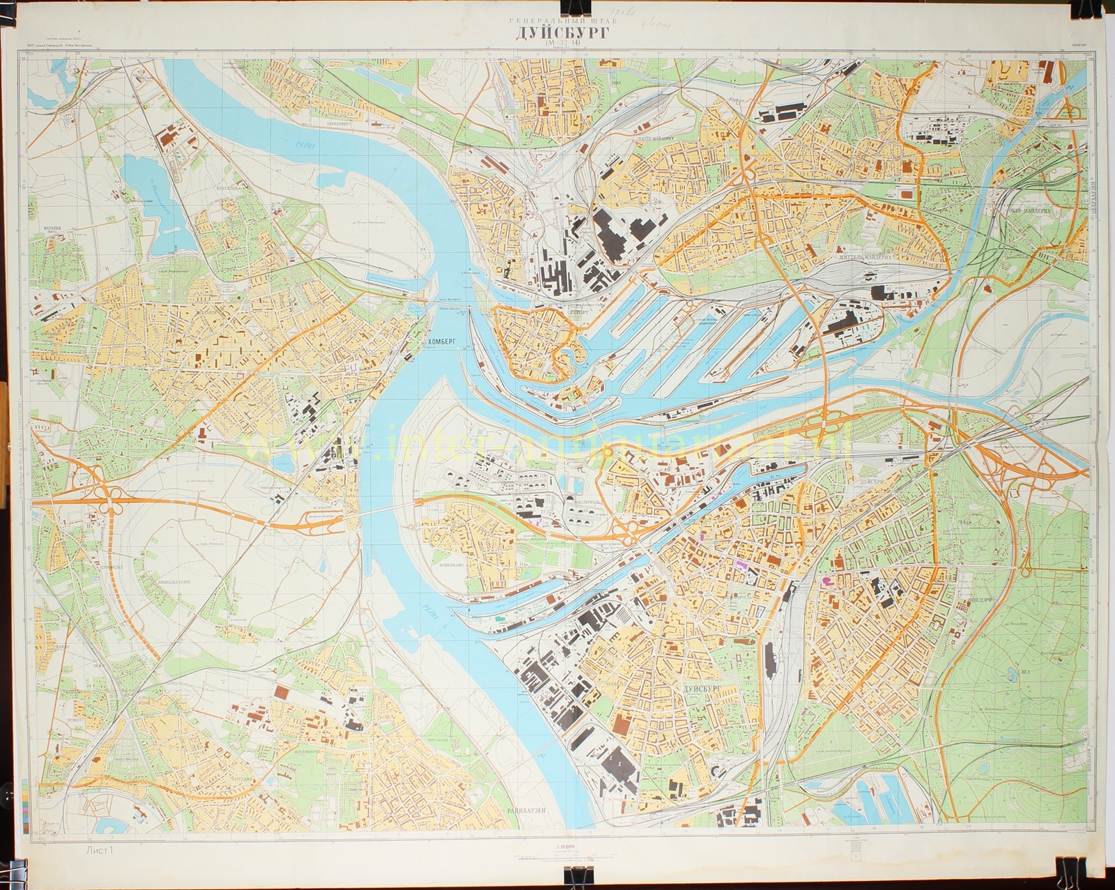
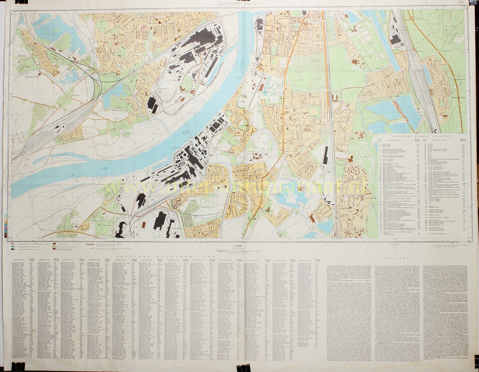

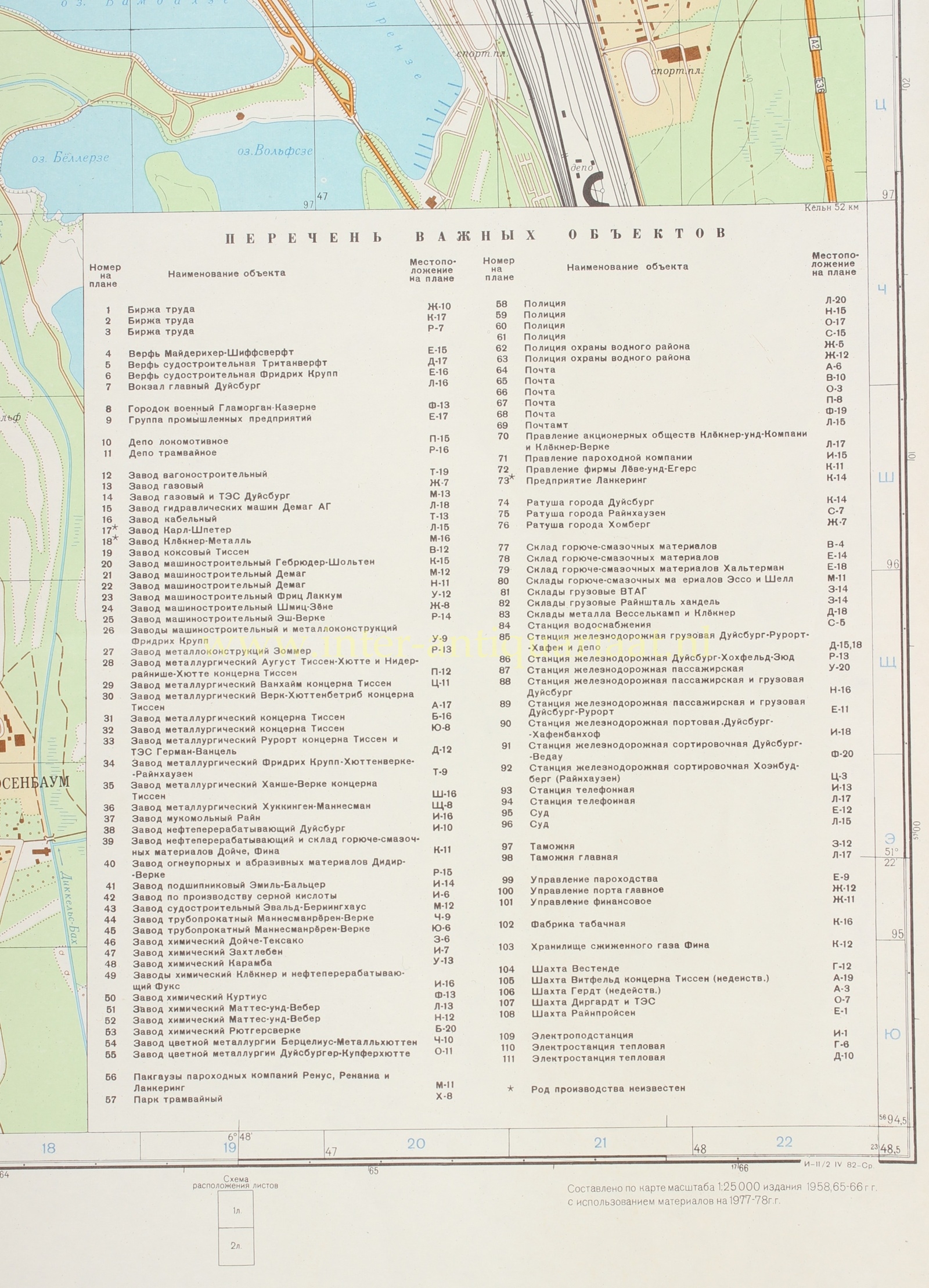

SECRET SOVIET MILITARY MAP OF DUISBURG, 1978
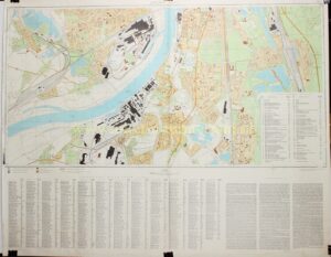
“ДУЙСБУРГ” [Duisburg], colour offset print on two sheets, published in 1978 by the Military Topographic Directorate of the General Staff of the Soviet Union. Size: 92 × 114 cm each.
This map of Duisburg forms part of the secret Soviet military cartography of the late Cold War. From the 1940s onwards, cities, ports, industrial areas, and transport nodes were mapped throughout the world. These maps served operational planning, logistical analysis, and strategic orientation. They recorded not only streets, buildings, and waterways, but also productive capacity, energy supply, communications, terrain conditions, and military installations.
Duisburg presented an exceptional target. The city lay at the heart of the Ruhr region, at the confluence of the Rhine and Ruhr and at the beginning of the Rhine–Herne Canal. It possessed the largest inland port in Western Europe, together with heavy industry, railway complexes, refineries, shipyards, and a dense network of roads and canals.
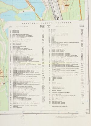
The two sheets depict this with great clarity. The broad Rhine, harbour basins, and canals dominate the map, surrounded by extensive railway yards, marshalling grounds, factory sites, and working-class districts. Large industrial complexes stand out as dark building masses amid residential development and green areas. The map also includes Homberg, Rheinhausen, Ruhrort, and the industrial suburbs on both sides of the Rhine. Harbours, railway lines, bridges, and main roads connect these individual urban districts.
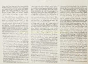
Beneath the second sheet appears an extensive СПРАВКА [Spravka, explanatory note], as follows:
“Duisburg lies on the right bank of the Rhine, at the mouth of the Ruhr and at the beginning of the Rhine–Herne Canal. The city stands approximately 40 kilometres from the Dutch border and forms one of the principal industrial centres of the Ruhr region: an important coal, steel, and military-economic base of the Federal Republic. Including its suburbs, the city has a population of approximately 568,000 inhabitants (1978) and covers about 130 km².
The Rhine forms the principal natural obstacle. Within the area, it is 300 to 400 metres wide and 4 to 5 metres deep; downstream from Duisburg, vessels of up to 4,000 tonnes can navigate it, and upstream from the city, vessels of up to 2,000 tonnes. Four bridges, including one railway bridge, and three ferry crossings connect the banks. The Ruhr and the canals form additional transport axes. Dikes protect large parts of the broad floodplains from flooding, while water levels can rise sharply in winter and early spring.
The region is densely built up. Cities, workers’ settlements, and villages together form an almost continuous industrial belt within the Ruhr region, which has a population of about five million. Factories, mine shafts, chimneys, railway lines, and colliery spoil heaps dominate the landscape. Quarries, coal mines, and railway tunnels provide potential underground shelters. From the air, Duisburg is recognisable by the confluence of the Rhine and Ruhr, the Rhine bridges, and the harbour installations at the mouth of the Ruhr.
Duisburg emerged from the amalgamation of the old city with industrial municipalities and workers’ districts to the north, east, and south of the Ruhr. The river divides the urban area into northern and southern parts, connected by six bridges, including one railway bridge. The administrative and commercial centre lies in old Duisburg, directly around the main railway station. Here stand the town hall, the central post office, the court, police headquarters, telephone exchange, labour exchange, banks, hotels, major shops, and the offices of commercial, industrial, and insurance companies. The city has dense, mixed development, chiefly of three- and four-storey stone buildings, often with cellars, alongside isolated modern high-rise buildings.
Beyond the centre, working-class districts and industrial suburbs alternate with extensive factory sites, railway complexes, and commercial facilities. The best-developed residential districts lie in the south-east; the central areas of Duisburg, Homberg, and Rheinhausen are comparatively sparsely provided with green space. In the south lies a joint military complex with underground ammunition storage. Duisburg and its suburbs also possess numerous storage facilities, including depots for fuel and lubricants.
Duisburg’s industrial importance is exceptional. The city and its surroundings produce approximately one quarter of West German pig iron and steel. Blast furnaces and steelworks produce iron, steel, rolled products, seamless and welded pipes, refractory and abrasive materials. Heavy engineering manufactures railway rolling stock, equipment for mining and metallurgy, turbines, boilers, pumps, presses, cables, bearings, machine tools, and components for armoured vehicles. Duisburg also forms one of Germany’s principal centres of inland-waterway shipbuilding, with twelve shipyards and numerous repair workshops for tankers, coasters, cargo ships, passenger vessels, and river craft.
Refineries receive crude oil through two pipelines from Wilhelmshaven and produce, among other products, aviation fuel, diesel, petrol, and lubricating oil. Chemical companies manufacture plastics, synthetic products, acids, chlorine, nitrogen compounds, pigments, dyes, and solvents. The city and its suburbs also have industries producing building materials, wood products, textiles, rubber goods, tobacco, beer, and foodstuffs. The large steel, engineering, refining, and chemical complexes have clear military significance.
Duisburg also forms an exceptional railway and port hub. The railway network comprises approximately ten stations, including the extensive Duisburg-Wedau marshalling yard, with around one hundred tracks, workshops, and depots. The river port is the largest in the Federal Republic and in Western Europe. In 1978, cargo throughput amounts to 25.8 million tonnes. The port area, covering 2.3 km², comprises 22 individual harbours, with approximately 25 kilometres of quays in total, more than one hundred cranes, rail connections, sheds, open storage areas, grain silos, fuel depots, and 32 pipelines for oil and other liquid cargoes.
Seven local thermal power stations, connected to the Ruhr energy network, supply Duisburg with electricity. The city has gas supply, mains water, sewerage, tram and bus services, and a dense network of telephone, telegraph, and radio-relay links. Water comes from the Rhine and Ruhr through separate waterworks; major industrial enterprises also have their own installations. Hospitals and specialist clinics complete this civil infrastructure.”
This broad inventory makes the map not only an accurate representation of Duisburg, but also a snapshot of the Ruhr region as the industrial core of the Federal Republic and a crucial link in the economy and logistics of Western Europe.
The map is therefore an intriguing document of the way in which the Soviet Union, during the Cold War, analysed and recorded cities not only in civil, but also in military-strategic terms.
Only after the dissolution of the Soviet Union in 1991 did the scale and sophistication of this cartographic programme become clear. Despite efforts to destroy the material, maps such as this subsequently reached the West.
Prijs: Euro 950,-
