

Vienna- Soviet military map, 1976
€1.250






SECRET SOVIET MILITARY MAP OF VIENNA, 1976
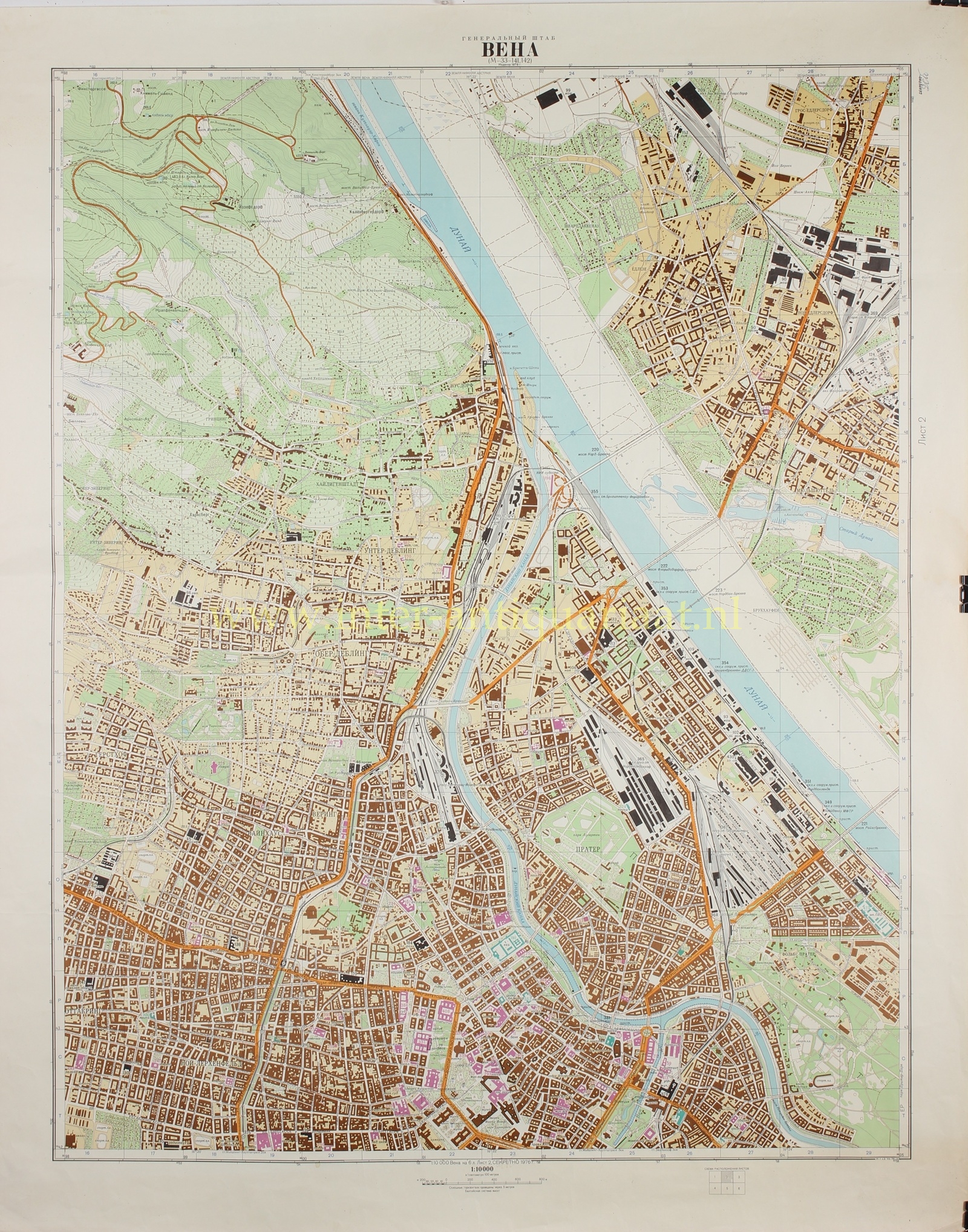
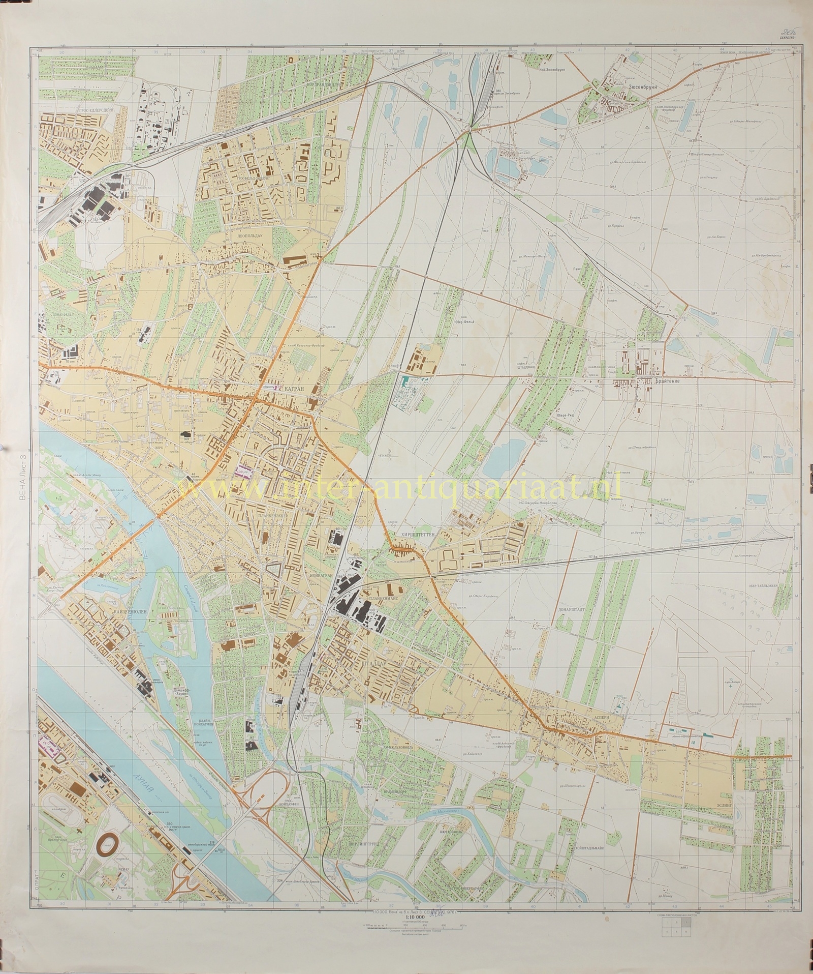
“ВЕНА” [Vienna], colour offset print on six sheets, issued in 1976 by the Military Topographic Directorate of the Soviet General Staff. Size: (each sheet) 97 × 82 cm.
This rare six-sheet map of Vienna forms part of the secret cartographic output of the General Staff of the Soviet Army, produced in the context of the Cold War. During this period, the Soviet Union systematically mapped cities both within its sphere of influence and beyond, including numerous Western European centres. These maps were intended for military use and served as instruments for operational planning, logistical analysis, and strategic orientation.
As is characteristic of this series, the map combines a high degree of topographical accuracy with a distinctly analytical approach, treating the city as a functional whole. The six sheets together provide a complete overview of Vienna and its immediate surroundings, encompassing not only the historic centre but also peripheral zones and the surrounding terrain.
The Danube and the Danube Canal occupy an imporant position within the map. These waterways are not merely carefully rendered, but are clearly interpreted as strategic transport axes and potential barriers. Bridges and crossings are systematically included, making the interrelationship of the infrastructure network readily legible. The relationship between water, city, and infrastructure is thus sharply articulated—an approach typical of Soviet military cartography, in which mobility and control are central concerns.
The railway network is likewise depicted with great precision. Extensive marshalling yards, rail depots, and station complexes dominate parts of the map, underscoring Vienna’s importance as a logistical hub. In Soviet analysis, such infrastructure formed the backbone of both civilian transport and military movement. The road network integrates seamlessly with this system: radial routes and ring roads make the spatial organisation of the city immediately clear.
The historic centre, with its dense fabric, is surrounded by nineteenth-century expansions and modern residential districts. Industrial zones and large-scale complexes are clearly identifiable. This reflects the broader Soviet practice of systematically recording industrial production and logistical capacity, with particular attention to sectors of potential relevance for military production or supply.
Towards the edges of the city, the representation gradually shifts to a more landscape-oriented view. Relief, wooded areas, and infrastructure corridors extending into the surrounding Austrian countryside are all depicted. The inclusion of both the urban area and its wider setting underscores that these maps were not solely intended for urban analysis, but also for operations on a broader scale, in which the relationship between city and surrounding terrain is essential.
Such cartography formed part of a wider Soviet intelligence programme. The map was intended to facilitate control and understanding of the terrain.
The extent to which the Soviet Union produced such detailed maps only became fully apparent after the collapse of the superpower in 1991. Despite efforts to destroy the material, some examples reached the West, where they are now appreciated as significant historical documents. They offer a rare insight into how a geopolitical adversary analysed the urban, industrial, and logistical structure of Western Europe.
This six-sheet map of Vienna is an impressive example of this practice—not only for its scale and level of detail, but also for the way in which a European capital is interpreted through a military-strategic lens. As such, it is not merely a cartographic document, but also a tangible witness to the tensions and mindset of the Cold War.
Price: Euro 1.250,- (6 sheets)
