

Breda and Western North Brabant – N. Kraft, 1842
€1.250
WESTERN NORTH BRABANT – THE ARRONDISSEMENT OF BREDA, 1842
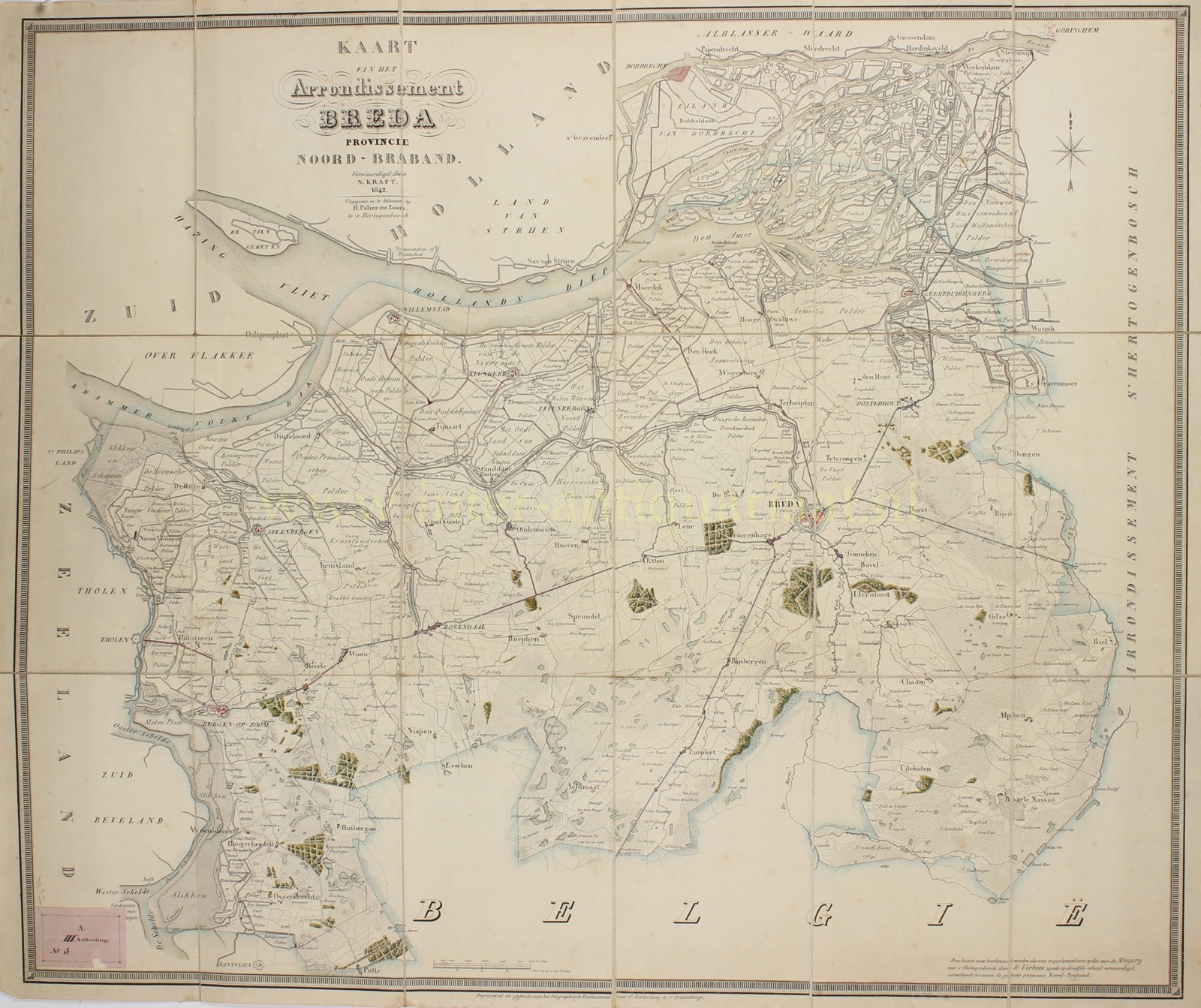
“Kaart van het Arrondissement Breda, Provincie Noord-Braband” [Map of the Arrondissement of Breda, Province of North Brabant], large and highly detailed map prepared by N. Kraft and engraved and printed at the Geographisch Etablissement of F. Desterbecq in The Hague. Published by H. Palier en Zoon in ’s-Hertogenbosch in 1842. Lithograph, dissected into eighteen sections and mounted on linen as a folding map. Orihginal hand colouring. Size (paper): 73 × 89 cm.
The map provides a detailed picture of the western part of North Brabant in the mid-nineteenth century. At its centre lies Breda, still entirely enclosed by its bastions and outer defensive works. To the west, the map extends via Roosendaal and Bergen op Zoom to the waterways of Zeeland; to the east it includes Oosterhout, Dongen, Gilze, Tilburg and Hilvarenbeek, among other places. In the north, the Hollands Diep, the Biesbosch and the extensive polder landscape around Geertruidenberg, Werkendam, Raamsdonk and Waspik dominate the map.
Not only towns and villages are shown, but also numerous hamlets, country estates, individual farms, polders, dykes, roads, waterways, woods and heathlands. Particularly striking is the contrast between the densely intersected clay and polder districts in the north and west and the extensive sandy and heathland areas to the south and east of Breda. For orientation, parts of Tholen, Zuid-Beveland and Overflakkee are included along the western edge. At the southern margin, the large inscription België marks the national border.
In an advertisement placed by the publisher H. Palier en Zoon in the Bredasche Courant in March 1843, the work was promoted as a “new map” based on the “Carte figurative de l’arrondissement de Breda”, produced in 1809–1810 by the Brabant surveyor and cartographer Hendrik Verhees (1744–1813). More than thirty years later, Kraft updated Verhees’s material to reflect the situation around 1842.
For Breda itself, the date is particularly interesting. The city is still shown as a fully fortified stronghold; its defences would not begin to be dismantled until 1869. Two lunettes near the Antwerp Gate had in fact only just been constructed in 1842 in response to the Belgian Revolution. The map thus records the landscape of western North Brabant at a moment when the border with the young Belgian state had already been established, while the pattern of roads, waterways and settlements still largely belonged to the pre-railway era.
Price: Euro 1.250,-
