

Castricum – Jan Punt + Johannes Covens & Cornelis Mortier, 1737
€5.500
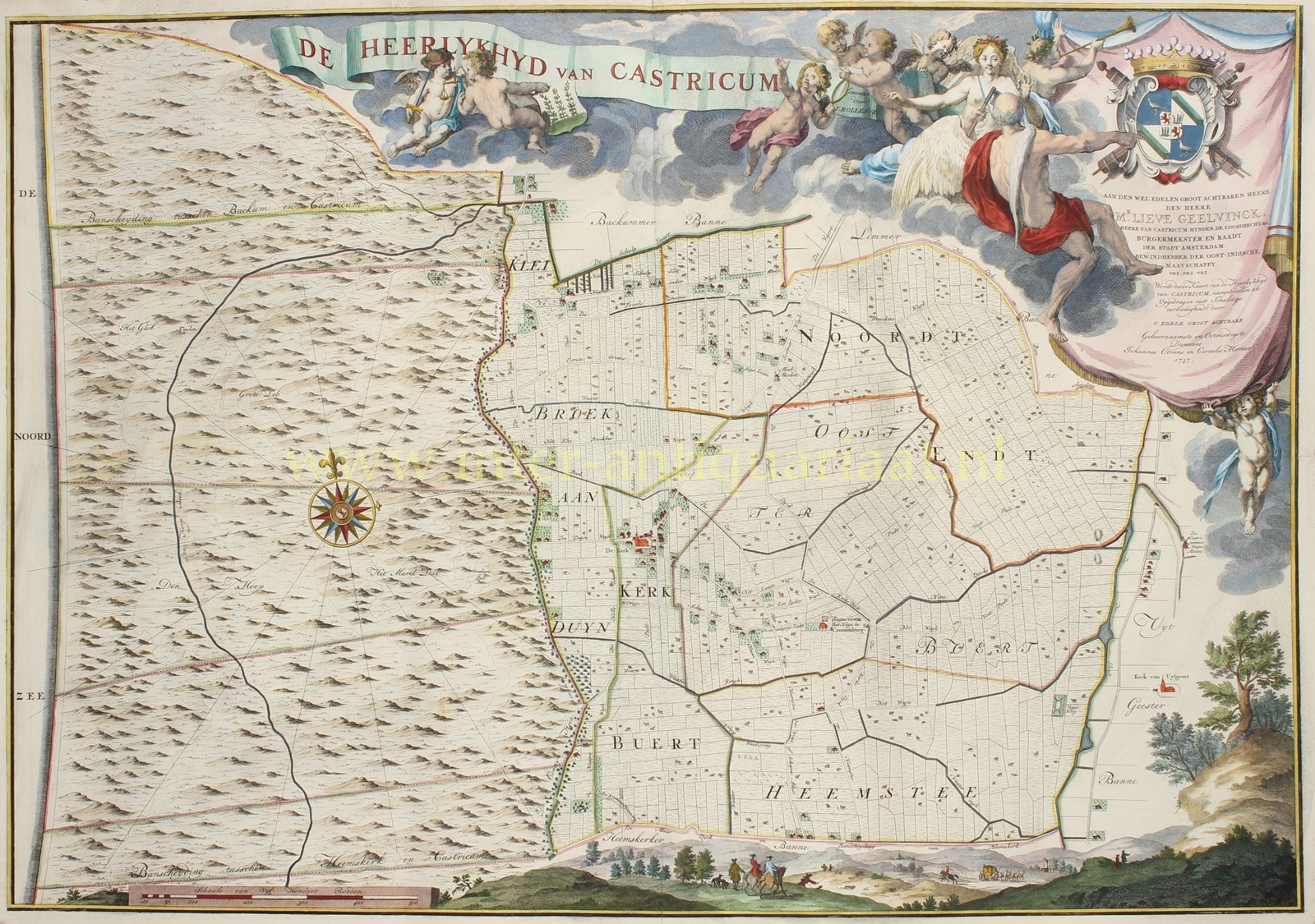
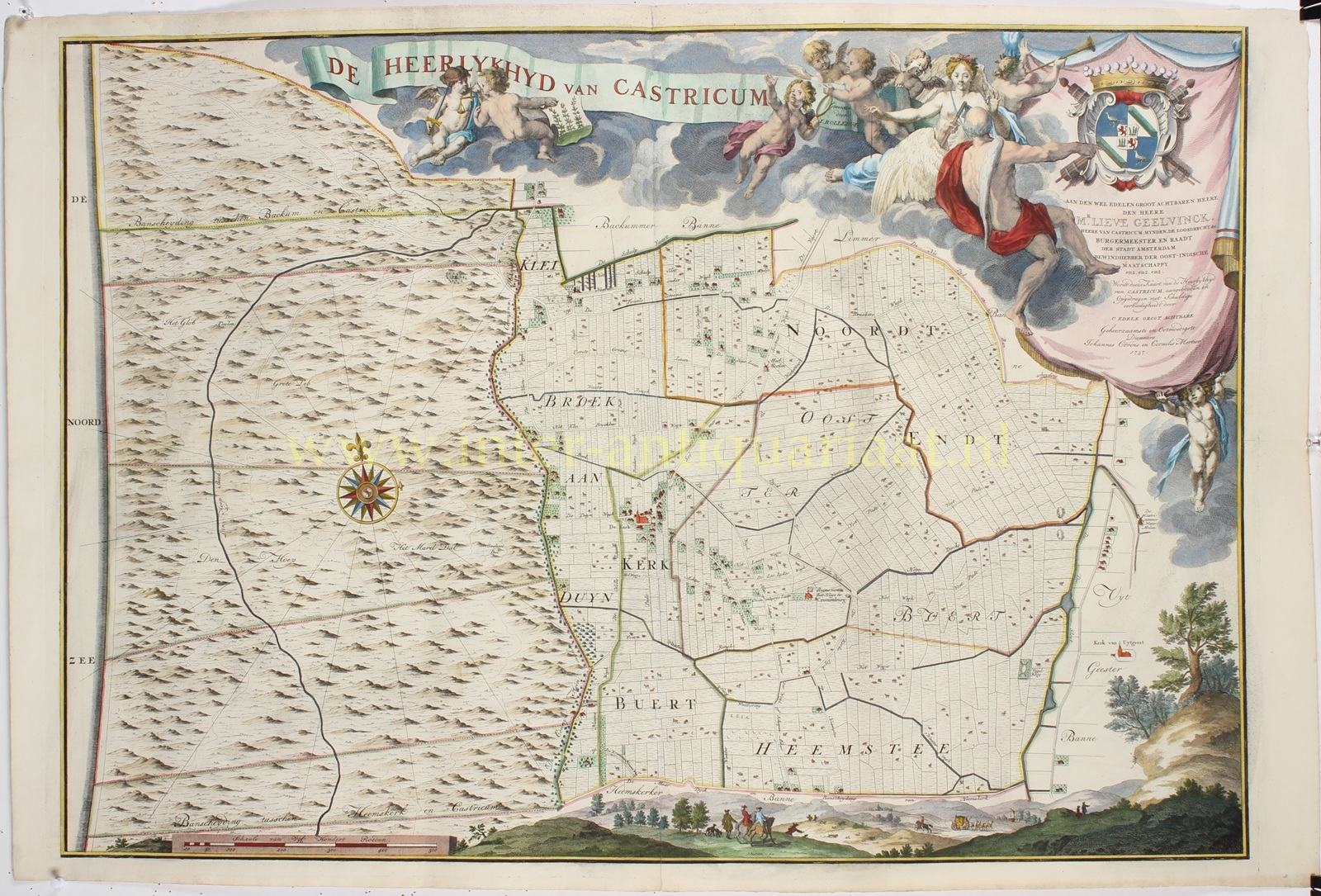

MONUMENTAL MAP OF THE LORDSHIP OF CASTRICUM, 1737
“De Heerlykhyd van Castricum” [The Lordship of Castricum], etching and engraving based on the surveys of land surveyor Johannes Rollerus, drawn and engraved by Jan Punt and published in Amsterdam by Johannes Covens and Cornelis Mortier in 1737. Later hand-coloured. Size: 62 × 89 cm.
In the upper right is a monumental drapery cartouche bearing the coat of arms of Lieve Geelvinck, to whom Covens and Mortier dedicated the map. The dedication describes him, among other titles, as Lord of Castricum, burgomaster and councillor of Amsterdam, and director of the Dutch East India Company. The lavish decoration, with putti, allegorical figures and, along the lower edge, a dune landscape with a hunting party, gives the map the character of a true showpiece.
This was entirely in keeping with the status of its patron. Lieve Geelvinck belonged to one of Amsterdam’s most powerful regent families. Between 1720 and his death in 1743 he repeatedly held the office of burgomaster, and from 1716 he was a director of the VOC. In 1734, on behalf of the States of Holland, he was delegated to welcome Prince William IV of Orange and his future wife Anne of Hanover before their marriage.
The lordship of Castricum had been purchased in 1664 by Lieve’s grandfather Cornelis Geelvinck and subsequently passed down within the family. The office of ambachtsheer , or lord of the manor, carried substantial administrative and economic privileges, including the appointment of local officials, certain judicial powers, and rights relating to hunting, fishing and the salvage of goods washed ashore. The prominently displayed family coat of arms and the costly execution of the map therefore emphasise not only Geelvinck’s ownership, but above all his status as “Lord of Castricum”.
The landscape is meticulously divided into individual plots and shows roads, waterways, dunes, fields, houses and farms. The five residential districts of the period are clearly recognisable: Kerkbuurt, Kleibroek aan Duin, Noordt Endt, Oosterbuurt and Heemstee. Also marked are the ruins of the former Kronenburg Castle, likewise owned by the Geelvinck family.
North of the boundary appears the inscription “Backummer Banne”. In 1737 Bakkum was still a separate lordship and therefore did not form part of the territory of Castricum mapped here. It was not until 1749 that Lieve’s son Nicolaas Geelvinck also purchased the lordship of Bakkum, after which both territories shared the same lord.
Remarkably, this map is one of the earliest examples in this large double-folio format to have been printed from a single copperplate.
Price: Euro 5.500,- (incl. frame)
