

Marsdiep and Meuse Estuary – Pieter Goos, 1672
€650
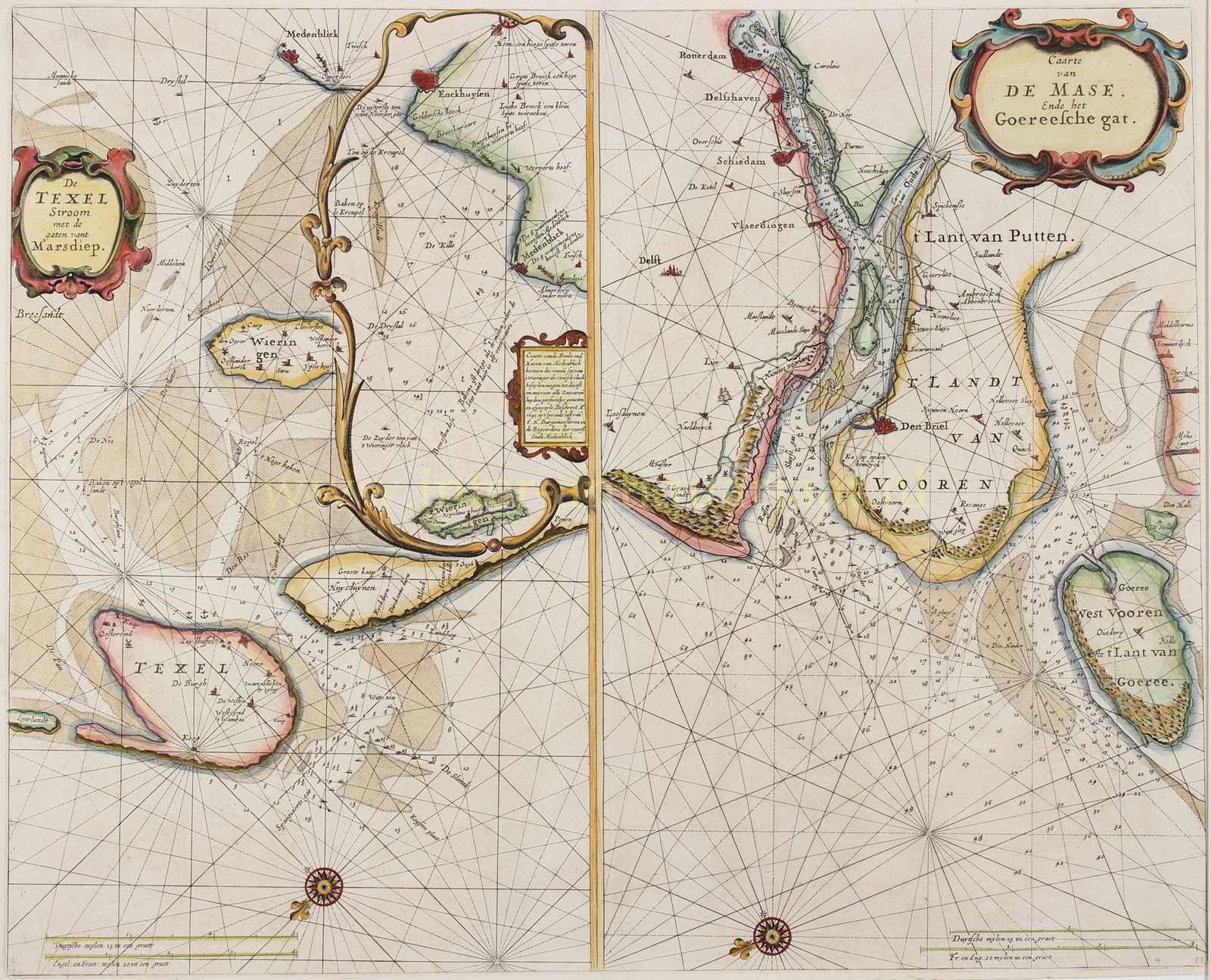
“De Texelstroom met de gaten vant Marsdiep” [The Texel Roads and the channels of the Marsdiep], with an inset chart of the coast of West Friesland between Enkhuizen and Medemblik, on the same sheet as “Caart van de Mase, ende het Goereesche Gat” [Chart of the River Meuse and the Goeree Channel]. Copper engraving published by Pieter Goos in Amsterdam in 1672, as part of his “De Zee-Atlas ofte Water-Wereld”. Coloured by a later hand. Size (plate mark): 43 × 53 cm.
Sea charts such as these were used for maritime navigation in the seventeenth century. They enabled navigators to plot their courses and measure distances travelled. Such charts provided a topographical representation of coastlines, rivers and islands, overlaid with a network of compass lines or rhumb lines. They also indicated anchorages, shallows, sandbanks, buoys and sailing directions, helping mariners navigate coastal waters safely.
The Marsdiep, the strait between Texel and Den Helder, was a crucial passage for ships sailing between the North Sea and the Zuiderzee (or vice versa).
The right-hand section of the chart depicts the mouth of the River Meuse (Maas), the area surrounding the present-day port of Rotterdam, including the island of Voorne-Putten and the surrounding waters. The tidal channels in this region were essential for shipping to and from the major ports. As in the Marsdiep chart, water depths are indicated in fathoms, providing vital information for navigating these sometimes shallow and treacherous waters. Sandbanks are also clearly marked, emphasising the complexity of navigation in the area. Pilots and shipmasters had to steer carefully to avoid running aground.
Pieter Goos (1616–1675) published his first maritime pilot guide in 1650. Over the following 25 years, he produced carefully compiled pilot guides and, from 1666 onwards, magnificent sea atlases. Almost all the charts contained in these atlases were copies of nautical charts by Hendrick Doncker, including the charts of the Marsdiep and the mouth of the River Meuse.
In 1672, Goos published what is regarded as one of the finest maritime atlases of its time, “De Zee-Atlas Ofte Water-Wereld, Waer in vertoont werden all de Zee-Kusten Van het bekende des Aerd-Bodems. Seer dienstigh voor alle Heeren en Kooplieden, Also oock voor alle Schippers en Stuurlieden” [The Sea Atlas or Water World, showing all the sea coasts of the known world. Highly useful for gentlemen and merchants, as well as for shipmasters and navigators].
Price: Euro 650,-
RESERVED