

Texel – 1962
€125
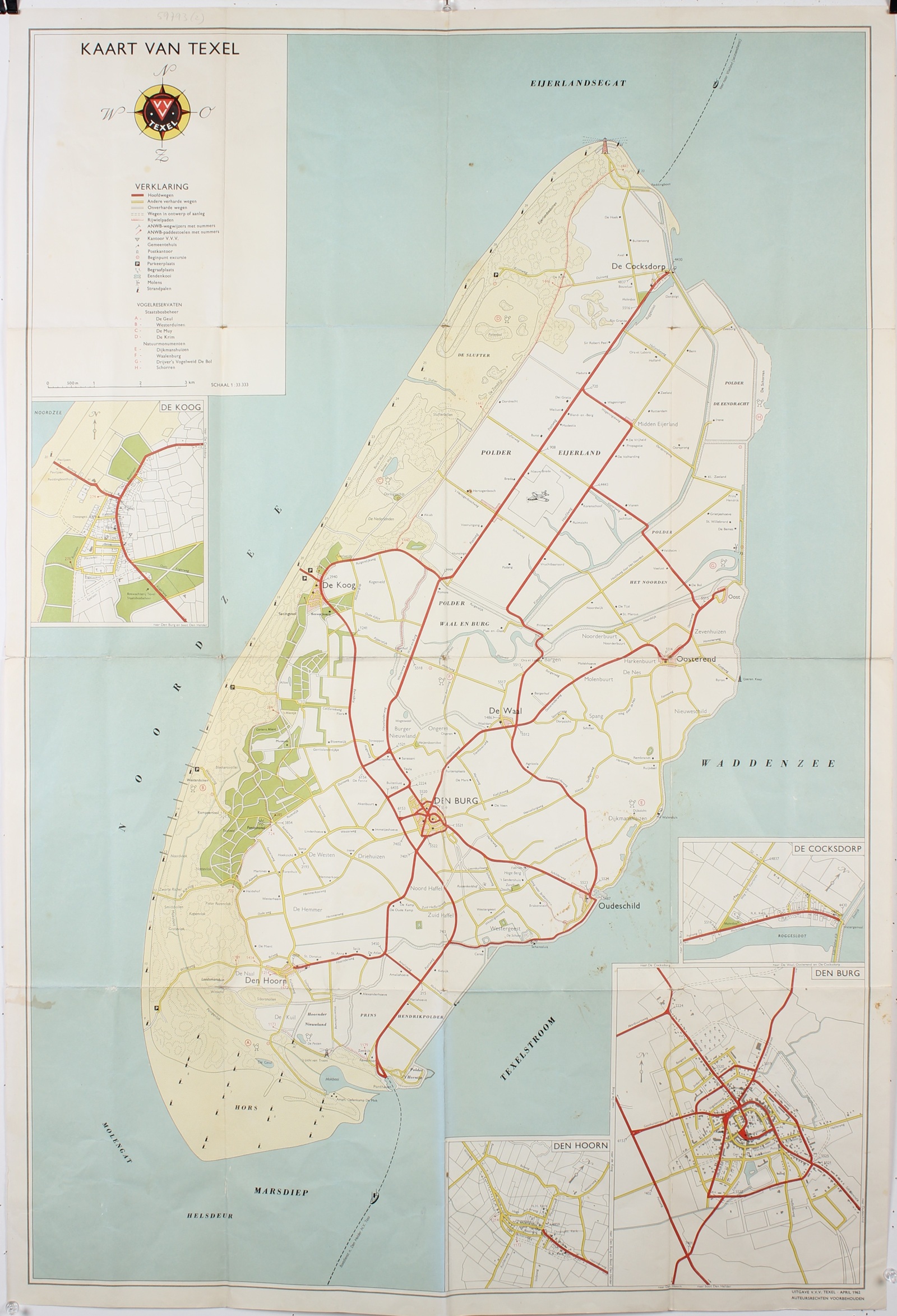
TOURIST MAP OF THE ISLAND TEXEL, 1962
“Kaart van Texel” [Map of Texel], colour offset lithograph published by the V.V.V. Texel (Texel Tourist Information Office) in April 1962. Size: approx. 93 × 63 cm.
This large and detailed map shows the Dutch Wadden Island of Texel in the early 1960s, when tourism was expanding rapidly and the island was increasingly developing into a popular holiday destination.
The island is depicted in considerable detail, from the lighthouse near De Cocksdorp in the north to De Hors and the Marsdiep Strait in the south. The principal villages, including Den Burg, De Koog, Den Hoorn, Oudeschild, Oosterend and De Waal, are clearly marked. Main roads are shown in red and other paved roads in yellow. Cycle paths, walking routes, beach access paths, car parks and ANWB signposts are also indicated.
Along the western coast stretch wide sandy beaches, dunes and woodland, while the interior is characterised by agricultural polders, scattered farmhouses and small villages. Particular attention is given to the nature reserves and bird sanctuaries, including De Slufter, De Muy, De Geul, Waal en Burg and De Bol. The legend distinguishes between reserves managed by Staatsbosbeheer (the Dutch State Forestry Service) and Natuurmonumenten (the Dutch Society for Nature Conservation).
An interesting historical detail is the new ferry harbour at ’t Horntje, which is already marked on the map. The map was published in April 1962, just two months before the new harbour officially opened on 8 June of that year. Until then, the ferries operated by Texels Eigen Stoomboot Onderneming (TESO) had docked at Oudeschild. The new ferry connection with Den Helder considerably shortened the crossing and marked an important step in improving access to the island.
Four separate, enlarged town plans of De Koog, De Cocksdorp, Den Burg and Den Hoorn provide additional details of these settlements. In the upper left corner is a colourful compass rose incorporating the emblem of the V.V.V. Texel.
With its soft blue sea, sandy-coloured dunes, green woodlands and clearly marked roads, this map is not only a practical guide for holidaymakers of the period but also an interesting historical document. It captures Texel at a time when the island was undergoing a transformation from a predominantly agricultural community into a thriving tourist destination.
Price: Euro 125,-