

Southern Africa – Chatelain, 1719
€750
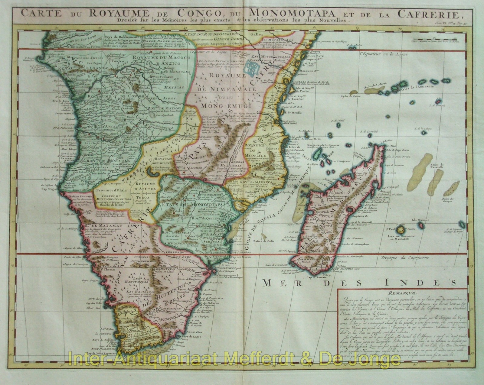
MAP OF SOUTHERN AFRICA, CONGO AND MADAGASCAR, 1719
“Carte du Royaume de Congo, du Monomotapa et de la Cafrerie, Dressée sur les Mémoires les plus exacts & les observations les plus Nouvelles” [Map of the Kingdom of Congo, Monomotapa and Cafrerie, drawn from the most exact accounts and the latest observations]. Copper engraving published in Amsterdam by L’Honoré & Chatelain in 1719, as part of the “Atlas Historique”. Later hand-coloured. Size: approx. 40.5 × 52 cm.
This detailed map covers almost the whole of Africa south of the equator, from the Atlantic coasts of Congo and Angola to Mozambique and the Indian Ocean, and from the equator to the Cape of Good Hope. Madagascar and several islands in the western Indian Ocean are also shown.
The cartographic basis derives from the “Carte du Congo et du Pays des Cafres”, published in 1708 by the influential French cartographer Guillaume Delisle. Delisle belonged to a new generation of mapmakers who critically compared existing maps with travel accounts and other recent geographical information. Chatelain’s map broadly follows his example, but adds an extensive text block in the lower right describing the principal regions named in the title.
In the west, the Kingdom of Kongo dominates, surrounded by Angola, Benguela and various smaller kingdoms and territories. Farther east lie the extensive lands that European geographers referred to as Monomotapa, corresponding to parts of present-day Zimbabwe and Mozambique. In this area in particular, the map repeatedly marks gold mines and regions associated with the gold trade. Reports of the supposed mineral wealth of the African interior had stimulated European interest in southeastern Africa since the sixteenth century.
Geographical knowledge is clearly more detailed along the coasts. Ports, rivers, capes and settlements are densely recorded, while the interior presents a mixture of factual information, older travellers’ accounts and still largely hypothetical political boundaries. Mountain ranges are depicted pictorially, while numerous short annotations provide information about local peoples, kingdoms, trade and natural resources. The map therefore reveals not only what European geographers around 1700 knew about Southern Africa, but also how much remained uncertain.
In the lower right, a separate “Remarque” summarises contemporary European ideas about Congo, Monomotapa and ‘Cafrerie’. The latter did not denote a single state: Cafrerie was a broad and imprecise term used in early modern European cartography for large parts of Southern Africa. The text block gives the map the encyclopaedic character typical of the Atlas Historique, in which cartography, history and geographical description were combined.
Price: Euro 750,-
