

Southern Africa – Adolf Graef, c. 1857-1860
€425
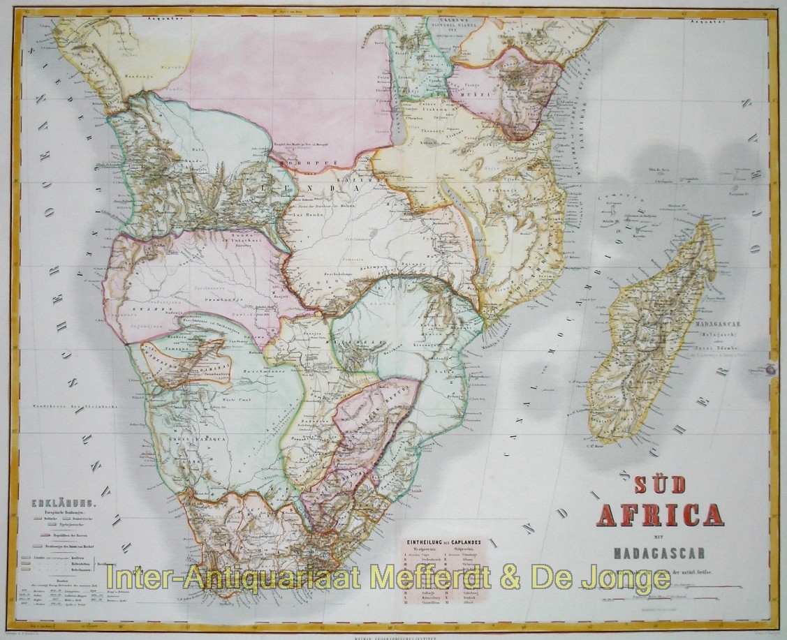
DETAILED MAP OF SOUTHERN AFRICA AND MADAGASCAR, C. 1857–1860
“Süd Africa mit Madagascar” [Southern Africa with Madagascar], steel engraving compiled by Adolf Gräf and engraved by G. Haubold, with the relief depiction by G. Dietrich, published in Weimar by the Geographisches Institut, c. 1857–1860, as part of the “Hand-Atlas der Erde und des Himmels”. Contemporary hand-colouring, with later additions. Size: 51.7 × 63.9 cm.
Large and exceptionally detailed map of Southern Africa from a period in which European geographical knowledge of the interior was rapidly expanding. The map covers the continent from the Atlantic coast of Angola and the southern part of Central Africa to Mozambique and the Indian Ocean, with the Cape Colony in the south and the entire island of Madagascar to the east.
The map provides a fascinating picture of the political patchwork of Southern Africa in the mid-nineteenth century. Boundaries and colour washes distinguish European colonies, the young Boer Republics, and various African states and territories. The southern part is shown in particularly great detail. The British Cape Colony is divided into districts, which are listed separately in a table entitled “Eintheilung des Caplandes”. To the north and east lie, among others, the Orange Free State, the territories north of the Vaal River, Natal, Basotho and Zulu territories, and the vast interior of the Kalahari Desert.
Particularly striking is the contrast between the accurately mapped coastal regions and the much less well-known interior. Rivers, mountain ranges and settlements are recorded in considerable detail, while large areas of Central Africa remain almost blank. At the same time, recent geographical discoveries had already been incorporated. Lake Ngami, in present-day Botswana, is shown on the map. It was reached in 1849 by William Oswell, David Livingstone and Mungo Murray, becoming known to Europeans through their expedition. New geographical information of this kind transformed European maps of Africa at a rapid pace during these years.
Madagascar is also shown separately and in considerable detail, with its strongly hilly interior, rivers, settlements and coastal regions. A number of smaller islands are furthermore indicated in the Mozambique Channel.
The map thus depicts Southern Africa before the major colonial expansion and territorial partition of the final decades of the nineteenth century.
Price: Euro 425,-
