

Northern India – Johannes Janssonius, 1641
€650
THE MUGHAL EMPIRE IN NORTHERN INDIA, MID-17TH CENTURY
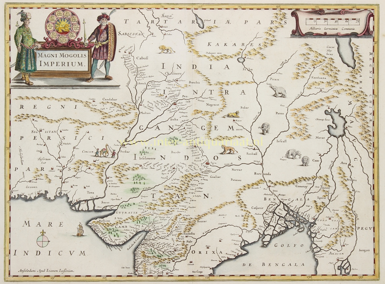
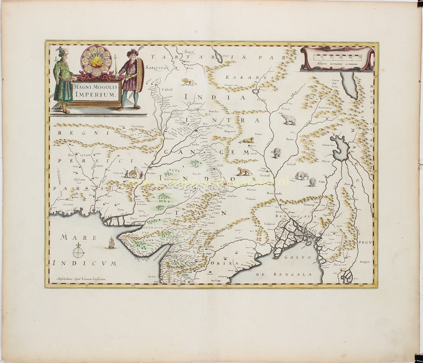
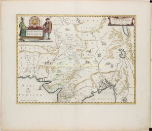
“Magni Mogolis Imperium” [The Empire of the Great Mughal], copper engraving published by Johannes Janssonius in Amsterdam, mid-17th century. The map was originally published by Henricus Hondius in 1638 and appeared with Janssonius’s imprint from around 1641 onwards. With original hand-colouring. Size: 44 × 53 cm.
This decorative map depicts the vast Mughal Empire, which in the seventeenth century was one of the most powerful and prosperous empires in the world. The map covers large parts of present-day India, Pakistan, Afghanistan and Bangladesh, as well as neighbouring regions of Persia, Tibet and Burma (Myanmar). It extends from the Indus Delta on the Arabian Sea in the west to the Bay of Bengal and the borders of China in the east.
The principal cities of the Mughal Empire, including Agra, Delhi, Lahore and Patna, are carefully marked, as are Kabul, Kandahar and the trading centres along India’s western coast. The great river systems of the Indus and Ganges form the backbone of the map. Numerous smaller towns and settlements convey the vast extent of the empire and the network of trade routes connecting its various regions.
The map is embellished with illustrations of elephants, lions, tigers, a rhinoceros and a camel caravan. A Dutch East Indiaman sails across the Indian Ocean. Mountain ranges are depicted as chains of small, individually coloured peaks, while clusters of trees indicate fertile regions.
Of particular interest is the large title cartouche in the upper left corner, flanked by two richly dressed figures in oriental costume. At its centre is a representation of the dynastic seal of Mughal Emperor Jahangir (reigned 1605–1627). Surrounding a lion set against a radiant sun are the names of his ancestors, tracing his lineage back to the celebrated conqueror Timur (Tamerlane), founder of the Timurid dynasty from which the Mughal emperors descended.
Alongside its detailed representation of the Mughal Empire, the map preserves several geographical misconceptions characteristic of seventeenth-century European cartography. In the northeast, for example, it depicts the imaginary Chiamay Lacus, a large lake then believed to be the source of several major rivers in Southeast Asia. This mythical lake continued to appear on European maps well into the eighteenth century.
The geographical foundations of this map can be traced to the work of the English navigator and explorer William Baffin, who produced a groundbreaking map of the Mughal Empire in 1619 using information supplied by Sir Thomas Roe. Roe served as the English ambassador at Emperor Jahangir’s court from 1615 to 1619, gathering valuable geographical information during his stay. Baffin’s map represented a major advance in European geographical knowledge of northern India, particularly regarding the locations of cities and the course of the Indus River.
Henricus Hondius incorporated this new geographical information into his map of 1638, which was subsequently published by his brother-in-law Johannes Janssonius as part of the celebrated Atlas Novus. The map thus became one of the most important seventeenth-century European representations of the Mughal Empire and remains a fine example of Dutch Golden Age cartography.
Price: Euro 650,-